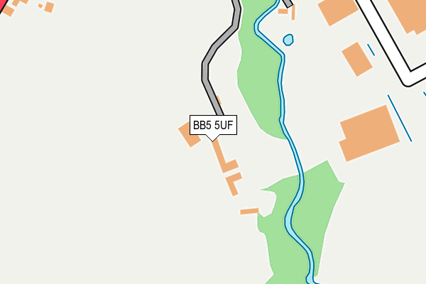
BB5 5UF is located in the Altham electoral ward, within the local authority district of Hyndburn and the English Parliamentary constituency of Hyndburn. The Sub Integrated Care Board (ICB) Location is NHS Lancashire and South Cumbria ICB - 01A and the police force is Lancashire. This postcode has been in use since January 1980.


GetTheData
Source: OS OpenMap – Local (Ordnance Survey)
Source: OS VectorMap District (Ordnance Survey)
Licence: Open Government Licence (requires attribution)
| Easting | 376688 |
| Northing | 432092 |
| Latitude | 53.784624 |
| Longitude | -2.355286 |
GetTheData
Source: Open Postcode Geo
Licence: Open Government Licence
| Country | England |
| Postcode District | BB5 |
| ➜ BB5 open data dashboard ➜ See where BB5 is on a map ➜ Where is Altham? | |
GetTheData
Source: Land Registry Price Paid Data
Licence: Open Government Licence
Elevation or altitude of BB5 5UF as distance above sea level:
| Metres | Feet | |
|---|---|---|
| Elevation | 100m | 328ft |
Elevation is measured from the approximate centre of the postcode, to the nearest point on an OS contour line from OS Terrain 50, which has contour spacing of ten vertical metres.
➜ How high above sea level am I? Find the elevation of your current position using your device's GPS.
GetTheData
Source: Open Postcode Elevation
Licence: Open Government Licence
| Ward | Altham |
| Constituency | Hyndburn |
GetTheData
Source: ONS Postcode Database
Licence: Open Government Licence
| June 2022 | Anti-social behaviour | On or near Metcalf Drive | 326m |
| May 2022 | Burglary | On or near Barnfield Way | 459m |
| April 2022 | Violence and sexual offences | On or near Metcalf Drive | 326m |
| ➜ Get more crime data in our Crime section | |||
GetTheData
Source: data.police.uk
Licence: Open Government Licence
| The Beeches (Burnley Road) | Altham | 359m |
| The Beeches (Burnley Road) | Altham | 377m |
| Syke Side Bridge (Burnley Road) | Altham | 525m |
| St James Ceps (Burnley Road) | Altham | 694m |
| Moorfield Garage (Burnley Road) | Altham | 711m |
| Huncoat Station | 1.5km |
| Hapton Station | 2.6km |
| Accrington Station | 3.6km |
GetTheData
Source: NaPTAN
Licence: Open Government Licence
| Percentage of properties with Next Generation Access | 100.0% |
| Percentage of properties with Superfast Broadband | 33.3% |
| Percentage of properties with Ultrafast Broadband | 0.0% |
| Percentage of properties with Full Fibre Broadband | 0.0% |
Superfast Broadband is between 30Mbps and 300Mbps
Ultrafast Broadband is > 300Mbps
| Percentage of properties unable to receive 2Mbps | 0.0% |
| Percentage of properties unable to receive 5Mbps | 0.0% |
| Percentage of properties unable to receive 10Mbps | 0.0% |
| Percentage of properties unable to receive 30Mbps | 66.7% |
GetTheData
Source: Ofcom
Licence: Ofcom Terms of Use (requires attribution)
GetTheData
Source: ONS Postcode Database
Licence: Open Government Licence


➜ Get more ratings from the Food Standards Agency
GetTheData
Source: Food Standards Agency
Licence: FSA terms & conditions
| Last Collection | |||
|---|---|---|---|
| Location | Mon-Fri | Sat | Distance |
| 216 Willows Lane | 17:00 | 12:45 | 980m |
| Clayton Le Moors Post Office | 16:45 | 12:15 | 2,077m |
| Harwood Bar | 16:30 | 11:15 | 2,197m |
GetTheData
Source: Dracos
Licence: Creative Commons Attribution-ShareAlike
| Facility | Distance |
|---|---|
| Altham St James Church Of England Primary School Burnley Road, Altham, Accrington Grass Pitches | 691m |
| Wilson Playing Fields Track Clayton Hall Drive, Clayton-le-moors Athletics, Grass Pitches | 1.6km |
| Wilsons Playing Field Clayton Hall Drive, Clayton Le Moors , Accrington Grass Pitches | 1.6km |
GetTheData
Source: Active Places
Licence: Open Government Licence
| School | Phase of Education | Distance |
|---|---|---|
| Altham St James Church of England Primary School Altham St James CE Primary School, Burnley Road, Altham, Accrington, BB5 5UH | Primary | 695m |
| Accrington Huncoat Primary School Lynwood Road, Huncoat, Accrington, BB5 6LR | Primary | 1.7km |
| St Mary's Roman Catholic Primary School, Clayton-le-Moors Devonshire Drive, Clayton-le-Moors, Accrington, BB5 5RJ | Primary | 1.8km |
GetTheData
Source: Edubase
Licence: Open Government Licence
The below table lists the International Territorial Level (ITL) codes (formerly Nomenclature of Territorial Units for Statistics (NUTS) codes) and Local Administrative Units (LAU) codes for BB5 5UF:
| ITL 1 Code | Name |
|---|---|
| TLD | North West (England) |
| ITL 2 Code | Name |
| TLD4 | Lancashire |
| ITL 3 Code | Name |
| TLD46 | East Lancashire |
| LAU 1 Code | Name |
| E07000120 | Hyndburn |
GetTheData
Source: ONS Postcode Directory
Licence: Open Government Licence
The below table lists the Census Output Area (OA), Lower Layer Super Output Area (LSOA), and Middle Layer Super Output Area (MSOA) for BB5 5UF:
| Code | Name | |
|---|---|---|
| OA | E00127062 | |
| LSOA | E01025033 | Hyndburn 002B |
| MSOA | E02005213 | Hyndburn 002 |
GetTheData
Source: ONS Postcode Directory
Licence: Open Government Licence
| BB5 5UA | Burnley Road | 384m |
| BB5 5WJ | Barnfield Way | 591m |
| BB5 5UQ | Burnley Road | 685m |
| BB5 5TZ | Burnley Road | 873m |
| BB5 5UL | Burnley Road | 892m |
| BB5 5UR | Altham Lane | 892m |
| BB5 5UJ | New Row | 911m |
| BB5 5BY | Mercury Rise | 1029m |
| BB5 5UD | Burnley Road | 1067m |
| BB5 5UW | River Bank Terrace | 1128m |
GetTheData
Source: Open Postcode Geo; Land Registry Price Paid Data
Licence: Open Government Licence