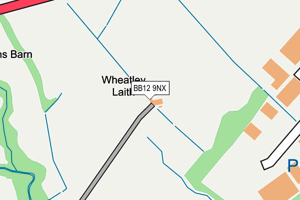
BB12 9NX is located in the Fence & Higham electoral ward, within the local authority district of Pendle and the English Parliamentary constituency of Pendle. The Sub Integrated Care Board (ICB) Location is NHS Lancashire and South Cumbria ICB - 01A and the police force is Lancashire. This postcode has been in use since January 1980.


GetTheData
Source: OS OpenMap – Local (Ordnance Survey)
Source: OS VectorMap District (Ordnance Survey)
Licence: Open Government Licence (requires attribution)
| Easting | 384186 |
| Northing | 437845 |
| Latitude | 53.836614 |
| Longitude | -2.241788 |
GetTheData
Source: Open Postcode Geo
Licence: Open Government Licence
| Country | England |
| Postcode District | BB12 |
| ➜ BB12 open data dashboard ➜ See where BB12 is on a map | |
GetTheData
Source: Land Registry Price Paid Data
Licence: Open Government Licence
Elevation or altitude of BB12 9NX as distance above sea level:
| Metres | Feet | |
|---|---|---|
| Elevation | 150m | 492ft |
Elevation is measured from the approximate centre of the postcode, to the nearest point on an OS contour line from OS Terrain 50, which has contour spacing of ten vertical metres.
➜ How high above sea level am I? Find the elevation of your current position using your device's GPS.
GetTheData
Source: Open Postcode Elevation
Licence: Open Government Licence
| Ward | Fence & Higham |
| Constituency | Pendle |
GetTheData
Source: ONS Postcode Database
Licence: Open Government Licence
| May 2022 | Burglary | On or near Holden Road | 303m |
| May 2022 | Violence and sexual offences | On or near Pendleside | 322m |
| April 2022 | Burglary | On or near Pendleside | 322m |
| ➜ Get more crime data in our Crime section | |||
GetTheData
Source: data.police.uk
Licence: Open Government Licence
| White Swan (Wheatley Lane) | Wheatley Lane | 647m |
| White Swan (Wheatley Lane) | Wheatley Lane | 653m |
| Ye Old Sparrowhawk (Wheatley Lane) | Wheatley Lane | 684m |
| Industrial Estate (Churchill Way) | Lomeshaye | 691m |
| Ye Old Sparrowhawk (Wheatley Lane) | Wheatley Lane | 707m |
| Brierfield Station | 1.4km |
| Nelson Station | 1.9km |
| Colne Station | 4.4km |
GetTheData
Source: NaPTAN
Licence: Open Government Licence
| Percentage of properties with Next Generation Access | 100.0% |
| Percentage of properties with Superfast Broadband | 100.0% |
| Percentage of properties with Ultrafast Broadband | 0.0% |
| Percentage of properties with Full Fibre Broadband | 0.0% |
Superfast Broadband is between 30Mbps and 300Mbps
Ultrafast Broadband is > 300Mbps
| Percentage of properties unable to receive 2Mbps | 0.0% |
| Percentage of properties unable to receive 5Mbps | 0.0% |
| Percentage of properties unable to receive 10Mbps | 0.0% |
| Percentage of properties unable to receive 30Mbps | 0.0% |
GetTheData
Source: Ofcom
Licence: Ofcom Terms of Use (requires attribution)
GetTheData
Source: ONS Postcode Database
Licence: Open Government Licence


➜ Get more ratings from the Food Standards Agency
GetTheData
Source: Food Standards Agency
Licence: FSA terms & conditions
| Last Collection | |||
|---|---|---|---|
| Location | Mon-Fri | Sat | Distance |
| Wheatley Lane, Fence | 16:00 | 10:30 | 482m |
| 46 Carr Road | 16:00 | 11:00 | 946m |
| Fence Post Office | 17:00 | 11:15 | 969m |
GetTheData
Source: Dracos
Licence: Creative Commons Attribution-ShareAlike
| Facility | Distance |
|---|---|
| Adpak Machinery Systems Ltd (Closed) Pendleside, Lomeshaye Industrial Estate, Nelson Sports Hall | 280m |
| Victoria Park (Nelson) Lomeshaye Way, Nelson Grass Pitches | 832m |
| Pendle Forest Sports Club Barrowford Road, Fence, Burnley Grass Pitches | 1km |
GetTheData
Source: Active Places
Licence: Open Government Licence
| School | Phase of Education | Distance |
|---|---|---|
| Wheatley Lane Methodist Voluntary Aided Primary School Fence, Burnley, BB12 9ED | Primary | 1.1km |
| Lomeshaye Junior School Norfolk Street, Nelson, BB9 7SY | Primary | 1.3km |
| Al-Ikhlaas Primary School 35 Norfolk Street, Nelson, BB9 7SY | Not applicable | 1.5km |
GetTheData
Source: Edubase
Licence: Open Government Licence
The below table lists the International Territorial Level (ITL) codes (formerly Nomenclature of Territorial Units for Statistics (NUTS) codes) and Local Administrative Units (LAU) codes for BB12 9NX:
| ITL 1 Code | Name |
|---|---|
| TLD | North West (England) |
| ITL 2 Code | Name |
| TLD4 | Lancashire |
| ITL 3 Code | Name |
| TLD46 | East Lancashire |
| LAU 1 Code | Name |
| E07000122 | Pendle |
GetTheData
Source: ONS Postcode Directory
Licence: Open Government Licence
The below table lists the Census Output Area (OA), Lower Layer Super Output Area (LSOA), and Middle Layer Super Output Area (MSOA) for BB12 9NX:
| Code | Name | |
|---|---|---|
| OA | E00127965 | |
| LSOA | E01025211 | Pendle 008F |
| MSOA | E02005247 | Pendle 008 |
GetTheData
Source: ONS Postcode Directory
Licence: Open Government Licence
| BB12 9NU | 512m | |
| BB12 9QF | Pollard Row | 585m |
| BB12 9QD | Wheatley Lane Road | 614m |
| BB9 6RS | Kirby Road | 616m |
| BB9 6RT | Churchill Way | 621m |
| BB9 6QB | Churchill Road | 631m |
| BB12 9QE | Tunstill Fold | 661m |
| BB9 6QD | Carr Hall Road | 687m |
| BB12 9QG | Wheatley Lane Road | 713m |
| BB9 5SP | Kenyon Road | 732m |
GetTheData
Source: Open Postcode Geo; Land Registry Price Paid Data
Licence: Open Government Licence