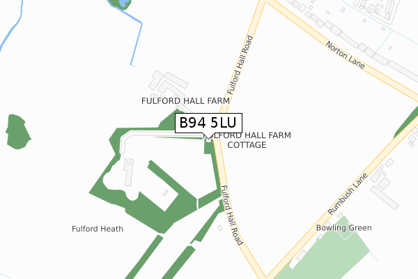
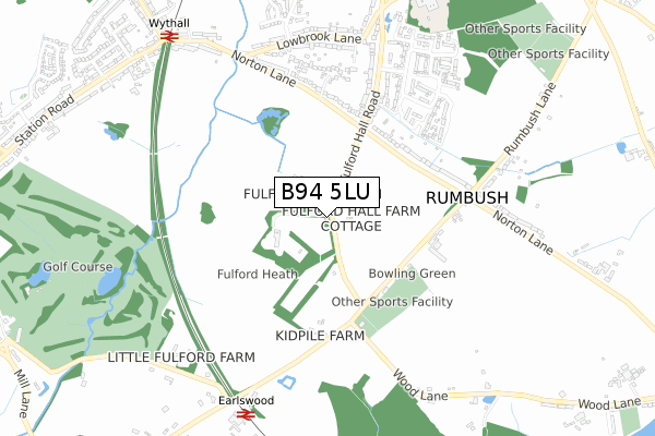
B94 5LU lies on Fulford Hall Road in Earlswood, Solihull. B94 5LU is located in the Blythe electoral ward, within the metropolitan district of Solihull and the English Parliamentary constituency of Meriden. The Sub Integrated Care Board (ICB) Location is NHS Birmingham and Solihull ICB - 15E and the police force is West Midlands. This postcode has been in use since January 1980.


GetTheData
Source: OS Open Zoomstack (Ordnance Survey)
Licence: Open Government Licence (requires attribution)
Attribution: Contains OS data © Crown copyright and database right 2024
Source: Open Postcode Geo
Licence: Open Government Licence (requires attribution)
Attribution: Contains OS data © Crown copyright and database right 2024; Contains Royal Mail data © Royal Mail copyright and database right 2024; Source: Office for National Statistics licensed under the Open Government Licence v.3.0
| Easting | 409844 |
| Northing | 275048 |
| Latitude | 52.373389 |
| Longitude | -1.856830 |
GetTheData
Source: Open Postcode Geo
Licence: Open Government Licence
| Street | Fulford Hall Road |
| Locality | Earlswood |
| Town/City | Solihull |
| Country | England |
| Postcode District | B94 |
| ➜ B94 open data dashboard ➜ See where B94 is on a map | |
GetTheData
Source: Land Registry Price Paid Data
Licence: Open Government Licence
Elevation or altitude of B94 5LU as distance above sea level:
| Metres | Feet | |
|---|---|---|
| Elevation | 150m | 492ft |
Elevation is measured from the approximate centre of the postcode, to the nearest point on an OS contour line from OS Terrain 50, which has contour spacing of ten vertical metres.
➜ How high above sea level am I? Find the elevation of your current position using your device's GPS.
GetTheData
Source: Open Postcode Elevation
Licence: Open Government Licence
| Ward | Blythe |
| Constituency | Meriden |
GetTheData
Source: ONS Postcode Database
Licence: Open Government Licence
| May 2022 | Violence and sexual offences | On or near Fulford Hall Road | 252m |
| May 2022 | Violence and sexual offences | On or near Fulford Hall Road | 252m |
| April 2022 | Violence and sexual offences | On or near Fulford Hall Road | 252m |
| ➜ Get more crime data in our Crime section | |||
GetTheData
Source: data.police.uk
Licence: Open Government Licence
| Fulford Hall Road (Norton Lane) | Tidbury Green | 388m |
| Norton Lane (Fulford Hall Rd) | Tidbury Green | 429m |
| Norton Lane (Fulford Hall Rd) | Tidbury Green | 431m |
| Rumbush Lane (Norton Lane) | Tidbury Green | 517m |
| Nr Lowbrook Lane (Norton Lane) | Tidbury Green | 546m |
| Earlswood (West Midlands) Station | 0.8km |
| Wythall Station | 0.9km |
| The Lakes Station | 1.8km |
GetTheData
Source: NaPTAN
Licence: Open Government Licence
➜ Broadband speed and availability dashboard for B94 5LU
| Percentage of properties with Next Generation Access | 100.0% |
| Percentage of properties with Superfast Broadband | 60.0% |
| Percentage of properties with Ultrafast Broadband | 0.0% |
| Percentage of properties with Full Fibre Broadband | 0.0% |
Superfast Broadband is between 30Mbps and 300Mbps
Ultrafast Broadband is > 300Mbps
| Median download speed | 14.9Mbps |
| Average download speed | 22.7Mbps |
| Maximum download speed | 54.30Mbps |
| Median upload speed | 1.2Mbps |
| Average upload speed | 4.6Mbps |
| Maximum upload speed | 10.00Mbps |
| Percentage of properties unable to receive 2Mbps | 0.0% |
| Percentage of properties unable to receive 5Mbps | 0.0% |
| Percentage of properties unable to receive 10Mbps | 0.0% |
| Percentage of properties unable to receive 30Mbps | 40.0% |
➜ Broadband speed and availability dashboard for B94 5LU
GetTheData
Source: Ofcom
Licence: Ofcom Terms of Use (requires attribution)
GetTheData
Source: ONS Postcode Database
Licence: Open Government Licence


➜ Get more ratings from the Food Standards Agency
GetTheData
Source: Food Standards Agency
Licence: FSA terms & conditions
| Last Collection | |||
|---|---|---|---|
| Location | Mon-Fri | Sat | Distance |
| Fullford Hall Road | 17:00 | 12:30 | 436m |
| Tidbury Green Garage | 17:00 | 11:30 | 789m |
| Grimes Hill Station | 17:15 | 11:30 | 954m |
GetTheData
Source: Dracos
Licence: Creative Commons Attribution-ShareAlike
| Facility | Distance |
|---|---|
| Woodbourne Sports Club Rumbush Lane, Earlswood, Solihull Grass Pitches | 357m |
| Leafield Athletic Fc (Rumbush Lane) Rumbush Lane, Earlswood, Solihull Grass Pitches | 1.1km |
| Dickens Heath Sports Club Rumbush Lane, Earlswood, Solihull Grass Pitches | 1.1km |
GetTheData
Source: Active Places
Licence: Open Government Licence
| School | Phase of Education | Distance |
|---|---|---|
| Tidbury Green School Dickens Heath Road, Tidbury Green, Solihull, B90 1QW | Primary | 897m |
| Meadow Green Primary School Meadow Road, Wythall, Birmingham, B47 6EQ | Primary | 1.7km |
| Dickens Heath Community Primary School Three Acres Lane, Dickens Heath, Solihull, B90 1NA | Primary | 2.1km |
GetTheData
Source: Edubase
Licence: Open Government Licence
The below table lists the International Territorial Level (ITL) codes (formerly Nomenclature of Territorial Units for Statistics (NUTS) codes) and Local Administrative Units (LAU) codes for B94 5LU:
| ITL 1 Code | Name |
|---|---|
| TLG | West Midlands (England) |
| ITL 2 Code | Name |
| TLG3 | West Midlands |
| ITL 3 Code | Name |
| TLG32 | Solihull |
| LAU 1 Code | Name |
| E08000029 | Solihull |
GetTheData
Source: ONS Postcode Directory
Licence: Open Government Licence
The below table lists the Census Output Area (OA), Lower Layer Super Output Area (LSOA), and Middle Layer Super Output Area (MSOA) for B94 5LU:
| Code | Name | |
|---|---|---|
| OA | E00051491 | |
| LSOA | E01032886 | Solihull 029G |
| MSOA | E02002109 | Solihull 029 |
GetTheData
Source: ONS Postcode Directory
Licence: Open Government Licence
| B94 5LT | Norton Lane | 427m |
| B90 1QY | Fulford Hall Road | 433m |
| B94 5LW | Rumbush Lane | 433m |
| B90 1QT | Norton Lane | 525m |
| B90 1QX | Fulford Hall Road | 575m |
| B94 5LX | Rumbush Lane | 659m |
| B94 5LP | Norton Lane | 697m |
| B90 1QS | Lowbrook Lane | 713m |
| B90 1QR | Lowbrook Lane | 719m |
| B94 5JS | Station Drive | 746m |
GetTheData
Source: Open Postcode Geo; Land Registry Price Paid Data
Licence: Open Government Licence