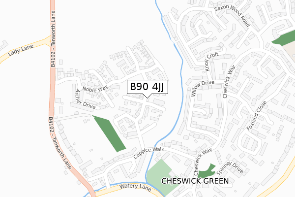
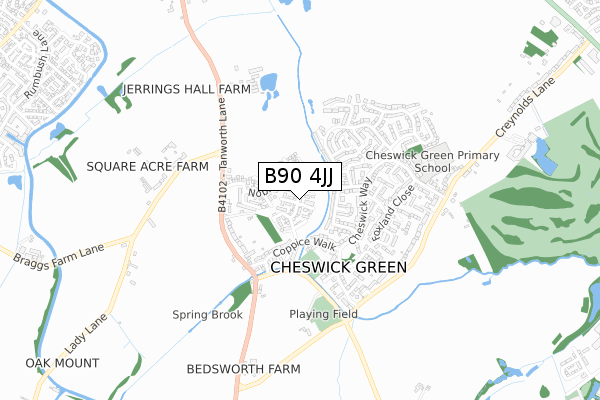
B90 4JJ maps, stats, and open data
B90 4JJ is located in the Blythe electoral ward, within the metropolitan district of Solihull and the English Parliamentary constituency of Meriden. The Sub Integrated Care Board (ICB) Location is NHS Birmingham and Solihull ICB - 15E and the police force is West Midlands. This postcode has been in use since December 2017.
B90 4JJ maps


Licence: Open Government Licence (requires attribution)
Attribution: Contains OS data © Crown copyright and database right 2026
Source: Open Postcode Geo
Licence: Open Government Licence (requires attribution)
Attribution: Contains OS data © Crown copyright and database right 2026; Contains Royal Mail data © Royal Mail copyright and database right 2026; Source: Office for National Statistics licensed under the Open Government Licence v.3.0
B90 4JJ geodata
| Easting | 412527 |
| Northing | 275848 |
| Latitude | 52.380541 |
| Longitude | -1.817383 |
Where is B90 4JJ?
| Country | England |
| Postcode District | B90 |
Politics
| Ward | Blythe |
|---|---|
| Constituency | Meriden |
House Prices
Sales of detached houses in B90 4JJ
2023 28 FEB £575,000 |
2021 30 NOV £339,950 |
95, NOBLE WAY, CHESWICK GREEN, SOLIHULL, B90 4JJ 2020 27 MAR £379,950 |
97, NOBLE WAY, CHESWICK GREEN, SOLIHULL, B90 4JJ 2019 30 AUG £394,950 |
99, NOBLE WAY, CHESWICK GREEN, SOLIHULL, B90 4JJ 2019 30 AUG £392,950 |
115, NOBLE WAY, CHESWICK GREEN, SOLIHULL, B90 4JJ 2019 31 JAN £394,950 |
121, NOBLE WAY, CHESWICK GREEN, SOLIHULL, B90 4JJ 2018 31 OCT £394,950 |
2017 21 DEC £545,000 |
65, NOBLE WAY, CHESWICK GREEN, SOLIHULL, B90 4JJ 2017 30 NOV £445,000 |
2017 30 NOV £315,000 |
Licence: Contains HM Land Registry data © Crown copyright and database right 2026. This data is licensed under the Open Government Licence v3.0.
Transport
Nearest bus stops to B90 4JJ
| Willow Drive (Cheswick Way) | Cheswick Green | 271m |
| The Saxon (Cheswick Way) | Cheswick Green | 306m |
| The Saxon (Cheswick Way) | Cheswick Green | 317m |
| Coppice Walk (Watery Lane) | Cheswick Green | 321m |
| Lady Lane (Tanworth Lane) | Cheswick Green | 336m |
Nearest railway stations to B90 4JJ
| Whitlocks End Station | 2.6km |
| The Lakes Station | 3km |
| Shirley Station | 3.2km |
Broadband
Broadband access in B90 4JJ (2020 data)
| Percentage of properties with Next Generation Access | 100.0% |
| Percentage of properties with Superfast Broadband | 100.0% |
| Percentage of properties with Ultrafast Broadband | 100.0% |
| Percentage of properties with Full Fibre Broadband | 100.0% |
Superfast Broadband is between 30Mbps and 300Mbps
Ultrafast Broadband is > 300Mbps
Broadband speed in B90 4JJ (2019 data)
Download
| Median download speed | 100.0Mbps |
| Average download speed | 113.6Mbps |
| Maximum download speed | 200.00Mbps |
Upload
Ofcom does not currently provide upload speed data for B90 4JJ. This is because there are less than four broadband connections in this postcode.
Broadband limitations in B90 4JJ (2020 data)
| Percentage of properties unable to receive 2Mbps | 0.0% |
| Percentage of properties unable to receive 5Mbps | 0.0% |
| Percentage of properties unable to receive 10Mbps | 0.0% |
| Percentage of properties unable to receive 30Mbps | 0.0% |
Deprivation
14.8% of English postcodes are less deprived than B90 4JJ:Food Standards Agency
Three nearest food hygiene ratings to B90 4JJ (metres)


➜ Get more ratings from the Food Standards Agency
Nearest post box to B90 4JJ
| Last Collection | |||
|---|---|---|---|
| Location | Mon-Fri | Sat | Distance |
| Cheswick Green Post Office | 18:30 | 11:30 | 301m |
| By Salter St School | 12:00 | 08:30 | 984m |
| Dickens Heath / Birchy Close | 17:15 | 11:30 | 1,503m |
B90 4JJ ITL and B90 4JJ LAU
The below table lists the International Territorial Level (ITL) codes (formerly Nomenclature of Territorial Units for Statistics (NUTS) codes) and Local Administrative Units (LAU) codes for B90 4JJ:
| ITL 1 Code | Name |
|---|---|
| TLG | West Midlands (England) |
| ITL 2 Code | Name |
| TLG3 | West Midlands |
| ITL 3 Code | Name |
| TLG32 | Solihull |
| LAU 1 Code | Name |
| E08000029 | Solihull |
B90 4JJ census areas
The below table lists the Census Output Area (OA), Lower Layer Super Output Area (LSOA), and Middle Layer Super Output Area (MSOA) for B90 4JJ:
| Code | Name | |
|---|---|---|
| OA | E00051491 | |
| LSOA | E01032886 | Solihull 029G |
| MSOA | E02002109 | Solihull 029 |
Nearest postcodes to B90 4JJ
| B90 4JF | Tanworth Lane | 147m |
| B90 4HW | Willow Drive | 176m |
| B90 4HY | Coppice Walk | 203m |
| B90 4HN | Willow Drive | 224m |
| B90 4JN | Saxon Wood Road | 244m |
| B90 4HE | Cheswick Way | 248m |
| B90 4HX | Coppice Close | 265m |
| B90 4HZ | Coppice Walk | 267m |
| B90 4JL | Knoll Croft | 269m |
| B90 4JW | The Dingle | 270m |