B90 1GJ maps, stats, and open data
- Home
- Postcode
- B
- B90
- B90 1
B90 1GJ is located in the Blythe electoral ward, within the metropolitan district of Solihull and the English Parliamentary constituency of Meriden. The Sub Integrated Care Board (ICB) Location is NHS Birmingham and Solihull ICB - 15E and the police force is West Midlands. This postcode has been in use since January 2018.
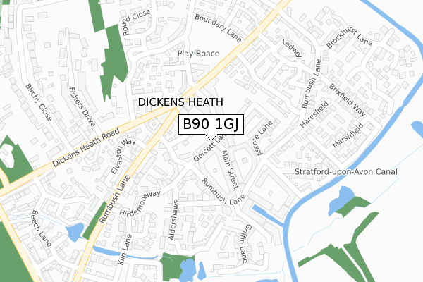
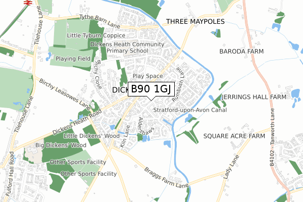
B90 1GJ maps


Source: OS Open Zoomstack (Ordnance Survey)
Licence: Open Government Licence (requires attribution)
Attribution: Contains OS data © Crown copyright and database right 2026
Source: Open Postcode GeoLicence: Open Government Licence (requires attribution)
Attribution: Contains OS data © Crown copyright and database right 2026; Contains Royal Mail data © Royal Mail copyright and database right 2026; Source: Office for National Statistics licensed under the Open Government Licence v.3.0
B90 1GJ geodata
| Easting | 411208 |
| Northing | 276277 |
| Latitude | 52.384426 |
| Longitude | -1.836746 |
Where is B90 1GJ?
| Country | England |
| Postcode District | B90 |
Politics
| Ward | Blythe |
|---|
| Constituency | Meriden |
|---|
Transport
Nearest bus stops to B90 1GJ
| Campion Way (Dickens Heath Rd) | Dickens Heath | 199m |
| Meadow Pleck Lane (Dickens Heath Rd) | Dickens Heath | 246m |
| Fishers Drive (Dickens Heath Rd) | Dickens Heath | 247m |
| Fishers Drive (Dickens Heath Rd) | Dickens Heath | 259m |
| Meadow Pleck Lane (Dickens Heath Rd) | Dickens Heath | 285m |
Nearest railway stations to B90 1GJ
| Whitlocks End Station | 1.3km |
| Wythall Station | 2km |
| Shirley Station | 2.2km |
Broadband
Broadband access in B90 1GJ (2020 data)
| Percentage of properties with Next Generation Access | 100.0% |
| Percentage of properties with Superfast Broadband | 100.0% |
| Percentage of properties with Ultrafast Broadband | 0.0% |
| Percentage of properties with Full Fibre Broadband | 0.0% |
Superfast Broadband is between 30Mbps and 300Mbps
Ultrafast Broadband is > 300Mbps
Broadband speed in B90 1GJ (2019 data)
Download
| Median download speed | 67.4Mbps |
| Average download speed | 56.2Mbps |
| Maximum download speed | 73.94Mbps |
Upload
| Median upload speed | 15.2Mbps |
| Average upload speed | 13.2Mbps |
| Maximum upload speed | 19.53Mbps |
Broadband limitations in B90 1GJ (2020 data)
| Percentage of properties unable to receive 2Mbps | 0.0% |
| Percentage of properties unable to receive 5Mbps | 0.0% |
| Percentage of properties unable to receive 10Mbps | 0.0% |
| Percentage of properties unable to receive 30Mbps | 0.0% |
Deprivation
7.8% of English postcodes are less deprived than
B90 1GJ:
Food Standards Agency
Three nearest food hygiene ratings to B90 1GJ (metres)
Pizzarella Bar & Grill
La Stores - (Go Local)
Ale Hub Micro Pub
➜ Get more ratings from the Food Standards Agency
Nearest post box to B90 1GJ
| | Last Collection | |
|---|
| Location | Mon-Fri | Sat | Distance |
|---|
| Dickens Heath / Birchy Close | 17:15 | 11:30 | 124m |
| Tidbury Green Garage | 17:00 | 11:30 | 1,264m |
| Fullford Hall Road | 17:00 | 12:30 | 1,460m |
B90 1GJ ITL and B90 1GJ LAU
The below table lists the International Territorial Level (ITL) codes (formerly Nomenclature of Territorial Units for Statistics (NUTS) codes) and Local Administrative Units (LAU) codes for B90 1GJ:
| ITL 1 Code | Name |
|---|
| TLG | West Midlands (England) |
| ITL 2 Code | Name |
|---|
| TLG3 | West Midlands |
| ITL 3 Code | Name |
|---|
| TLG32 | Solihull |
| LAU 1 Code | Name |
|---|
| E08000029 | Solihull |
B90 1GJ census areas
The below table lists the Census Output Area (OA), Lower Layer Super Output Area (LSOA), and Middle Layer Super Output Area (MSOA) for B90 1GJ:
| Code | Name |
|---|
| OA | E00168165 | |
|---|
| LSOA | E01032885 | Solihull 029F |
|---|
| MSOA | E02002109 | Solihull 029 |
|---|
Nearest postcodes to B90 1GJ


