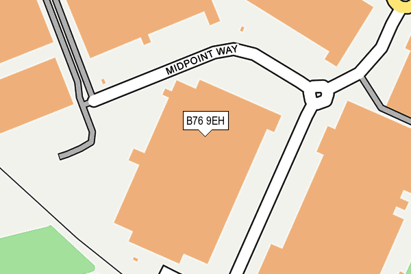
B76 9EH is located in the Sutton Walmley & Minworth electoral ward, within the metropolitan district of Birmingham and the English Parliamentary constituency of Sutton Coldfield. The Sub Integrated Care Board (ICB) Location is NHS Birmingham and Solihull ICB - 15E and the police force is West Midlands. This postcode has been in use since December 2009.


GetTheData
Source: OS OpenMap – Local (Ordnance Survey)
Source: OS VectorMap District (Ordnance Survey)
Licence: Open Government Licence (requires attribution)
| Easting | 415899 |
| Northing | 291532 |
| Latitude | 52.521438 |
| Longitude | -1.767111 |
GetTheData
Source: Open Postcode Geo
Licence: Open Government Licence
| Country | England |
| Postcode District | B76 |
| ➜ B76 open data dashboard ➜ See where B76 is on a map ➜ Where is Birmingham? | |
GetTheData
Source: Land Registry Price Paid Data
Licence: Open Government Licence
Elevation or altitude of B76 9EH as distance above sea level:
| Metres | Feet | |
|---|---|---|
| Elevation | 80m | 262ft |
Elevation is measured from the approximate centre of the postcode, to the nearest point on an OS contour line from OS Terrain 50, which has contour spacing of ten vertical metres.
➜ How high above sea level am I? Find the elevation of your current position using your device's GPS.
GetTheData
Source: Open Postcode Elevation
Licence: Open Government Licence
| Ward | Sutton Walmley & Minworth |
| Constituency | Sutton Coldfield |
GetTheData
Source: ONS Postcode Database
Licence: Open Government Licence
| June 2022 | Violence and sexual offences | On or near Park Lane | 371m |
| June 2022 | Vehicle crime | On or near Park Lane | 371m |
| May 2022 | Public order | On or near Park Lane | 371m |
| ➜ Get more crime data in our Crime section | |||
GetTheData
Source: data.police.uk
Licence: Open Government Licence
| Water Orton Lane (Park Lane) | Minworth | 370m |
| Water Orton Lane (Park Lane) | Minworth | 381m |
| Severn Trent Water Works (Park Lane) | Castle Bromwich | 442m |
| Severn Trent Water Works (Park Lane) | Castle Bromwich | 484m |
| Minworth Hall Farm (Water Orton Lane) | Minworth | 500m |
| Water Orton Station | 1.7km |
| Coleshill Parkway Station | 4km |
| Chester Road Station | 4.7km |
GetTheData
Source: NaPTAN
Licence: Open Government Licence
GetTheData
Source: ONS Postcode Database
Licence: Open Government Licence


➜ Get more ratings from the Food Standards Agency
GetTheData
Source: Food Standards Agency
Licence: FSA terms & conditions
| Last Collection | |||
|---|---|---|---|
| Location | Mon-Fri | Sat | Distance |
| Park Lane / Water Orton Lane | 16:00 | 09:00 | 383m |
| Park Lane / Farnborough Road | 17:15 | 12:30 | 771m |
| Minworth | 17:00 | 12:00 | 783m |
GetTheData
Source: Dracos
Licence: Creative Commons Attribution-ShareAlike
| Facility | Distance |
|---|---|
| Minworth Junior And Infant School Water Orton Lane, Minworth, Sutton Coldfield Grass Pitches | 719m |
| Castle Vale Football Stadium Farnborough Road, Birmingham Artificial Grass Pitch, Grass Pitches | 901m |
| Greenwood Academy Farnborough Road, Birmingham Sports Hall, Studio, Grass Pitches | 963m |
GetTheData
Source: Active Places
Licence: Open Government Licence
| School | Phase of Education | Distance |
|---|---|---|
| Minworth Junior and Infant School Water Orton Lane, Minworth, SUTTON COLDFIELD, B76 9BU | Primary | 719m |
| Greenwood Academy Farnborough Road, Castle Vale, Birmingham, B35 7NL | Secondary | 1km |
| Park Hall Academy Water Orton Road, Castle Bromwich, Birmingham, B36 9HF | Secondary | 1.1km |
GetTheData
Source: Edubase
Licence: Open Government Licence
| Risk of B76 9EH flooding from rivers and sea | Very Low |
| ➜ B76 9EH flood map | |
GetTheData
Source: Open Flood Risk by Postcode
Licence: Open Government Licence
The below table lists the International Territorial Level (ITL) codes (formerly Nomenclature of Territorial Units for Statistics (NUTS) codes) and Local Administrative Units (LAU) codes for B76 9EH:
| ITL 1 Code | Name |
|---|---|
| TLG | West Midlands (England) |
| ITL 2 Code | Name |
| TLG3 | West Midlands |
| ITL 3 Code | Name |
| TLG31 | Birmingham |
| LAU 1 Code | Name |
| E08000025 | Birmingham |
GetTheData
Source: ONS Postcode Directory
Licence: Open Government Licence
The below table lists the Census Output Area (OA), Lower Layer Super Output Area (LSOA), and Middle Layer Super Output Area (MSOA) for B76 9EH:
| Code | Name | |
|---|---|---|
| OA | E00047854 | |
| LSOA | E01009441 | Birmingham 021B |
| MSOA | E02001847 | Birmingham 021 |
GetTheData
Source: ONS Postcode Directory
Licence: Open Government Licence
| B76 9BJ | Water Orton Lane | 344m |
| B76 9BL | Park Lane | 348m |
| B76 9BD | Water Orton Lane | 458m |
| B35 6LJ | Park Lane | 461m |
| B76 9BT | Water Orton Lane | 516m |
| B35 6AN | Park Lane | 531m |
| B76 9BB | Robinsons Way | 590m |
| B76 9BA | Water Orton Lane | 751m |
| B35 7NR | Farnborough Road | 772m |
| B76 9BU | Water Orton Lane | 779m |
GetTheData
Source: Open Postcode Geo; Land Registry Price Paid Data
Licence: Open Government Licence