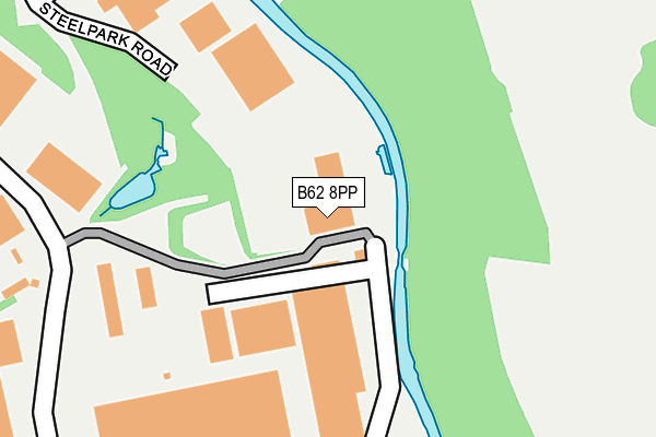
B62 8PP is located in the Halesowen North electoral ward, within the metropolitan district of Dudley and the English Parliamentary constituency of Halesowen and Rowley Regis. The Sub Integrated Care Board (ICB) Location is NHS Black Country ICB - D2P2L and the police force is West Midlands. This postcode has been in use since June 2001.


GetTheData
Source: OS OpenMap – Local (Ordnance Survey)
Source: OS VectorMap District (Ordnance Survey)
Licence: Open Government Licence (requires attribution)
| Easting | 397329 |
| Northing | 284779 |
| Latitude | 52.460965 |
| Longitude | -2.040733 |
GetTheData
Source: Open Postcode Geo
Licence: Open Government Licence
| Country | England |
| Postcode District | B62 |
| ➜ B62 open data dashboard ➜ See where B62 is on a map ➜ Where is Halesowen? | |
GetTheData
Source: Land Registry Price Paid Data
Licence: Open Government Licence
Elevation or altitude of B62 8PP as distance above sea level:
| Metres | Feet | |
|---|---|---|
| Elevation | 140m | 459ft |
Elevation is measured from the approximate centre of the postcode, to the nearest point on an OS contour line from OS Terrain 50, which has contour spacing of ten vertical metres.
➜ How high above sea level am I? Find the elevation of your current position using your device's GPS.
GetTheData
Source: Open Postcode Elevation
Licence: Open Government Licence
| Ward | Halesowen North |
| Constituency | Halesowen And Rowley Regis |
GetTheData
Source: ONS Postcode Database
Licence: Open Government Licence
| November 2023 | Burglary | On or near Park/Open Space | 391m |
| October 2023 | Public order | On or near Park/Open Space | 391m |
| August 2023 | Other theft | On or near Park/Open Space | 391m |
| ➜ Get more crime data in our Crime section | |||
GetTheData
Source: data.police.uk
Licence: Open Government Licence
| Halesowen Industrial Park (Coombs Rd) | Coombeswood | 520m |
| Halesowen Industrial Park (Coombs Rd) | Coombeswood | 527m |
| Coombes Rd (Dudley Rd) | Hawne | 586m |
| Linnet Close (Lodgefield Rd) | Coombeswood | 597m |
| Sylvan Green (Mucklow Hill) | Halesowen | 602m |
| Old Hill Station | 1.5km |
| Rowley Regis Station | 1.9km |
| Cradley Heath Station | 3.5km |
GetTheData
Source: NaPTAN
Licence: Open Government Licence
GetTheData
Source: ONS Postcode Database
Licence: Open Government Licence


➜ Get more ratings from the Food Standards Agency
GetTheData
Source: Food Standards Agency
Licence: FSA terms & conditions
| Last Collection | |||
|---|---|---|---|
| Location | Mon-Fri | Sat | Distance |
| Mucklow Hill | 17:45 | 12:00 | 578m |
| Stewart Road / Ridgefield Road | 17:15 | 12:00 | 655m |
| Chatsworth Road / Lodgefield Road | 17:30 | 12:00 | 697m |
GetTheData
Source: Dracos
Licence: Creative Commons Attribution-ShareAlike
| Facility | Distance |
|---|---|
| Coombs Wood Cricket Club Stewarts Road, Halesowen Grass Pitches | 519m |
| Gym 212 (Closed) Dudley Road, Halesowen Health and Fitness Gym, Studio | 636m |
| Olive Hill Primary School Springfield Road, Halesowen Grass Pitches | 672m |
GetTheData
Source: Active Places
Licence: Open Government Licence
| School | Phase of Education | Distance |
|---|---|---|
| Olive Hill Primary Academy Springfield Road, Halesowen, B62 8JZ | Primary | 689m |
| Halesowen College Whittingham Road, Halesowen, B63 3NA | 16 plus | 852m |
| Leasowes High School Kent Road, Halesowen, B62 8PJ | Secondary | 926m |
GetTheData
Source: Edubase
Licence: Open Government Licence
The below table lists the International Territorial Level (ITL) codes (formerly Nomenclature of Territorial Units for Statistics (NUTS) codes) and Local Administrative Units (LAU) codes for B62 8PP:
| ITL 1 Code | Name |
|---|---|
| TLG | West Midlands (England) |
| ITL 2 Code | Name |
| TLG3 | West Midlands |
| ITL 3 Code | Name |
| TLG36 | Dudley |
| LAU 1 Code | Name |
| E08000027 | Dudley |
GetTheData
Source: ONS Postcode Directory
Licence: Open Government Licence
The below table lists the Census Output Area (OA), Lower Layer Super Output Area (LSOA), and Middle Layer Super Output Area (MSOA) for B62 8PP:
| Code | Name | |
|---|---|---|
| OA | E00049275 | |
| LSOA | E01009734 | Dudley 034A |
| MSOA | E02002033 | Dudley 034 |
GetTheData
Source: ONS Postcode Directory
Licence: Open Government Licence
| B62 8SE | Halesowen Industrial Park | 198m |
| B62 8AN | Hereward Rise | 262m |
| B62 8BN | Mucklow Hill | 445m |
| B62 8BT | Mucklow Hill | 533m |
| B62 8AA | Coombs Road | 537m |
| B62 8BU | Mucklow Hill | 548m |
| B62 8BL | Mucklow Hill | 567m |
| B62 8BS | Mucklow Hill | 570m |
| B62 8ND | Stewarts Road | 583m |
| B62 8TR | Golden Orchard | 593m |
GetTheData
Source: Open Postcode Geo; Land Registry Price Paid Data
Licence: Open Government Licence