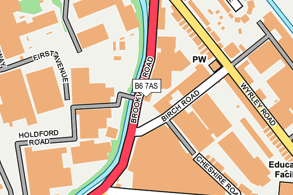
B6 7AS is located in the Aston electoral ward, within the metropolitan district of Birmingham and the English Parliamentary constituency of Birmingham, Perry Barr. The Sub Integrated Care Board (ICB) Location is NHS Birmingham and Solihull ICB - 15E and the police force is West Midlands. This postcode has been in use since January 1980.


GetTheData
Source: OS OpenMap – Local (Ordnance Survey)
Source: OS VectorMap District (Ordnance Survey)
Licence: Open Government Licence (requires attribution)
| Easting | 408242 |
| Northing | 290894 |
| Latitude | 52.515870 |
| Longitude | -1.879975 |
GetTheData
Source: Open Postcode Geo
Licence: Open Government Licence
| Country | England |
| Postcode District | B6 |
| ➜ B6 open data dashboard ➜ See where B6 is on a map ➜ Where is Birmingham? | |
GetTheData
Source: Land Registry Price Paid Data
Licence: Open Government Licence
Elevation or altitude of B6 7AS as distance above sea level:
| Metres | Feet | |
|---|---|---|
| Elevation | 100m | 328ft |
Elevation is measured from the approximate centre of the postcode, to the nearest point on an OS contour line from OS Terrain 50, which has contour spacing of ten vertical metres.
➜ How high above sea level am I? Find the elevation of your current position using your device's GPS.
GetTheData
Source: Open Postcode Elevation
Licence: Open Government Licence
| Ward | Aston |
| Constituency | Birmingham, Perry Barr |
GetTheData
Source: ONS Postcode Database
Licence: Open Government Licence
| June 2022 | Violence and sexual offences | On or near Cheshire Road | 177m |
| June 2022 | Violence and sexual offences | On or near Cheshire Road | 177m |
| June 2022 | Vehicle crime | On or near Cheshire Road | 177m |
| ➜ Get more crime data in our Crime section | |||
GetTheData
Source: data.police.uk
Licence: Open Government Licence
| Wyrley Rd (Brookvale Rd) | Witton | 132m |
| Deykin Ave (Brookvale Rd) | Witton | 135m |
| Deykin Ave (Brookvale Rd) | Witton | 141m |
| Wyrley Rd (Brookvale Rd) | Witton | 205m |
| Wyrley Rd (Brookvale Rd) | Witton | 212m |
| Witton (West Midlands) Station | 0.5km |
| Aston Station | 1.4km |
| Perry Barr Station | 1.5km |
GetTheData
Source: NaPTAN
Licence: Open Government Licence
GetTheData
Source: ONS Postcode Database
Licence: Open Government Licence

➜ Get more ratings from the Food Standards Agency
GetTheData
Source: Food Standards Agency
Licence: FSA terms & conditions
| Last Collection | |||
|---|---|---|---|
| Location | Mon-Fri | Sat | Distance |
| Deykin Avenue | 18:30 | 12:30 | 214m |
| Amberley Grove / Brookvale Road | 17:30 | 12:30 | 330m |
| Electric Avenue/Westwood Road | 18:30 | 12:30 | 529m |
GetTheData
Source: Dracos
Licence: Creative Commons Attribution-ShareAlike
| Facility | Distance |
|---|---|
| Aston Villa Fc (Brookvale Academy) Tame Road, Birmingham Artificial Grass Pitch | 382m |
| Holford Drive Community Sports Hub Holford Drive, Perry Barr, Birmingham Grass Pitches, Outdoor Tennis Courts, Artificial Grass Pitch | 825m |
| Aston Villa Fc (Villa Park) Trinity Road, Birmingham Grass Pitches | 888m |
GetTheData
Source: Active Places
Licence: Open Government Licence
| School | Phase of Education | Distance |
|---|---|---|
| Deykin Avenue Junior and Infant School Deykin Avenue, Witton, Birmingham, B6 7BU | Primary | 353m |
| Deykin Avenue Junior and Infant School Deykin Avenue, Witton, Birmingham, B6 7BU | Primary | 353m |
| Yew Tree Community Junior and Infant School (NC) Yew Tree Road, Aston, Birmingham, B6 6RX | Primary | 624m |
GetTheData
Source: Edubase
Licence: Open Government Licence
| Risk of B6 7AS flooding from rivers and sea | High |
| ➜ B6 7AS flood map | |
GetTheData
Source: Open Flood Risk by Postcode
Licence: Open Government Licence
The below table lists the International Territorial Level (ITL) codes (formerly Nomenclature of Territorial Units for Statistics (NUTS) codes) and Local Administrative Units (LAU) codes for B6 7AS:
| ITL 1 Code | Name |
|---|---|
| TLG | West Midlands (England) |
| ITL 2 Code | Name |
| TLG3 | West Midlands |
| ITL 3 Code | Name |
| TLG31 | Birmingham |
| LAU 1 Code | Name |
| E08000025 | Birmingham |
GetTheData
Source: ONS Postcode Directory
Licence: Open Government Licence
The below table lists the Census Output Area (OA), Lower Layer Super Output Area (LSOA), and Middle Layer Super Output Area (MSOA) for B6 7AS:
| Code | Name | |
|---|---|---|
| OA | E00045215 | |
| LSOA | E01008915 | Birmingham 030A |
| MSOA | E02001856 | Birmingham 030 |
GetTheData
Source: ONS Postcode Directory
Licence: Open Government Licence
| B6 7EX | Brookvale Road | 124m |
| B6 7DD | Birch Road | 127m |
| B6 7AR | Brookvale Road | 163m |
| B6 7BS | Wyrley Road | 164m |
| B6 7BY | Deykin Avenue | 193m |
| B6 7BP | Wyrley Road | 205m |
| B6 7BE | Deykin Avenue | 225m |
| B6 7BX | Cheshire Road | 232m |
| B6 7BT | Wyrley Road | 234m |
| B6 7BN | Sapcote Trading Centre | 240m |
GetTheData
Source: Open Postcode Geo; Land Registry Price Paid Data
Licence: Open Government Licence