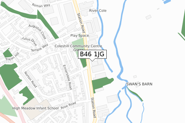
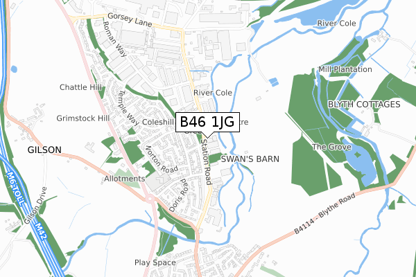
B46 1JG is located in the Coleshill North electoral ward, within the local authority district of North Warwickshire and the English Parliamentary constituency of North Warwickshire. The Sub Integrated Care Board (ICB) Location is NHS Coventry and Warwickshire ICB - B2M3M and the police force is Warwickshire. This postcode has been in use since January 1980.


GetTheData
Source: OS Open Zoomstack (Ordnance Survey)
Licence: Open Government Licence (requires attribution)
Attribution: Contains OS data © Crown copyright and database right 2024
Source: Open Postcode Geo
Licence: Open Government Licence (requires attribution)
Attribution: Contains OS data © Crown copyright and database right 2024; Contains Royal Mail data © Royal Mail copyright and database right 2024; Source: Office for National Statistics licensed under the Open Government Licence v.3.0
| Easting | 419976 |
| Northing | 290646 |
| Latitude | 52.513355 |
| Longitude | -1.707071 |
GetTheData
Source: Open Postcode Geo
Licence: Open Government Licence
| Country | England |
| Postcode District | B46 |
| ➜ B46 open data dashboard ➜ See where B46 is on a map ➜ Where is Coleshill? | |
GetTheData
Source: Land Registry Price Paid Data
Licence: Open Government Licence
Elevation or altitude of B46 1JG as distance above sea level:
| Metres | Feet | |
|---|---|---|
| Elevation | 80m | 262ft |
Elevation is measured from the approximate centre of the postcode, to the nearest point on an OS contour line from OS Terrain 50, which has contour spacing of ten vertical metres.
➜ How high above sea level am I? Find the elevation of your current position using your device's GPS.
GetTheData
Source: Open Postcode Elevation
Licence: Open Government Licence
| Ward | Coleshill North |
| Constituency | North Warwickshire |
GetTheData
Source: ONS Postcode Database
Licence: Open Government Licence
| June 2023 | Other crime | On or near Temple Way | 477m |
| June 2022 | Vehicle crime | On or near Gorsey Lane | 345m |
| June 2022 | Criminal damage and arson | On or near Stanhope Way | 462m |
| ➜ Get more crime data in our Crime section | |||
GetTheData
Source: data.police.uk
Licence: Open Government Licence
| Headlam Factory (Gorsey Lane) | Coleshill | 246m |
| Coleshill Parkway (Private Road) | Coleshill | 294m |
| Headlam Factory (Gorsey Lane) | Coleshill | 307m |
| Coleshill Parkway (Private Road) | Coleshill | 322m |
| Coleshill Parkway (Private Road) | Coleshill | 331m |
| Coleshill Parkway Station | 0.4km |
| Water Orton Station | 2.5km |
GetTheData
Source: NaPTAN
Licence: Open Government Licence
GetTheData
Source: ONS Postcode Database
Licence: Open Government Licence


➜ Get more ratings from the Food Standards Agency
GetTheData
Source: Food Standards Agency
Licence: FSA terms & conditions
| Last Collection | |||
|---|---|---|---|
| Location | Mon-Fri | Sat | Distance |
| Gorsey Lane / Station Road | 17:30 | 07:00 | 169m |
| Chattle Hill | 18:30 | 459m | |
| Ennersdale Close / Station Road | 17:15 | 11:00 | 567m |
GetTheData
Source: Dracos
Licence: Creative Commons Attribution-ShareAlike
| Facility | Distance |
|---|---|
| Grimstock Country House Hotel Gilson Road, Coleshill, Birmingham Health and Fitness Gym | 909m |
| Old Saltleians Rugby Football Club (Closed) Watton Lane, Water Orton, Birmingham Grass Pitches, Health and Fitness Gym | 1.2km |
| Coleshill Tennis And Sports Club Off Maxstoke Lane, Coleshill, Birmingham Outdoor Tennis Courts | 1.6km |
GetTheData
Source: Active Places
Licence: Open Government Licence
| School | Phase of Education | Distance |
|---|---|---|
| High Meadow Community School High Meadow Community School, Norton Road, Coleshill, B46 1ES | Primary | 811m |
| Coleshill Church of England Primary School Wingfield Road, Coleshill, Birmingham, B46 3LL | Primary | 2.1km |
| Water Orton Primary School Plank Lane, Water Orton, Birmingham, B46 1SG | Primary | 2.4km |
GetTheData
Source: Edubase
Licence: Open Government Licence
| Risk of B46 1JG flooding from rivers and sea | Medium |
| ➜ B46 1JG flood map | |
GetTheData
Source: Open Flood Risk by Postcode
Licence: Open Government Licence
The below table lists the International Territorial Level (ITL) codes (formerly Nomenclature of Territorial Units for Statistics (NUTS) codes) and Local Administrative Units (LAU) codes for B46 1JG:
| ITL 1 Code | Name |
|---|---|
| TLG | West Midlands (England) |
| ITL 2 Code | Name |
| TLG1 | Herefordshire, Worcestershire and Warwickshire |
| ITL 3 Code | Name |
| TLG13 | Warwickshire CC |
| LAU 1 Code | Name |
| E07000218 | North Warwickshire |
GetTheData
Source: ONS Postcode Directory
Licence: Open Government Licence
The below table lists the Census Output Area (OA), Lower Layer Super Output Area (LSOA), and Middle Layer Super Output Area (MSOA) for B46 1JG:
| Code | Name | |
|---|---|---|
| OA | E00158128 | |
| LSOA | E01031020 | North Warwickshire 006B |
| MSOA | E02006473 | North Warwickshire 006 |
GetTheData
Source: ONS Postcode Directory
Licence: Open Government Licence
| B46 1HH | Temple Way | 412m |
| B46 1HJ | Augustus Close | 457m |
| B46 1EZ | Stanhope Way | 462m |
| B46 1HQ | Roman Way | 482m |
| B46 1UD | Caesar Way | 521m |
| B46 1UB | Centurion Close | 525m |
| B46 1HL | Julius Drive | 526m |
| B46 1EY | Ennersdale Bungalows | 526m |
| B46 1TX | Constantine Lane | 530m |
| B46 1HN | Temple Way | 544m |
GetTheData
Source: Open Postcode Geo; Land Registry Price Paid Data
Licence: Open Government Licence