Search properties, postcodes, flood maps:
B46 1DS maps, stats, and open data
B46 1DS is located in the Curdworth electoral ward, within the local authority district of North Warwickshire and the English Parliamentary constituency of North Warwickshire. The Sub Integrated Care Board (ICB) Location is NHS Coventry and Warwickshire ICB - B2M3M and the police force is Warwickshire. This postcode has been in use since April 2020.
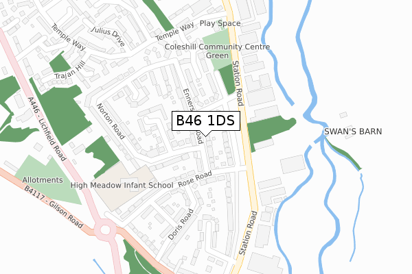
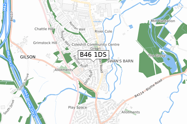
B46 1DS maps


Source: OS Open Zoomstack (Ordnance Survey)
Licence: Open Government Licence (requires attribution)
Attribution: Contains OS data © Crown copyright and database right 2026
Source: Open Postcode Geo
Licence: Open Government Licence (requires attribution)
Attribution: Contains OS data © Crown copyright and database right 2026; Contains Royal Mail data © Royal Mail copyright and database right 2026; Source: Office for National Statistics licensed under the Open Government Licence v.3.0
Licence: Open Government Licence (requires attribution)
Attribution: Contains OS data © Crown copyright and database right 2026
Source: Open Postcode Geo
Licence: Open Government Licence (requires attribution)
Attribution: Contains OS data © Crown copyright and database right 2026; Contains Royal Mail data © Royal Mail copyright and database right 2026; Source: Office for National Statistics licensed under the Open Government Licence v.3.0
B46 1DS geodata
| Easting | 419898 |
| Northing | 292463 |
| Latitude | 52.529693 |
| Longitude | -1.708112 |
Where is B46 1DS?
| Country | England |
| Postcode District | B46 |
Politics
| Ward | Curdworth |
|---|---|
| Constituency | North Warwickshire |
Transport
Nearest bus stops to B46 1DS
| Hams Hall (Faraday Avenue) | Hams Hall | 439m |
| Canton Lane (Faraday Avenue) | Hams Hall | 467m |
| Hams Hall (Faraday Avenue) | Hams Hall | 696m |
| Hams Hall (Faraday Avenue) | Hams Hall | 711m |
| Hams Hall (Edison Road) | Hams Hall | 812m |
Nearest railway stations to B46 1DS
| Coleshill Parkway Station | 1.5km |
| Water Orton Station | 2.7km |
Deprivation
38.1% of English postcodes are less deprived than B46 1DS:Food Standards Agency
Three nearest food hygiene ratings to B46 1DS (metres)
Elior Uk

Bmw Motoren Gmbh Hams Hall National Distribution Park Canton Lane
193m
Eurest @ Sainsburys Hams Hall

Sainsburys Distribution Centre Hams Hall National Distribution Park Faraday Avenue
757m
Elior

Nestle Purina ( Wincanton Distribution ) Hams Hall National Distribution Park Faraday Avenue
757m
➜ Get more ratings from the Food Standards Agency
Nearest post box to B46 1DS
| Last Collection | |||
|---|---|---|---|
| Location | Mon-Fri | Sat | Distance |
| Lea Marston Post Office | 16:00 | 09:30 | 1,002m |
| Chattle Hill | 18:30 | 11:00 | 1,694m |
| Gorsey Lane / Station Road | 17:30 | 07:00 | 1,720m |
B46 1DS ITL and B46 1DS LAU
The below table lists the International Territorial Level (ITL) codes (formerly Nomenclature of Territorial Units for Statistics (NUTS) codes) and Local Administrative Units (LAU) codes for B46 1DS:
| ITL 1 Code | Name |
|---|---|
| TLG | West Midlands (England) |
| ITL 2 Code | Name |
| TLG1 | Herefordshire, Worcestershire and Warwickshire |
| ITL 3 Code | Name |
| TLG13 | Warwickshire CC |
| LAU 1 Code | Name |
| E07000218 | North Warwickshire |
B46 1DS census areas
The below table lists the Census Output Area (OA), Lower Layer Super Output Area (LSOA), and Middle Layer Super Output Area (MSOA) for B46 1DS:
| Code | Name | |
|---|---|---|
| OA | E00168279 | |
| LSOA | E01031024 | North Warwickshire 004B |
| MSOA | E02006471 | North Warwickshire 004 |
Nearest postcodes to B46 1DS
| B46 1AQ | Hams Hall Distribution Park | 686m |
| B46 1AL | Faraday Avenue | 906m |
| B76 0BJ | Church Lane | 929m |
| B76 0BL | Hams Lane | 944m |
| B76 0BP | The Green | 993m |
| B76 0BW | School Lane | 1038m |
| B76 0BS | Paddys Row | 1077m |
| B76 0BN | Birmingham Road | 1098m |
| B76 0DE | Kingsbury Road | 1305m |
| B46 2EF | Barnes Wood Lane | 1409m |