B36 0QJ maps, stats, and open data
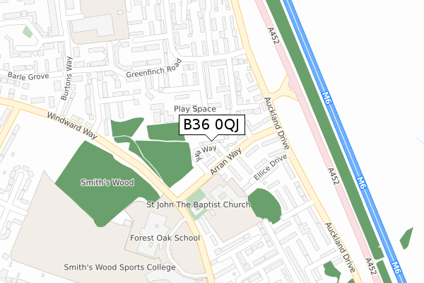
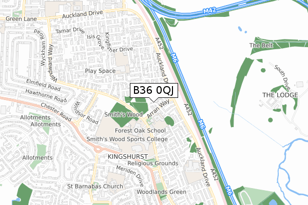
B36 0QJ lies on Auckland Drive in Birmingham. B36 0QJ is located in the Smith's Wood electoral ward, within the metropolitan district of Solihull and the English Parliamentary constituency of Meriden. The Sub Integrated Care Board (ICB) Location is NHS Birmingham and Solihull ICB - 15E and the police force is West Midlands. This postcode has been in use since May 2019.
B36 0QJ maps


Licence: Open Government Licence (requires attribution)
Attribution: Contains OS data © Crown copyright and database right 2026
Source: Open Postcode Geo
Licence: Open Government Licence (requires attribution)
Attribution: Contains OS data © Crown copyright and database right 2026; Contains Royal Mail data © Royal Mail copyright and database right 2026; Source: Office for National Statistics licensed under the Open Government Licence v.3.0
B36 0QJ geodata
| Easting | 417486 |
| Northing | 289237 |
| Latitude | 52.500773 |
| Longitude | -1.743835 |
Where is B36 0QJ?
| Street | Auckland Drive |
| Town/City | Birmingham |
| Country | England |
| Postcode District | B36 |
Politics
| Ward | Smith's Wood |
|---|---|
| Constituency | Meriden |
House Prices
Sales of detached houses in B36 0QJ
2025 30 MAY £345,000 |
2024 27 SEP £365,000 |
7, JURA WAY, BIRMINGHAM, B36 0QJ 2019 31 JUL £240,000 |
2019 28 JUN £294,500 |
2019 28 JUN £296,500 |
3, JURA WAY, BIRMINGHAM, B36 0QJ 2019 28 JUN £292,500 |
9, JURA WAY, BIRMINGHAM, B36 0QJ 2019 25 JUN £232,995 |
20, JURA WAY, BIRMINGHAM, B36 0QJ 2019 21 JUN £249,995 |
2, JURA WAY, BIRMINGHAM, B36 0QJ 2019 14 JUN £242,500 |
6, JURA WAY, BIRMINGHAM, B36 0QJ 2019 24 MAY £239,995 |
Licence: Contains HM Land Registry data © Crown copyright and database right 2026. This data is licensed under the Open Government Licence v3.0.
Transport
Nearest bus stops to B36 0QJ
| Mull Croft (Arran Way) | Smith's Wood | 56m |
| Mull Croft (Arran Way) | Smith's Wood | 83m |
| Greenfinch Rd (Auckland Dr) | Smith's Wood | 198m |
| Greenfinch Rd (Auckland Dr) | Smith's Wood | 199m |
| Woodpecker Grove (Windward Way) | Smith's Wood | 283m |
Nearest railway stations to B36 0QJ
| Water Orton Station | 2km |
| Coleshill Parkway Station | 3km |
| Lea Hall Station | 3.6km |
Broadband
Broadband access in B36 0QJ (2020 data)
| Percentage of properties with Next Generation Access | 100.0% |
| Percentage of properties with Superfast Broadband | 100.0% |
| Percentage of properties with Ultrafast Broadband | 100.0% |
| Percentage of properties with Full Fibre Broadband | 100.0% |
Superfast Broadband is between 30Mbps and 300Mbps
Ultrafast Broadband is > 300Mbps
Broadband limitations in B36 0QJ (2020 data)
| Percentage of properties unable to receive 2Mbps | 0.0% |
| Percentage of properties unable to receive 5Mbps | 0.0% |
| Percentage of properties unable to receive 10Mbps | 0.0% |
| Percentage of properties unable to receive 30Mbps | 0.0% |
Deprivation
94.4% of English postcodes are less deprived than B36 0QJ:Food Standards Agency
Three nearest food hygiene ratings to B36 0QJ (metres)


➜ Get more ratings from the Food Standards Agency
Nearest post box to B36 0QJ
| Last Collection | |||
|---|---|---|---|
| Location | Mon-Fri | Sat | Distance |
| Auckland Drive/Lundy View | 17:30 | 12:30 | 817m |
| Water Orton School | 17:15 | 07:00 | 1,479m |
| Gilson Road Gilson (B4117) | 17:15 | 07:00 | 1,729m |
B36 0QJ ITL and B36 0QJ LAU
The below table lists the International Territorial Level (ITL) codes (formerly Nomenclature of Territorial Units for Statistics (NUTS) codes) and Local Administrative Units (LAU) codes for B36 0QJ:
| ITL 1 Code | Name |
|---|---|
| TLG | West Midlands (England) |
| ITL 2 Code | Name |
| TLG3 | West Midlands |
| ITL 3 Code | Name |
| TLG32 | Solihull |
| LAU 1 Code | Name |
| E08000029 | Solihull |
B36 0QJ census areas
The below table lists the Census Output Area (OA), Lower Layer Super Output Area (LSOA), and Middle Layer Super Output Area (MSOA) for B36 0QJ:
| Code | Name | |
|---|---|---|
| OA | E00051732 | |
| LSOA | E01010234 | Solihull 004B |
| MSOA | E02002084 | Solihull 004 |
Nearest postcodes to B36 0QJ
| B36 0QF | Mull Croft | 45m |
| B36 0QG | Arran Way | 77m |
| B36 0QE | Arran Way | 95m |
| B36 0QH | Chaffinch Drive | 131m |
| B36 0QP | Wheatfield Close | 142m |
| B36 0QD | Ellice Drive | 154m |
| B36 0QY | Greenfinch Road | 181m |
| B36 0QB | Auckland Drive | 222m |
| B36 0QL | Greenfinch Road | 225m |
| B36 0QA | Orkney Croft | 234m |