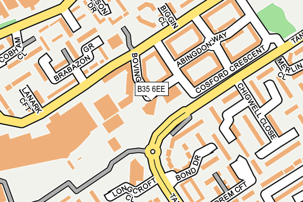
B35 6EE is located in the Castle Vale electoral ward, within the metropolitan district of Birmingham and the English Parliamentary constituency of Birmingham, Erdington. The Sub Integrated Care Board (ICB) Location is NHS Birmingham and Solihull ICB - 15E and the police force is West Midlands. This postcode has been in use since August 2004.


GetTheData
Source: OS OpenMap – Local (Ordnance Survey)
Source: OS VectorMap District (Ordnance Survey)
Licence: Open Government Licence (requires attribution)
| Easting | 414075 |
| Northing | 291156 |
| Latitude | 52.518108 |
| Longitude | -1.794009 |
GetTheData
Source: Open Postcode Geo
Licence: Open Government Licence
| Country | England |
| Postcode District | B35 |
| ➜ B35 open data dashboard ➜ See where B35 is on a map ➜ Where is Birmingham? | |
GetTheData
Source: Land Registry Price Paid Data
Licence: Open Government Licence
Elevation or altitude of B35 6EE as distance above sea level:
| Metres | Feet | |
|---|---|---|
| Elevation | 90m | 295ft |
Elevation is measured from the approximate centre of the postcode, to the nearest point on an OS contour line from OS Terrain 50, which has contour spacing of ten vertical metres.
➜ How high above sea level am I? Find the elevation of your current position using your device's GPS.
GetTheData
Source: Open Postcode Elevation
Licence: Open Government Licence
| Ward | Castle Vale |
| Constituency | Birmingham, Erdington |
GetTheData
Source: ONS Postcode Database
Licence: Open Government Licence
| December 2023 | Burglary | On or near Cranwell Way | 171m |
| December 2023 | Drugs | On or near Cranwell Way | 171m |
| December 2023 | Violence and sexual offences | On or near Cranwell Way | 171m |
| ➜ Get more crime data in our Crime section | |||
GetTheData
Source: data.police.uk
Licence: Open Government Licence
| Roundmoor Walk (Tangmere Dr) | Castle Vale | 67m |
| Roundmoor Walk (Tangmere Dr) | Castle Vale | 114m |
| Sainsburys (Tangmere Dr) | Tyburn | 146m |
| Brabazon Grove (Yatesbury Ave) | Tyburn | 155m |
| Drem Croft (Tangmere Dr) | Tyburn | 210m |
| Chester Road Station | 3.3km |
| Erdington Station | 3.3km |
| Water Orton Station | 3.5km |
GetTheData
Source: NaPTAN
Licence: Open Government Licence
GetTheData
Source: ONS Postcode Database
Licence: Open Government Licence

➜ Get more ratings from the Food Standards Agency
GetTheData
Source: Food Standards Agency
Licence: FSA terms & conditions
| Last Collection | |||
|---|---|---|---|
| Location | Mon-Fri | Sat | Distance |
| Castle Vale Post Office | 17:15 | 12:30 | 104m |
| Farnborough Road / Tangmere Dri | 17:15 | 12:30 | 384m |
| Manby Road / Doniibirstle Close | 17:15 | 12:30 | 485m |
GetTheData
Source: Dracos
Licence: Creative Commons Attribution-ShareAlike
| Facility | Distance |
|---|---|
| B-active (Erdington) (Closed) Kingsbury Road, Castle Vale, Birmingham Health and Fitness Gym, Studio | 374m |
| Castle Pool Farnborough Road, Birmingham Swimming Pool | 475m |
| The Gym Group (Birmingham Kingsbury Road) Kingsbury Road, Erdington, Birmingham Health and Fitness Gym, Studio | 778m |
GetTheData
Source: Active Places
Licence: Open Government Licence
| School | Phase of Education | Distance |
|---|---|---|
| Castle Vale Nursery School Yatesbury Avenue, Castle Vale, Birmingham, B35 6DU | Nursery | 146m |
| Topcliffe Primary School Hawkinge Drive, Castle Vale, Birmingham, B35 6BS | Primary | 289m |
| Chivenor Primary School Farnborough Road, Castle Vale, Birmingham, B35 7JA | Primary | 339m |
GetTheData
Source: Edubase
Licence: Open Government Licence
| Risk of B35 6EE flooding from rivers and sea | Very Low |
| ➜ B35 6EE flood map | |
GetTheData
Source: Open Flood Risk by Postcode
Licence: Open Government Licence
The below table lists the International Territorial Level (ITL) codes (formerly Nomenclature of Territorial Units for Statistics (NUTS) codes) and Local Administrative Units (LAU) codes for B35 6EE:
| ITL 1 Code | Name |
|---|---|
| TLG | West Midlands (England) |
| ITL 2 Code | Name |
| TLG3 | West Midlands |
| ITL 3 Code | Name |
| TLG31 | Birmingham |
| LAU 1 Code | Name |
| E08000025 | Birmingham |
GetTheData
Source: ONS Postcode Directory
Licence: Open Government Licence
The below table lists the Census Output Area (OA), Lower Layer Super Output Area (LSOA), and Middle Layer Super Output Area (MSOA) for B35 6EE:
| Code | Name | |
|---|---|---|
| OA | E00046174 | |
| LSOA | E01009101 | Birmingham 029D |
| MSOA | E02001855 | Birmingham 029 |
GetTheData
Source: ONS Postcode Directory
Licence: Open Government Licence
| B35 7QA | Tangmere Drive | 90m |
| B35 7HJ | Round Moor Walk | 144m |
| B35 7QX | Tangmere Drive | 145m |
| B35 6DU | Yatesbury Avenue | 148m |
| B35 7HL | Round Moor Walk | 154m |
| B35 7PY | Tangmere Drive | 157m |
| B35 7HX | Halfpenny Field Walk | 165m |
| B35 6BU | Biggin Close | 195m |
| B35 7HG | Chigwell Close | 199m |
| B35 6BX | Yatesbury Avenue | 200m |
GetTheData
Source: Open Postcode Geo; Land Registry Price Paid Data
Licence: Open Government Licence