B31 2GR maps, stats, and open data
B31 2GR is located in the Longbridge & West Heath electoral ward, within the metropolitan district of Birmingham and the English Parliamentary constituency of Birmingham, Northfield. The Sub Integrated Care Board (ICB) Location is NHS Birmingham and Solihull ICB - 15E and the police force is West Midlands. This postcode has been in use since March 2019.
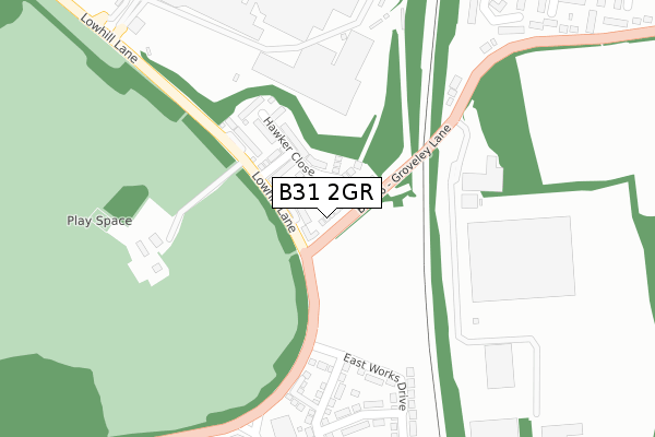
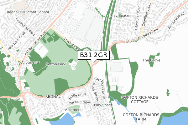
B31 2GR maps


Licence: Open Government Licence (requires attribution)
Attribution: Contains OS data © Crown copyright and database right 2026
Source: Open Postcode Geo
Licence: Open Government Licence (requires attribution)
Attribution: Contains OS data © Crown copyright and database right 2026; Contains Royal Mail data © Royal Mail copyright and database right 2026; Source: Office for National Statistics licensed under the Open Government Licence v.3.0
B31 2GR geodata
| Easting | 400936 |
| Northing | 276346 |
| Latitude | 52.385158 |
| Longitude | -1.987664 |
Where is B31 2GR?
| Country | England |
| Postcode District | B31 |
Politics
| Ward | Longbridge & West Heath |
|---|---|
| Constituency | Birmingham, Northfield |
House Prices
Sales of detached houses in B31 2GR
2025 6 JUN £365,000 |
2025 21 MAR £430,000 |
375, GROVELEY LANE, BIRMINGHAM, B31 2GR 2019 13 DEC £289,500 |
381, GROVELEY LANE, BIRMINGHAM, B31 2GR 2019 8 NOV £293,500 |
2019 25 OCT £374,500 |
369, GROVELEY LANE, BIRMINGHAM, B31 2GR 2019 18 OCT £305,000 |
2019 27 SEP £315,995 |
Licence: Contains HM Land Registry data © Crown copyright and database right 2026. This data is licensed under the Open Government Licence v3.0.
Transport
Nearest bus stops to B31 2GR
| Lowhill Lane (Groveley Lane) | Rednal | 28m |
| Lowhill Lane (Groveley Lane) | Rednal | 69m |
| Rover Works Gate R (Lowhill Lane) | Rednal | 160m |
| Parsonage Drive (Groveley Lane) | Rednal | 308m |
| Parsonage Drive (Groveley Lane) | Rednal | 328m |
Nearest railway stations to B31 2GR
| Longbridge Station | 1.3km |
| Barnt Green Station | 2.7km |
| Northfield Station | 3km |
Broadband
Broadband access in B31 2GR (2020 data)
| Percentage of properties with Next Generation Access | 100.0% |
| Percentage of properties with Superfast Broadband | 100.0% |
| Percentage of properties with Ultrafast Broadband | 100.0% |
| Percentage of properties with Full Fibre Broadband | 95.0% |
Superfast Broadband is between 30Mbps and 300Mbps
Ultrafast Broadband is > 300Mbps
Broadband limitations in B31 2GR (2020 data)
| Percentage of properties unable to receive 2Mbps | 0.0% |
| Percentage of properties unable to receive 5Mbps | 0.0% |
| Percentage of properties unable to receive 10Mbps | 0.0% |
| Percentage of properties unable to receive 30Mbps | 0.0% |
Deprivation
89.2% of English postcodes are less deprived than B31 2GR:Food Standards Agency
Three nearest food hygiene ratings to B31 2GR (metres)


➜ Get more ratings from the Food Standards Agency
Nearest post box to B31 2GR
| Last Collection | |||
|---|---|---|---|
| Location | Mon-Fri | Sat | Distance |
| Cofton Post Office | 17:15 | 11:30 | 353m |
| Thurlestone Road | 17:30 | 12:30 | 755m |
| Groveley Lane | 17:30 | 12:30 | 777m |
B31 2GR ITL and B31 2GR LAU
The below table lists the International Territorial Level (ITL) codes (formerly Nomenclature of Territorial Units for Statistics (NUTS) codes) and Local Administrative Units (LAU) codes for B31 2GR:
| ITL 1 Code | Name |
|---|---|
| TLG | West Midlands (England) |
| ITL 2 Code | Name |
| TLG3 | West Midlands |
| ITL 3 Code | Name |
| TLG31 | Birmingham |
| LAU 1 Code | Name |
| E08000025 | Birmingham |
B31 2GR census areas
The below table lists the Census Output Area (OA), Lower Layer Super Output Area (LSOA), and Middle Layer Super Output Area (MSOA) for B31 2GR:
| Code | Name | |
|---|---|---|
| OA | E00046488 | |
| LSOA | E01009163 | Birmingham 129B |
| MSOA | E02001955 | Birmingham 129 |
Nearest postcodes to B31 2GR
| B45 8PD | Groveley Lane | 178m |
| B45 8GX | Hurricane Avenue | 321m |
| B45 8GS | East Works Drive | 351m |
| B45 8GY | Jenson Street | 353m |
| B45 8GU | Fairey Street | 354m |
| B45 8GW | Fairey Street | 361m |
| B45 8AS | Parsonage Drive | 378m |
| B45 8GR | East Works Drive | 396m |
| B45 8GZ | Healey Avenue | 413m |
| B31 4NF | Fountain Close | 416m |