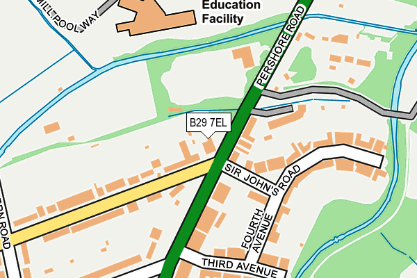
B29 7EL is located in the Bournbrook & Selly Park electoral ward, within the metropolitan district of Birmingham and the English Parliamentary constituency of Birmingham, Selly Oak. The Sub Integrated Care Board (ICB) Location is NHS Birmingham and Solihull ICB - 15E and the police force is West Midlands. This postcode has been in use since September 2006.


GetTheData
Source: OS OpenMap – Local (Ordnance Survey)
Source: OS VectorMap District (Ordnance Survey)
Licence: Open Government Licence (requires attribution)
| Easting | 405993 |
| Northing | 283380 |
| Latitude | 52.448349 |
| Longitude | -1.913249 |
GetTheData
Source: Open Postcode Geo
Licence: Open Government Licence
| Country | England |
| Postcode District | B29 |
| ➜ B29 open data dashboard ➜ See where B29 is on a map ➜ Where is Birmingham? | |
GetTheData
Source: Land Registry Price Paid Data
Licence: Open Government Licence
Elevation or altitude of B29 7EL as distance above sea level:
| Metres | Feet | |
|---|---|---|
| Elevation | 120m | 394ft |
Elevation is measured from the approximate centre of the postcode, to the nearest point on an OS contour line from OS Terrain 50, which has contour spacing of ten vertical metres.
➜ How high above sea level am I? Find the elevation of your current position using your device's GPS.
GetTheData
Source: Open Postcode Elevation
Licence: Open Government Licence
| Ward | Bournbrook & Selly Park |
| Constituency | Birmingham, Selly Oak |
GetTheData
Source: ONS Postcode Database
Licence: Open Government Licence
| June 2022 | Burglary | On or near Petrol Station | 74m |
| June 2022 | Other theft | On or near Sports/Recreation Area | 88m |
| June 2022 | Vehicle crime | On or near Sir John'S Road | 132m |
| ➜ Get more crime data in our Crime section | |||
GetTheData
Source: data.police.uk
Licence: Open Government Licence
| Upland Rd (Pershore Rd) | Bournbrook | 74m |
| Upland Rd (Pershore Rd) | Bournbrook | 151m |
| Nature Centre (Pershore Rd) | Cannon Hill Park | 205m |
| Nature Centre (Pershore Rd) | Cannon Hill Park | 211m |
| First Avenue (Pershore Rd) | Selly Park | 333m |
| University Station | 1.6km |
| Selly Oak Station | 1.7km |
| Five Ways Station | 2.5km |
GetTheData
Source: NaPTAN
Licence: Open Government Licence
GetTheData
Source: ONS Postcode Database
Licence: Open Government Licence


➜ Get more ratings from the Food Standards Agency
GetTheData
Source: Food Standards Agency
Licence: FSA terms & conditions
| Last Collection | |||
|---|---|---|---|
| Location | Mon-Fri | Sat | Distance |
| Selly Park | 17:30 | 12:30 | 35m |
| Eastern Road / Upland Road | 17:30 | 12:30 | 356m |
| Pebblemill Road / Bristol Road | 17:30 | 12:30 | 427m |
GetTheData
Source: Dracos
Licence: Creative Commons Attribution-ShareAlike
| Facility | Distance |
|---|---|
| King Edward's School Birmingham (Eastern Road Pitches) Eastern Road, Selly Park, Birmingham Grass Pitches, Artificial Grass Pitch | 336m |
| King Edward's School Running Track Birmingham Athletics, Grass Pitches, Outdoor Tennis Courts | 585m |
| Holders Lane Complex Holders Lane, Birmingham Grass Pitches | 653m |
GetTheData
Source: Active Places
Licence: Open Government Licence
| School | Phase of Education | Distance |
|---|---|---|
| Elmhurst Ballet School 249 Bristol Road, Edgbaston, Birmingham, B5 7UH | Not applicable | 701m |
| King Edward's School Edgbaston Park Road, Birmingham, B15 2UA | Not applicable | 742m |
| Red Boots School (National Institute of Conductive Education) Cannon Hill House, 14 Russell Road, Moseley, Birmingham, B13 8RD | Not applicable | 856m |
GetTheData
Source: Edubase
Licence: Open Government Licence
| Risk of B29 7EL flooding from rivers and sea | Medium |
| ➜ B29 7EL flood map | |
GetTheData
Source: Open Flood Risk by Postcode
Licence: Open Government Licence
The below table lists the International Territorial Level (ITL) codes (formerly Nomenclature of Territorial Units for Statistics (NUTS) codes) and Local Administrative Units (LAU) codes for B29 7EL:
| ITL 1 Code | Name |
|---|---|
| TLG | West Midlands (England) |
| ITL 2 Code | Name |
| TLG3 | West Midlands |
| ITL 3 Code | Name |
| TLG31 | Birmingham |
| LAU 1 Code | Name |
| E08000025 | Birmingham |
GetTheData
Source: ONS Postcode Directory
Licence: Open Government Licence
The below table lists the Census Output Area (OA), Lower Layer Super Output Area (LSOA), and Middle Layer Super Output Area (MSOA) for B29 7EL:
| Code | Name | |
|---|---|---|
| OA | E00047107 | |
| LSOA | E01009283 | Birmingham 079E |
| MSOA | E02001905 | Birmingham 079 |
GetTheData
Source: ONS Postcode Directory
Licence: Open Government Licence
| B29 7EN | Pershore Road | 44m |
| B29 7ES | Riverside Drive | 99m |
| B29 7HQ | Pershore Road | 133m |
| B29 7EP | Sir Johns Road | 153m |
| B29 7EJ | Oakfield Road | 155m |
| B29 7EU | Fourth Avenue | 157m |
| B29 7HA | Pershore Road | 161m |
| B29 7ER | Sir Johns Road | 164m |
| B29 7HH | Oakfield Road | 186m |
| B29 7EX | Third Avenue | 209m |
GetTheData
Source: Open Postcode Geo; Land Registry Price Paid Data
Licence: Open Government Licence