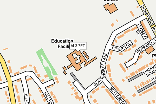
AL3 7ET is located in the Redbourn electoral ward, within the local authority district of St Albans and the English Parliamentary constituency of Hitchin and Harpenden. The Sub Integrated Care Board (ICB) Location is NHS Hertfordshire and West Essex ICB - 06N and the police force is Hertfordshire. This postcode has been in use since January 1980.


GetTheData
Source: OS OpenMap – Local (Ordnance Survey)
Source: OS VectorMap District (Ordnance Survey)
Licence: Open Government Licence (requires attribution)
| Easting | 510132 |
| Northing | 212893 |
| Latitude | 51.803842 |
| Longitude | -0.404133 |
GetTheData
Source: Open Postcode Geo
Licence: Open Government Licence
| Country | England |
| Postcode District | AL3 |
| ➜ AL3 open data dashboard ➜ See where AL3 is on a map ➜ Where is Redbourn? | |
GetTheData
Source: Land Registry Price Paid Data
Licence: Open Government Licence
Elevation or altitude of AL3 7ET as distance above sea level:
| Metres | Feet | |
|---|---|---|
| Elevation | 120m | 394ft |
Elevation is measured from the approximate centre of the postcode, to the nearest point on an OS contour line from OS Terrain 50, which has contour spacing of ten vertical metres.
➜ How high above sea level am I? Find the elevation of your current position using your device's GPS.
GetTheData
Source: Open Postcode Elevation
Licence: Open Government Licence
| Ward | Redbourn |
| Constituency | Hitchin And Harpenden |
GetTheData
Source: ONS Postcode Database
Licence: Open Government Licence
| June 2022 | Violence and sexual offences | On or near Bettespol Meadows | 262m |
| June 2022 | Violence and sexual offences | On or near Hilltop | 265m |
| June 2022 | Vehicle crime | On or near Coopers Meadow | 297m |
| ➜ Get more crime data in our Crime section | |||
GetTheData
Source: data.police.uk
Licence: Open Government Licence
| Aysgarth Road (Dunstable Road) | Redbourn | 361m |
| Aysgarth Road (Dunstable Road) | Redbourn | 401m |
| Luton Lane (Dunstable Road) | Redbourn | 413m |
| Luton Lane (Dunstable Road) | Redbourn | 446m |
| Ridgedown (Lybury Lane) | Redbourn | 483m |
| Harpenden Station | 3.8km |
GetTheData
Source: NaPTAN
Licence: Open Government Licence
GetTheData
Source: ONS Postcode Database
Licence: Open Government Licence


➜ Get more ratings from the Food Standards Agency
GetTheData
Source: Food Standards Agency
Licence: FSA terms & conditions
| Last Collection | |||
|---|---|---|---|
| Location | Mon-Fri | Sat | Distance |
| Bettespol Meadows | 16:40 | 11:00 | 253m |
| Redbourn P.o | 18:40 | 10:30 | 738m |
| High Street Redbourn | 18:40 | 11:00 | 981m |
GetTheData
Source: Dracos
Licence: Creative Commons Attribution-ShareAlike
| Facility | Distance |
|---|---|
| St Lukes School Crouch Hall Lane, Redbourn, St. Albans Sports Hall, Grass Pitches, Health and Fitness Gym | 0m |
| Redbourn Leisure Centre Dunstable Road, Redbourn, St. Albans Sports Hall, Health and Fitness Gym, Grass Pitches, Studio | 217m |
| Redbourn Primary School Long Cutt, Redbourn, St. Albans Grass Pitches | 364m |
GetTheData
Source: Active Places
Licence: Open Government Licence
| School | Phase of Education | Distance |
|---|---|---|
| St Luke's School Crouch Hall Lane, Redbourn, St Albans, AL3 7ET | Not applicable | 0m |
| Redbourn Primary School Long Cutt, Redbourn, St Albans, AL3 7EX | Primary | 324m |
| Flamstead Village School Trowley Hill Road, Flamstead, 59 Trowley Hill Road, St. Albans, AL3 8DL | Primary | 2.7km |
GetTheData
Source: Edubase
Licence: Open Government Licence
The below table lists the International Territorial Level (ITL) codes (formerly Nomenclature of Territorial Units for Statistics (NUTS) codes) and Local Administrative Units (LAU) codes for AL3 7ET:
| ITL 1 Code | Name |
|---|---|
| TLH | East |
| ITL 2 Code | Name |
| TLH2 | Bedfordshire and Hertfordshire |
| ITL 3 Code | Name |
| TLH23 | Hertfordshire CC |
| LAU 1 Code | Name |
| E07000240 | St Albans |
GetTheData
Source: ONS Postcode Directory
Licence: Open Government Licence
The below table lists the Census Output Area (OA), Lower Layer Super Output Area (LSOA), and Middle Layer Super Output Area (MSOA) for AL3 7ET:
| Code | Name | |
|---|---|---|
| OA | E00120461 | |
| LSOA | E01023725 | St Albans 006D |
| MSOA | E02004929 | St Albans 006 |
GetTheData
Source: ONS Postcode Directory
Licence: Open Government Licence
| AL3 7EP | Blackhorse Lane | 132m |
| AL3 7ES | Blackhorse Lane | 161m |
| AL3 7NX | Hilltop | 173m |
| AL3 7ER | Pipers Close | 199m |
| AL3 7EB | Peppard Close | 201m |
| AL3 7JG | Hilltop | 221m |
| AL3 7EU | Crouch Hall Lane | 244m |
| AL3 7PL | Linden Road | 246m |
| AL3 7PP | Dunstable Road | 254m |
| AL3 7JQ | Lybury Lane | 270m |
GetTheData
Source: Open Postcode Geo; Land Registry Price Paid Data
Licence: Open Government Licence