Where is Kirkheaton?
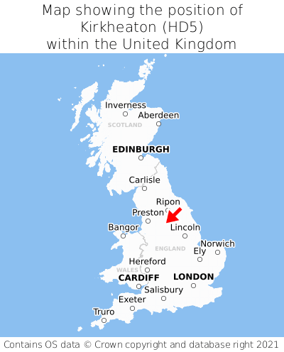
Kirkheaton is located in the county of West Yorkshire, Yorkshire and the Humber, two miles south-west of the town of Mirfield, two miles north-east of the major town of Huddersfield, 162 miles north of Cardiff, and 163 miles north-west of London. Kirkheaton lies seven miles north-west of the South Yorkshire border, and was historically in the county of Yorkshire. Kirkheaton falls within the metropolitan district council of Kirklees. It is in the HD5 postcode district. The post town for Kirkheaton is Huddersfield.
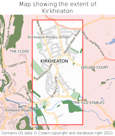
Kirkheaton on a map


Which county is Kirkheaton in?
Kirkheaton is in the ceremonial county of West Yorkshire, and the historic county of Yorkshire.
| Ceremonial County | West Yorkshire |
|---|---|
| Historic County | Yorkshire |
Where is Kirkheaton in West Yorkshire?
Kirkheaton is situated towards the southernmost extremity of West Yorkshire, and roughly centrally between the easternmost and westernmost extremities of West Yorkshire.

What is the postcode for Kirkheaton?
The nearest postcode to the centre of Kirkheaton is HD5 0DA.
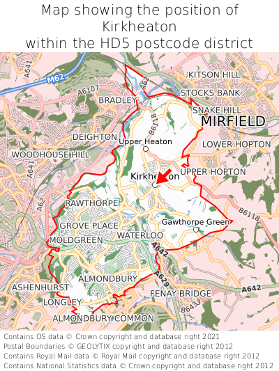
Where is Kirkheaton in HD5?
Kirkheaton is situated roughly centrally between the southernmost and northernmost extremities of the HD5 postcode district, and roughly centrally between the easternmost and westernmost extremities of the HD5 postcode district.

What is the post town for Kirkheaton?
The post town for Kirkheaton is Huddersfield. Kirkheaton is in the HD5 postcode district, which corresponds to the post town of Huddersfield.
What is the latitude and longitude of Kirkheaton?
The centre of Kirkheaton is located at position 53.65852° latitude and -1.72864° longitude.
| Latitude | 53.65852° |
|---|---|
| Longitude | -1.72864° |
What is the easting and northing of Kirkheaton?
The centre of Kirkheaton is located at the grid reference easting 418031 and northing 418038 within the British National Grid (OSGB36) system.
| Easting | 418031 |
|---|---|
| Northing | 418038 |
What are the nearest towns to Kirkheaton?
Position of Kirkheaton relative to nearby towns. Distance is measured from the centre of Kirkheaton to the centre of the town.
What are the nearest cities to Kirkheaton?
Position of Kirkheaton relative to nearby cities. Distance is measured from the centre of Kirkheaton to the centre of the city.