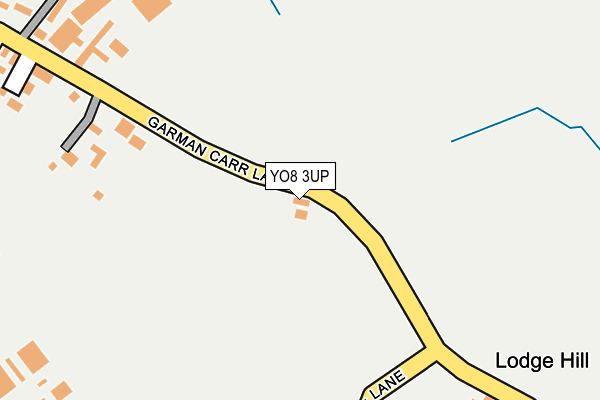
YO8 3UP is located in the Cawood & Escrick electoral ward, within the unitary authority of North Yorkshire and the English Parliamentary constituency of Selby and Ainsty. The Sub Integrated Care Board (ICB) Location is NHS Humber and North Yorkshire ICB - 03Q and the police force is North Yorkshire. This postcode has been in use since June 1998.


GetTheData
Source: OS OpenMap – Local (Ordnance Survey)
Source: OS VectorMap District (Ordnance Survey)
Licence: Open Government Licence (requires attribution)
| Easting | 460058 |
| Northing | 435158 |
| Latitude | 53.809272 |
| Longitude | -1.089444 |
GetTheData
Source: Open Postcode Geo
Licence: Open Government Licence
| Country | England |
| Postcode District | YO8 |
➜ See where YO8 is on a map | |
GetTheData
Source: Land Registry Price Paid Data
Licence: Open Government Licence
Elevation or altitude of YO8 3UP as distance above sea level:
| Metres | Feet | |
|---|---|---|
| Elevation | 0m | 0ft |
Elevation is measured from the approximate centre of the postcode, to the nearest point on an OS contour line from OS Terrain 50, which has contour spacing of ten vertical metres.
➜ How high above sea level am I? Find the elevation of your current position using your device's GPS.
GetTheData
Source: Open Postcode Elevation
Licence: Open Government Licence
| Ward | Cawood & Escrick |
| Constituency | Selby And Ainsty |
GetTheData
Source: ONS Postcode Database
Licence: Open Government Licence
| Wesleyan Chapel (Church Hill) | Wistow | 943m |
| All Saints Church (George Street) | Wistow | 943m |
| Greenways Court (Green Ways) | Wistow | 1,281m |
| Greenways Court (Cawood Road) | Wistow | 1,282m |
| Selby Station | 3.4km |
GetTheData
Source: NaPTAN
Licence: Open Government Licence
| Percentage of properties with Next Generation Access | 100.0% |
| Percentage of properties with Superfast Broadband | 100.0% |
| Percentage of properties with Ultrafast Broadband | 0.0% |
| Percentage of properties with Full Fibre Broadband | 0.0% |
Superfast Broadband is between 30Mbps and 300Mbps
Ultrafast Broadband is > 300Mbps
| Percentage of properties unable to receive 2Mbps | 0.0% |
| Percentage of properties unable to receive 5Mbps | 0.0% |
| Percentage of properties unable to receive 10Mbps | 0.0% |
| Percentage of properties unable to receive 30Mbps | 0.0% |
GetTheData
Source: Ofcom
Licence: Ofcom Terms of Use (requires attribution)
GetTheData
Source: ONS Postcode Database
Licence: Open Government Licence


➜ Get more ratings from the Food Standards Agency
GetTheData
Source: Food Standards Agency
Licence: FSA terms & conditions
| Last Collection | |||
|---|---|---|---|
| Location | Mon-Fri | Sat | Distance |
| Wistow Post Office | 18:40 | 10:40 | 851m |
| Bondgate | 18:40 | 11:45 | 2,016m |
| 27 Charles Street Selby | 18:20 | 11:45 | 2,439m |
GetTheData
Source: Dracos
Licence: Creative Commons Attribution-ShareAlike
| Risk of YO8 3UP flooding from rivers and sea | Low |
| ➜ YO8 3UP flood map | |
GetTheData
Source: Open Flood Risk by Postcode
Licence: Open Government Licence
The below table lists the International Territorial Level (ITL) codes (formerly Nomenclature of Territorial Units for Statistics (NUTS) codes) and Local Administrative Units (LAU) codes for YO8 3UP:
| ITL 1 Code | Name |
|---|---|
| TLE | Yorkshire and The Humber |
| ITL 2 Code | Name |
| TLE2 | North Yorkshire |
| ITL 3 Code | Name |
| TLE22 | North Yorkshire CC |
| LAU 1 Code | Name |
| E07000169 | Selby |
GetTheData
Source: ONS Postcode Directory
Licence: Open Government Licence
The below table lists the Census Output Area (OA), Lower Layer Super Output Area (LSOA), and Middle Layer Super Output Area (MSOA) for YO8 3UP:
| Code | Name | |
|---|---|---|
| OA | E00142076 | |
| LSOA | E01027887 | Selby 002C |
| MSOA | E02005810 | Selby 002 |
GetTheData
Source: ONS Postcode Directory
Licence: Open Government Licence
| YO8 3XJ | Grange Garth | 556m |
| YO8 3WJ | Kingsthorpe Park | 607m |
| YO8 3UW | Garmancarr Lane | 632m |
| YO8 3FS | The Green | 718m |
| YO8 3UQ | Pasture Way | 731m |
| YO8 3UT | Selby Road | 741m |
| YO8 3UL | Pasture Close | 803m |
| YO8 3FW | Oak Farm | 807m |
| YO8 3PN | Kirkham Mews | 816m |
| YO8 3YP | Jubilee Road | 827m |
GetTheData
Source: Open Postcode Geo; Land Registry Price Paid Data
Licence: Open Government Licence