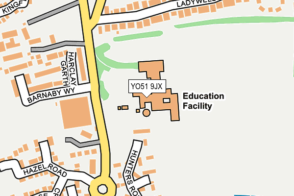
YO51 9JX is located in the Boroughbridge & Claro electoral ward, within the unitary authority of North Yorkshire and the English Parliamentary constituency of Harrogate and Knaresborough. The Sub Integrated Care Board (ICB) Location is NHS Humber and North Yorkshire ICB - 42D and the police force is North Yorkshire. This postcode has been in use since June 1998.


GetTheData
Source: OS OpenMap – Local (Ordnance Survey)
Source: OS VectorMap District (Ordnance Survey)
Licence: Open Government Licence (requires attribution)
| Easting | 439641 |
| Northing | 466035 |
| Latitude | 54.088705 |
| Longitude | -1.395470 |
GetTheData
Source: Open Postcode Geo
Licence: Open Government Licence
| Country | England |
| Postcode District | YO51 |
| ➜ YO51 open data dashboard ➜ See where YO51 is on a map ➜ Where is Boroughbridge? | |
GetTheData
Source: Land Registry Price Paid Data
Licence: Open Government Licence
Elevation or altitude of YO51 9JX as distance above sea level:
| Metres | Feet | |
|---|---|---|
| Elevation | 20m | 66ft |
Elevation is measured from the approximate centre of the postcode, to the nearest point on an OS contour line from OS Terrain 50, which has contour spacing of ten vertical metres.
➜ How high above sea level am I? Find the elevation of your current position using your device's GPS.
GetTheData
Source: Open Postcode Elevation
Licence: Open Government Licence
| Ward | Boroughbridge & Claro |
| Constituency | Harrogate And Knaresborough |
GetTheData
Source: ONS Postcode Database
Licence: Open Government Licence
| January 2024 | Other theft | On or near Petrol Station | 371m |
| January 2024 | Other theft | On or near Petrol Station | 371m |
| January 2024 | Other theft | On or near Petrol Station | 371m |
| ➜ Get more crime data in our Crime section | |||
GetTheData
Source: data.police.uk
Licence: Open Government Licence
| High School (N/A) | Boroughbridge | 98m |
| High School (Unclassified) | Boroughbridge | 114m |
| Morrisons Car Park (N/A) | Minskip | 374m |
| Morrisons Car Park (N/A) | Minskip | 378m |
| Morrisons Car Park (N/A) | Minskip | 380m |
GetTheData
Source: NaPTAN
Licence: Open Government Licence
GetTheData
Source: ONS Postcode Database
Licence: Open Government Licence


➜ Get more ratings from the Food Standards Agency
GetTheData
Source: Food Standards Agency
Licence: FSA terms & conditions
| Last Collection | |||
|---|---|---|---|
| Location | Mon-Fri | Sat | Distance |
| Morrisons Supermarket | 17:30 | 12:35 | 340m |
| High Street Boroughbridge | 17:30 | 12:10 | 644m |
| Boroughbridge Post Office | 17:30 | 12:15 | 855m |
GetTheData
Source: Dracos
Licence: Creative Commons Attribution-ShareAlike
| Facility | Distance |
|---|---|
| Boroughbridge High School Wetherby Road, Boroughbridge, York Sports Hall, Grass Pitches, Squash Courts, Studio, Artificial Grass Pitch, Outdoor Tennis Courts | 0m |
| Boroughbridge Primary School & Nursery York Road, Boroughbridge, York Sports Hall, Grass Pitches, Swimming Pool | 612m |
| Aldborough Road Sports Ground Aldborough Road, Boroughbridge, York Grass Pitches, Outdoor Tennis Courts | 621m |
GetTheData
Source: Active Places
Licence: Open Government Licence
| School | Phase of Education | Distance |
|---|---|---|
| Boroughbridge High School Wetherby Road, Boroughbridge, York, YO51 9JX | Secondary | 2m |
| Boroughbridge Primary School York Road, Boroughbridge, York, YO51 9EB | Primary | 611m |
| Roecliffe CofE Primary School Roecliffe, Boroughbridge, York, YO51 9LY | Primary | 2km |
GetTheData
Source: Edubase
Licence: Open Government Licence
The below table lists the International Territorial Level (ITL) codes (formerly Nomenclature of Territorial Units for Statistics (NUTS) codes) and Local Administrative Units (LAU) codes for YO51 9JX:
| ITL 1 Code | Name |
|---|---|
| TLE | Yorkshire and The Humber |
| ITL 2 Code | Name |
| TLE2 | North Yorkshire |
| ITL 3 Code | Name |
| TLE22 | North Yorkshire CC |
| LAU 1 Code | Name |
| E07000165 | Harrogate |
GetTheData
Source: ONS Postcode Directory
Licence: Open Government Licence
The below table lists the Census Output Area (OA), Lower Layer Super Output Area (LSOA), and Middle Layer Super Output Area (MSOA) for YO51 9JX:
| Code | Name | |
|---|---|---|
| OA | E00140784 | |
| LSOA | E01027644 | Harrogate 005A |
| MSOA | E02005765 | Harrogate 005 |
GetTheData
Source: ONS Postcode Directory
Licence: Open Government Licence
| YO51 9HS | Wetherby Road | 145m |
| YO51 9GH | Victory Row | 149m |
| YO51 9PE | Hunters Row | 162m |
| YO51 9UZ | Smithsons Grove | 168m |
| YO51 9GL | Harclay Garth | 180m |
| YO51 9GJ | Barnaby Way | 201m |
| YO51 9UX | Fothergill Way | 218m |
| YO51 9HL | Ladywell Road | 245m |
| YO51 9GN | Battle Close | 250m |
| YO51 9UT | Hazel Road | 276m |
GetTheData
Source: Open Postcode Geo; Land Registry Price Paid Data
Licence: Open Government Licence