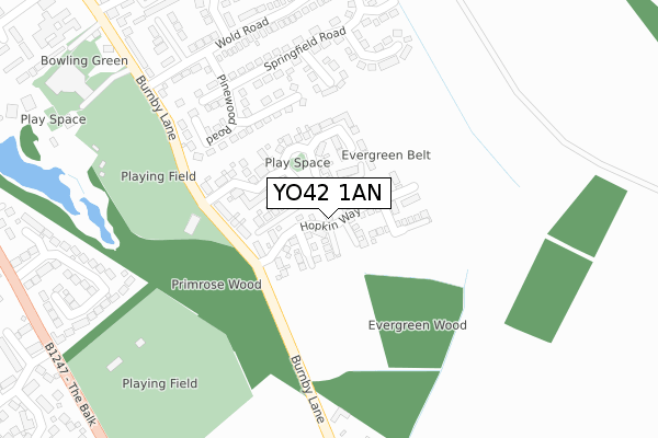
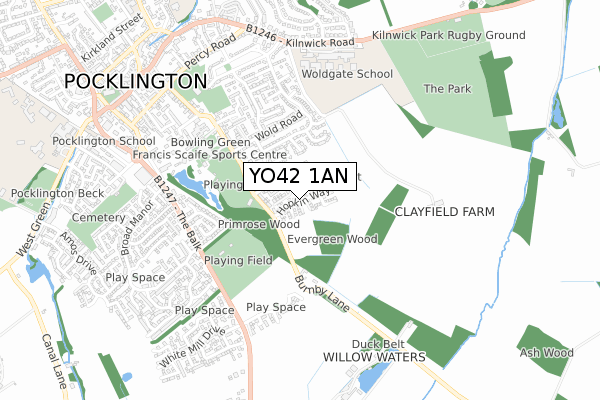
YO42 1AN is located in the Pocklington Provincial electoral ward, within the unitary authority of East Riding of Yorkshire and the English Parliamentary constituency of East Yorkshire. The Sub Integrated Care Board (ICB) Location is NHS Humber and North Yorkshire ICB - 03Q and the police force is Humberside. This postcode has been in use since January 2018.


GetTheData
Source: OS Open Zoomstack (Ordnance Survey)
Licence: Open Government Licence (requires attribution)
Attribution: Contains OS data © Crown copyright and database right 2024
Source: Open Postcode Geo
Licence: Open Government Licence (requires attribution)
Attribution: Contains OS data © Crown copyright and database right 2024; Contains Royal Mail data © Royal Mail copyright and database right 2024; Source: Office for National Statistics licensed under the Open Government Licence v.3.0
| Easting | 481028 |
| Northing | 448526 |
| Latitude | 53.926555 |
| Longitude | -0.767540 |
GetTheData
Source: Open Postcode Geo
Licence: Open Government Licence
| Country | England |
| Postcode District | YO42 |
| ➜ YO42 open data dashboard ➜ See where YO42 is on a map ➜ Where is Pocklington? | |
GetTheData
Source: Land Registry Price Paid Data
Licence: Open Government Licence
| Ward | Pocklington Provincial |
| Constituency | East Yorkshire |
GetTheData
Source: ONS Postcode Database
Licence: Open Government Licence
2023 12 APR £380,000 |
2022 10 FEB £355,000 |
2021 30 SEP £285,000 |
2021 30 JUL £330,500 |
2021 28 JUN £365,000 |
2021 27 MAY £328,500 |
2021 19 JAN £452,500 |
25, HOPKIN WAY, POCKLINGTON, YORK, YO42 1AN 2019 31 MAY £334,995 |
2019 29 MAR £321,995 |
23, HOPKIN WAY, POCKLINGTON, YORK, YO42 1AN 2019 29 MAR £269,995 |
GetTheData
Source: HM Land Registry Price Paid Data
Licence: Contains HM Land Registry data © Crown copyright and database right 2024. This data is licensed under the Open Government Licence v3.0.
| June 2022 | Violence and sexual offences | On or near Greenacre Close | 237m |
| June 2022 | Violence and sexual offences | On or near Derek Vivian Close | 459m |
| June 2022 | Violence and sexual offences | On or near Derek Vivian Close | 459m |
| ➜ Get more crime data in our Crime section | |||
GetTheData
Source: data.police.uk
Licence: Open Government Licence
| The Balk Pocklington (The Balk) | Burnby Hall And Gardens | 495m |
| Pocklington The Balk (The Balk) | Pocklington | 499m |
| Pocklington The Balk (The Balk) | Pocklington | 517m |
| The Balk Pocklington (The Balk) | Burnby Hall And Gardens | 521m |
| Kilnwick House (Kilnwick Road) | Pocklington | 655m |
GetTheData
Source: NaPTAN
Licence: Open Government Licence
| Percentage of properties with Next Generation Access | 100.0% |
| Percentage of properties with Superfast Broadband | 100.0% |
| Percentage of properties with Ultrafast Broadband | 100.0% |
| Percentage of properties with Full Fibre Broadband | 100.0% |
Superfast Broadband is between 30Mbps and 300Mbps
Ultrafast Broadband is > 300Mbps
| Percentage of properties unable to receive 2Mbps | 0.0% |
| Percentage of properties unable to receive 5Mbps | 0.0% |
| Percentage of properties unable to receive 10Mbps | 0.0% |
| Percentage of properties unable to receive 30Mbps | 0.0% |
GetTheData
Source: Ofcom
Licence: Ofcom Terms of Use (requires attribution)
GetTheData
Source: ONS Postcode Database
Licence: Open Government Licence


➜ Get more ratings from the Food Standards Agency
GetTheData
Source: Food Standards Agency
Licence: FSA terms & conditions
| Last Collection | |||
|---|---|---|---|
| Location | Mon-Fri | Sat | Distance |
| 1 The Oval Pocklington | 17:10 | 11:30 | 665m |
| St Helens Road Pocklington | 17:10 | 11:30 | 711m |
| Union Street Pocklington | 17:10 | 11:30 | 854m |
GetTheData
Source: Dracos
Licence: Creative Commons Attribution-ShareAlike
| Facility | Distance |
|---|---|
| Pocklington Cricket Club Burnby Lane, Pocklington, York Grass Pitches | 237m |
| Pocklington Town Football Club The Balk, Pocklington, York Grass Pitches | 393m |
| Francis Scaife Sports Centre Burnby Lane, Pocklington, York Sports Hall, Swimming Pool, Health and Fitness Gym, Squash Courts | 455m |
GetTheData
Source: Active Places
Licence: Open Government Licence
| School | Phase of Education | Distance |
|---|---|---|
| Woldgate School and Sixth Form College 92 Kilnwick Road, Pocklington, York, YO42 2LL | Secondary | 650m |
| St Mary & St Joseph Catholic Primary School - a Catholic voluntary academy Maxwell Road, Pocklington, YO42 2HE | Primary | 964m |
| Pocklington Church of England Voluntary Controlled Infant School Maxwell Road, York, YO42 2HE | Primary | 1km |
GetTheData
Source: Edubase
Licence: Open Government Licence
The below table lists the International Territorial Level (ITL) codes (formerly Nomenclature of Territorial Units for Statistics (NUTS) codes) and Local Administrative Units (LAU) codes for YO42 1AN:
| ITL 1 Code | Name |
|---|---|
| TLE | Yorkshire and The Humber |
| ITL 2 Code | Name |
| TLE1 | East Yorkshire and Northern Lincolnshire |
| ITL 3 Code | Name |
| TLE12 | East Riding of Yorkshire |
| LAU 1 Code | Name |
| E06000011 | East Riding of Yorkshire |
GetTheData
Source: ONS Postcode Directory
Licence: Open Government Licence
The below table lists the Census Output Area (OA), Lower Layer Super Output Area (LSOA), and Middle Layer Super Output Area (MSOA) for YO42 1AN:
| Code | Name | |
|---|---|---|
| OA | E00065887 | |
| LSOA | E01013052 | East Riding of Yorkshire 011A |
| MSOA | E02002694 | East Riding of Yorkshire 011 |
GetTheData
Source: ONS Postcode Directory
Licence: Open Government Licence
| YO42 1UN | Horseshoe Crescent | 96m |
| YO42 2UW | Pinewood Close | 178m |
| YO42 2US | Greenacre Close | 216m |
| YO42 2UZ | Pinewood Road | 220m |
| YO42 2UT | Wheatlands Close | 269m |
| YO42 2UU | Pinewood Court | 271m |
| YO42 2UY | Springfield Road | 276m |
| YO42 1UJ | Burnby Lane | 311m |
| YO42 2UX | Chestnut View | 320m |
| YO42 2QG | Wold Road | 341m |
GetTheData
Source: Open Postcode Geo; Land Registry Price Paid Data
Licence: Open Government Licence