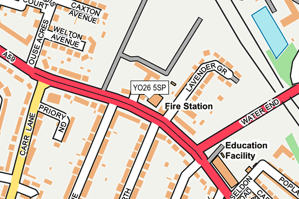
YO26 5SP is located in the Holgate electoral ward, within the unitary authority of York and the English Parliamentary constituency of York Central. The Sub Integrated Care Board (ICB) Location is NHS Humber and North Yorkshire ICB - 03Q and the police force is North Yorkshire. This postcode has been in use since June 1998.


GetTheData
Source: OS OpenMap – Local (Ordnance Survey)
Source: OS VectorMap District (Ordnance Survey)
Licence: Open Government Licence (requires attribution)
| Easting | 457973 |
| Northing | 452337 |
| Latitude | 53.963873 |
| Longitude | -1.117854 |
GetTheData
Source: Open Postcode Geo
Licence: Open Government Licence
| Country | England |
| Postcode District | YO26 |
| ➜ YO26 open data dashboard ➜ See where YO26 is on a map ➜ Where is York? | |
GetTheData
Source: Land Registry Price Paid Data
Licence: Open Government Licence
Elevation or altitude of YO26 5SP as distance above sea level:
| Metres | Feet | |
|---|---|---|
| Elevation | 20m | 66ft |
Elevation is measured from the approximate centre of the postcode, to the nearest point on an OS contour line from OS Terrain 50, which has contour spacing of ten vertical metres.
➜ How high above sea level am I? Find the elevation of your current position using your device's GPS.
GetTheData
Source: Open Postcode Elevation
Licence: Open Government Licence
| Ward | Holgate |
| Constituency | York Central |
GetTheData
Source: ONS Postcode Database
Licence: Open Government Licence
| January 2024 | Criminal damage and arson | On or near Winchester Avenue | 376m |
| January 2024 | Burglary | On or near Regents Mews | 402m |
| June 2022 | Violence and sexual offences | On or near Lavender Grove | 81m |
| ➜ Get more crime data in our Crime section | |||
GetTheData
Source: data.police.uk
Licence: Open Government Licence
| Malvern Avenue (Boroughbridge Road A59) | Holgate | 37m |
| Malvern Avenue (Boroughbridge Road A59) | Holgate | 103m |
| The Ainsty (Carr Lane) | Acomb | 226m |
| The Ainsty (Carr Lane) | Acomb | 242m |
| Seldon Road (Poppleton Road) | Holgate | 278m |
| York Station | 1.7km |
| Poppleton Station | 2.4km |
GetTheData
Source: NaPTAN
Licence: Open Government Licence
GetTheData
Source: ONS Postcode Database
Licence: Open Government Licence


➜ Get more ratings from the Food Standards Agency
GetTheData
Source: Food Standards Agency
Licence: FSA terms & conditions
| Last Collection | |||
|---|---|---|---|
| Location | Mon-Fri | Sat | Distance |
| Manor Drive | 17:45 | 12:30 | 65m |
| 97 Poppleton Road York | 17:45 | 12:15 | 440m |
| 109 Carr Lane York | 17:30 | 12:30 | 566m |
GetTheData
Source: Dracos
Licence: Creative Commons Attribution-ShareAlike
| Facility | Distance |
|---|---|
| Poppleton Road Memorial Hall Oak Street, York Studio | 442m |
| Carr Junior School Ostman Road, York Swimming Pool, Sports Hall, Grass Pitches | 643m |
| Holgate Working Mens Club New Lane, York Sports Hall | 1.1km |
GetTheData
Source: Active Places
Licence: Open Government Licence
| School | Phase of Education | Distance |
|---|---|---|
| Poppleton Road Primary School Poppleton Road, York, YO26 4UP | Primary | 214m |
| Carr Junior School Ostman Road, Acomb, York, YO26 5QA | Primary | 643m |
| Carr Infant School Ostman Road, Acomb, York, YO26 5QA | Primary | 751m |
GetTheData
Source: Edubase
Licence: Open Government Licence
The below table lists the International Territorial Level (ITL) codes (formerly Nomenclature of Territorial Units for Statistics (NUTS) codes) and Local Administrative Units (LAU) codes for YO26 5SP:
| ITL 1 Code | Name |
|---|---|
| TLE | Yorkshire and The Humber |
| ITL 2 Code | Name |
| TLE2 | North Yorkshire |
| ITL 3 Code | Name |
| TLE21 | York |
| LAU 1 Code | Name |
| E06000014 | York |
GetTheData
Source: ONS Postcode Directory
Licence: Open Government Licence
The below table lists the Census Output Area (OA), Lower Layer Super Output Area (LSOA), and Middle Layer Super Output Area (MSOA) for YO26 5SP:
| Code | Name | |
|---|---|---|
| OA | E00067634 | |
| LSOA | E01013392 | York 012F |
| MSOA | E02002783 | York 012 |
GetTheData
Source: ONS Postcode Directory
Licence: Open Government Licence
| YO26 5SU | Sandacre Court | 35m |
| YO26 5SE | Boroughbridge Road | 53m |
| YO26 5RU | Boroughbridge Road | 80m |
| YO26 5RT | Boroughbridge Road | 112m |
| YO26 5RX | Lavender Grove | 119m |
| YO26 5SQ | Boroughbridge Road | 134m |
| YO26 5SH | Boroughbridge Road | 172m |
| YO26 5BP | Priory Green | 179m |
| YO26 5SL | Welton Avenue | 201m |
| YO26 5SN | Caxton Avenue | 221m |
GetTheData
Source: Open Postcode Geo; Land Registry Price Paid Data
Licence: Open Government Licence