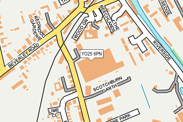
YO25 6PN is located in the Driffield and Rural electoral ward, within the unitary authority of East Riding of Yorkshire and the English Parliamentary constituency of East Yorkshire. The Sub Integrated Care Board (ICB) Location is NHS Humber and North Yorkshire ICB - 02Y and the police force is Humberside. This postcode has been in use since June 1998.


GetTheData
Source: OS OpenMap – Local (Ordnance Survey)
Source: OS VectorMap District (Ordnance Survey)
Licence: Open Government Licence (requires attribution)
| Easting | 502699 |
| Northing | 457085 |
| Latitude | 53.999595 |
| Longitude | -0.434753 |
GetTheData
Source: Open Postcode Geo
Licence: Open Government Licence
| Country | England |
| Postcode District | YO25 |
| ➜ YO25 open data dashboard ➜ See where YO25 is on a map ➜ Where is Driffield? | |
GetTheData
Source: Land Registry Price Paid Data
Licence: Open Government Licence
Elevation or altitude of YO25 6PN as distance above sea level:
| Metres | Feet | |
|---|---|---|
| Elevation | 20m | 66ft |
Elevation is measured from the approximate centre of the postcode, to the nearest point on an OS contour line from OS Terrain 50, which has contour spacing of ten vertical metres.
➜ How high above sea level am I? Find the elevation of your current position using your device's GPS.
GetTheData
Source: Open Postcode Elevation
Licence: Open Government Licence
| Ward | Driffield And Rural |
| Constituency | East Yorkshire |
GetTheData
Source: ONS Postcode Database
Licence: Open Government Licence
| August 2023 | Public order | On or near The Horseshoe | 454m |
| June 2023 | Criminal damage and arson | On or near Riverside Mews | 182m |
| May 2023 | Anti-social behaviour | On or near Skerne Road | 213m |
| ➜ Get more crime data in our Crime section | |||
GetTheData
Source: data.police.uk
Licence: Open Government Licence
| Driffield Beverley Road (Beverley Road) | Driffield | 170m |
| Driffield Beverley Road (Beverley Road) | Driffield | 221m |
| Driffield Middle Street South (Middle Street South) | Driffield | 264m |
| Driffield Middle St South (Middle Street South) | Driffield | 295m |
| Driffield Beverley Road (Beverley Road) | Driffield | 388m |
| Driffield Station | 0.2km |
| Nafferton Station | 3.4km |
| Hutton Cranswick Station | 4.9km |
GetTheData
Source: NaPTAN
Licence: Open Government Licence
GetTheData
Source: ONS Postcode Database
Licence: Open Government Licence


➜ Get more ratings from the Food Standards Agency
GetTheData
Source: Food Standards Agency
Licence: FSA terms & conditions
| Last Collection | |||
|---|---|---|---|
| Location | Mon-Fri | Sat | Distance |
| Middle St South Post Office | 17:30 | 12:15 | 236m |
| St Johns Road | 17:30 | 13:00 | 476m |
| Malton Gates Beverley Road Drf/D | 17:30 | 13:00 | 514m |
GetTheData
Source: Dracos
Licence: Creative Commons Attribution-ShareAlike
| Facility | Distance |
|---|---|
| Driffield Spa @ Bell Hotel Market Place, Driffield Health and Fitness Gym, Swimming Pool, Squash Courts | 751m |
| Wolds Way To Health Cranwell Road, Driffield Health and Fitness Gym, Studio | 809m |
| Driffield Town Cricket And Recreation Club Kings Mill Road, Driffield Grass Pitches, Outdoor Tennis Courts | 833m |
GetTheData
Source: Active Places
Licence: Open Government Licence
| School | Phase of Education | Distance |
|---|---|---|
| Driffield Church of England Voluntary Controlled Infant School St John's Road, Crosshill, Driffield, YO25 6RS | Primary | 359m |
| Driffield Junior School Bridlington Road, Driffield, YO25 5HN | Primary | 878m |
| Kings Mill School Victoria Road, Driffield, YO25 6UG | Not applicable | 1km |
GetTheData
Source: Edubase
Licence: Open Government Licence
The below table lists the International Territorial Level (ITL) codes (formerly Nomenclature of Territorial Units for Statistics (NUTS) codes) and Local Administrative Units (LAU) codes for YO25 6PN:
| ITL 1 Code | Name |
|---|---|
| TLE | Yorkshire and The Humber |
| ITL 2 Code | Name |
| TLE1 | East Yorkshire and Northern Lincolnshire |
| ITL 3 Code | Name |
| TLE12 | East Riding of Yorkshire |
| LAU 1 Code | Name |
| E06000011 | East Riding of Yorkshire |
GetTheData
Source: ONS Postcode Directory
Licence: Open Government Licence
The below table lists the Census Output Area (OA), Lower Layer Super Output Area (LSOA), and Middle Layer Super Output Area (MSOA) for YO25 6PN:
| Code | Name | |
|---|---|---|
| OA | E00065477 | |
| LSOA | E01012980 | East Riding of Yorkshire 045C |
| MSOA | E02006892 | East Riding of Yorkshire 045 |
GetTheData
Source: ONS Postcode Directory
Licence: Open Government Licence
| YO25 6SP | Skerne Road | 97m |
| YO25 6SR | Wood Green | 100m |
| YO25 6PQ | The Beechlands | 119m |
| YO25 6PL | Georgian Mews | 128m |
| YO25 6SB | Railway Cottages | 137m |
| YO25 6YA | Southorpe Court | 149m |
| YO25 6SF | Skerne Road | 156m |
| YO25 6PF | Riverside Mews | 164m |
| YO25 6SA | Beverley Road | 180m |
| YO25 6PA | Riverside | 191m |
GetTheData
Source: Open Postcode Geo; Land Registry Price Paid Data
Licence: Open Government Licence