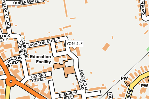
YO16 4LF is located in the Bridlington South electoral ward, within the unitary authority of East Riding of Yorkshire and the English Parliamentary constituency of East Yorkshire. The Sub Integrated Care Board (ICB) Location is NHS Humber and North Yorkshire ICB - 02Y and the police force is Humberside. This postcode has been in use since January 1980.


GetTheData
Source: OS OpenMap – Local (Ordnance Survey)
Source: OS VectorMap District (Ordnance Survey)
Licence: Open Government Licence (requires attribution)
| Easting | 518006 |
| Northing | 467228 |
| Latitude | 54.087445 |
| Longitude | -0.197415 |
GetTheData
Source: Open Postcode Geo
Licence: Open Government Licence
| Country | England |
| Postcode District | YO16 |
| ➜ YO16 open data dashboard ➜ See where YO16 is on a map ➜ Where is Bridlington? | |
GetTheData
Source: Land Registry Price Paid Data
Licence: Open Government Licence
Elevation or altitude of YO16 4LF as distance above sea level:
| Metres | Feet | |
|---|---|---|
| Elevation | 10m | 33ft |
Elevation is measured from the approximate centre of the postcode, to the nearest point on an OS contour line from OS Terrain 50, which has contour spacing of ten vertical metres.
➜ How high above sea level am I? Find the elevation of your current position using your device's GPS.
GetTheData
Source: Open Postcode Elevation
Licence: Open Government Licence
| Ward | Bridlington South |
| Constituency | East Yorkshire |
GetTheData
Source: ONS Postcode Database
Licence: Open Government Licence
| January 2024 | Violence and sexual offences | On or near Parking Area | 446m |
| December 2023 | Violence and sexual offences | On or near Parking Area | 446m |
| December 2023 | Violence and sexual offences | On or near Parking Area | 446m |
| ➜ Get more crime data in our Crime section | |||
GetTheData
Source: data.police.uk
Licence: Open Government Licence
| Bridlington Quay Road (Quay Road) | Bridlington | 230m |
| Bridlington Quay Road (Quay Road) | Bridlington | 246m |
| Bridlington Quay Road (Quay Road) | Bridlington | 270m |
| Bridlington Quay Road (Quay Road) | Bridlington | 293m |
| Bridlington Quay Road (Quay Road) | Bridlington | 294m |
| Bridlington Station | 0.4km |
| Bempton Station | 4.6km |
GetTheData
Source: NaPTAN
Licence: Open Government Licence
GetTheData
Source: ONS Postcode Database
Licence: Open Government Licence


➜ Get more ratings from the Food Standards Agency
GetTheData
Source: Food Standards Agency
Licence: FSA terms & conditions
| Last Collection | |||
|---|---|---|---|
| Location | Mon-Fri | Sat | Distance |
| 148 Quay Road Bridlington | 17:45 | 12:45 | 275m |
| 67 Queensgate Bridlington | 17:45 | 12:30 | 319m |
| Bridlington Delivery Office | 18:00 | 13:00 | 365m |
GetTheData
Source: Dracos
Licence: Creative Commons Attribution-ShareAlike
| Facility | Distance |
|---|---|
| Quay Academy Oxford Street, Bridlington Grass Pitches | 94m |
| Bridlington Sports And Community Club Moorfield Road, Bridlington Grass Pitches, Outdoor Tennis Courts | 167m |
| Moorfield Road Recreation Ground St. Wilfred Road, Bridlington Outdoor Tennis Courts | 188m |
GetTheData
Source: Active Places
Licence: Open Government Licence
| School | Phase of Education | Distance |
|---|---|---|
| Quay Academy Oxford Street, Bridlington, YO16 4LB | Primary | 87m |
| Bridlington Nursery School Butts Close, Butts Close, Bridlington, YO16 7BS | Nursery | 664m |
| Bay Primary School St Alban Road, Bridlington, YO16 7SZ | Primary | 774m |
GetTheData
Source: Edubase
Licence: Open Government Licence
The below table lists the International Territorial Level (ITL) codes (formerly Nomenclature of Territorial Units for Statistics (NUTS) codes) and Local Administrative Units (LAU) codes for YO16 4LF:
| ITL 1 Code | Name |
|---|---|
| TLE | Yorkshire and The Humber |
| ITL 2 Code | Name |
| TLE1 | East Yorkshire and Northern Lincolnshire |
| ITL 3 Code | Name |
| TLE12 | East Riding of Yorkshire |
| LAU 1 Code | Name |
| E06000011 | East Riding of Yorkshire |
GetTheData
Source: ONS Postcode Directory
Licence: Open Government Licence
The below table lists the Census Output Area (OA), Lower Layer Super Output Area (LSOA), and Middle Layer Super Output Area (MSOA) for YO16 4LF:
| Code | Name | |
|---|---|---|
| OA | E00065327 | |
| LSOA | E01012945 | East Riding of Yorkshire 004C |
| MSOA | E02002687 | East Riding of Yorkshire 004 |
GetTheData
Source: ONS Postcode Directory
Licence: Open Government Licence
| YO16 4JJ | Moorfield Road | 34m |
| YO16 4JS | Hill Street | 43m |
| YO16 4JU | Thompson Street | 64m |
| YO16 4JX | Gilbert Street | 100m |
| YO16 4JR | Carlton Street | 123m |
| YO16 4LE | Moorfield Road | 156m |
| YO16 4LB | Oxford Street | 161m |
| YO16 4LD | Blenheim Road | 167m |
| YO16 4LG | Railway Walk | 178m |
| YO16 4JZ | Cambridge Street | 197m |
GetTheData
Source: Open Postcode Geo; Land Registry Price Paid Data
Licence: Open Government Licence