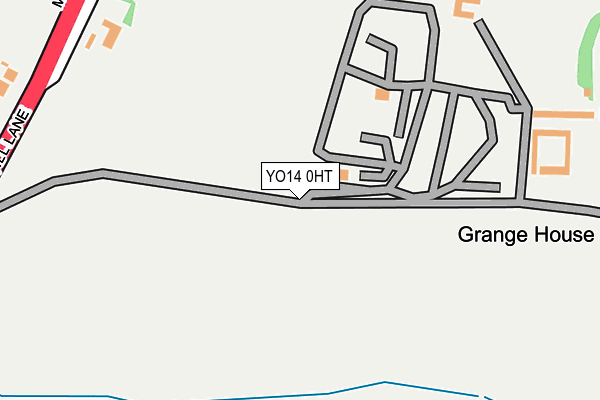
YO14 0HT is located in the Filey electoral ward, within the unitary authority of North Yorkshire and the English Parliamentary constituency of Thirsk and Malton. The Sub Integrated Care Board (ICB) Location is NHS Humber and North Yorkshire ICB - 42D and the police force is North Yorkshire. This postcode has been in use since January 1995.


GetTheData
Source: OS OpenMap – Local (Ordnance Survey)
Source: OS VectorMap District (Ordnance Survey)
Licence: Open Government Licence (requires attribution)
| Easting | 510978 |
| Northing | 479631 |
| Latitude | 54.200428 |
| Longitude | -0.300248 |
GetTheData
Source: Open Postcode Geo
Licence: Open Government Licence
| Country | England |
| Postcode District | YO14 |
| ➜ YO14 open data dashboard ➜ See where YO14 is on a map | |
GetTheData
Source: Land Registry Price Paid Data
Licence: Open Government Licence
Elevation or altitude of YO14 0HT as distance above sea level:
| Metres | Feet | |
|---|---|---|
| Elevation | 40m | 131ft |
Elevation is measured from the approximate centre of the postcode, to the nearest point on an OS contour line from OS Terrain 50, which has contour spacing of ten vertical metres.
➜ How high above sea level am I? Find the elevation of your current position using your device's GPS.
GetTheData
Source: Open Postcode Elevation
Licence: Open Government Licence
| Ward | Filey |
| Constituency | Thirsk And Malton |
GetTheData
Source: ONS Postcode Database
Licence: Open Government Licence
| Mill Farm (Mill Lane) | Muston | 313m |
| Mill Farm (Mill Lane) | Muston | 335m |
| Secondary School (A1039) | Filey | 463m |
| Secondary School (A1039) | Filey | 539m |
| Grange Avenue (Cooper Road) | Filey | 572m |
| Filey Station | 1.1km |
| Hunmanby Station | 3.1km |
GetTheData
Source: NaPTAN
Licence: Open Government Licence
GetTheData
Source: ONS Postcode Database
Licence: Open Government Licence


➜ Get more ratings from the Food Standards Agency
GetTheData
Source: Food Standards Agency
Licence: FSA terms & conditions
| Last Collection | |||
|---|---|---|---|
| Location | Mon-Fri | Sat | Distance |
| Wharfedale Road | 17:00 | 12:30 | 767m |
| 43 Clarence Drive Filey | 17:00 | 12:30 | 792m |
| 37 West Avenue Filey | 17:30 | 13:00 | 943m |
GetTheData
Source: Dracos
Licence: Creative Commons Attribution-ShareAlike
| Facility | Distance |
|---|---|
| Ebor Academy Filey Muston Road, Filey Swimming Pool, Sports Hall, Grass Pitches, Outdoor Tennis Courts, Health and Fitness Gym, Artificial Grass Pitch | 513m |
| Filey Golf Club West Avenue, Filey Golf | 661m |
| Filey Tennis Club Southdene, Filey Outdoor Tennis Courts | 917m |
GetTheData
Source: Active Places
Licence: Open Government Licence
| School | Phase of Education | Distance |
|---|---|---|
| Filey School Muston Road, Filey, YO14 0HG | Secondary | 513m |
| Filey Church of England Nursery and Infants Academy Padbury Avenue, Filey, YO14 0BA | Primary | 766m |
| Filey Junior School West Road, Filey, YO14 9LU | Primary | 1.3km |
GetTheData
Source: Edubase
Licence: Open Government Licence
The below table lists the International Territorial Level (ITL) codes (formerly Nomenclature of Territorial Units for Statistics (NUTS) codes) and Local Administrative Units (LAU) codes for YO14 0HT:
| ITL 1 Code | Name |
|---|---|
| TLE | Yorkshire and The Humber |
| ITL 2 Code | Name |
| TLE2 | North Yorkshire |
| ITL 3 Code | Name |
| TLE22 | North Yorkshire CC |
| LAU 1 Code | Name |
| E07000168 | Scarborough |
GetTheData
Source: ONS Postcode Directory
Licence: Open Government Licence
The below table lists the Census Output Area (OA), Lower Layer Super Output Area (LSOA), and Middle Layer Super Output Area (MSOA) for YO14 0HT:
| Code | Name | |
|---|---|---|
| OA | E00141765 | |
| LSOA | E01027828 | Scarborough 014B |
| MSOA | E02005808 | Scarborough 014 |
GetTheData
Source: ONS Postcode Directory
Licence: Open Government Licence
| YO14 0HH | Muston Road | 318m |
| YO14 0FN | Green Meadows Drive | 350m |
| YO14 0FA | Mill Meadows Lane | 388m |
| YO14 0FB | Mill Meadows Lane | 414m |
| YO14 0FD | Windmill Drive | 484m |
| YO14 0FE | Summer Way | 512m |
| YO14 0AR | Grange Avenue | 579m |
| YO14 0AD | Coxswain Close | 589m |
| YO14 0BB | Seadale Terrace | 592m |
| YO14 0AS | Cooper Road | 607m |
GetTheData
Source: Open Postcode Geo; Land Registry Price Paid Data
Licence: Open Government Licence