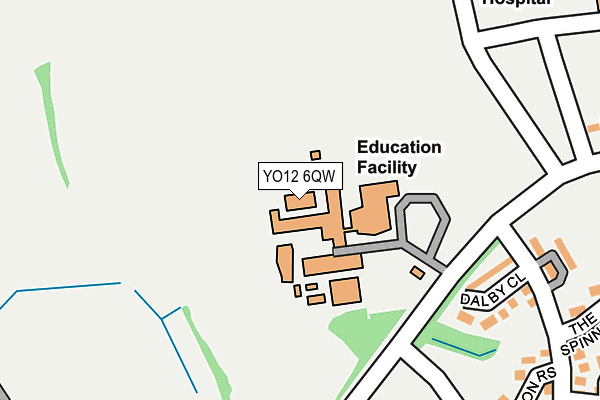
YO12 6QW is located in the Woodlands electoral ward, within the unitary authority of North Yorkshire and the English Parliamentary constituency of Scarborough and Whitby. The Sub Integrated Care Board (ICB) Location is NHS Humber and North Yorkshire ICB - 42D and the police force is North Yorkshire. This postcode has been in use since January 1995.


GetTheData
Source: OS OpenMap – Local (Ordnance Survey)
Source: OS VectorMap District (Ordnance Survey)
Licence: Open Government Licence (requires attribution)
| Easting | 501563 |
| Northing | 488226 |
| Latitude | 54.279594 |
| Longitude | -0.441607 |
GetTheData
Source: Open Postcode Geo
Licence: Open Government Licence
| Country | England |
| Postcode District | YO12 |
| ➜ YO12 open data dashboard ➜ See where YO12 is on a map ➜ Where is Scarborough? | |
GetTheData
Source: Land Registry Price Paid Data
Licence: Open Government Licence
Elevation or altitude of YO12 6QW as distance above sea level:
| Metres | Feet | |
|---|---|---|
| Elevation | 80m | 262ft |
Elevation is measured from the approximate centre of the postcode, to the nearest point on an OS contour line from OS Terrain 50, which has contour spacing of ten vertical metres.
➜ How high above sea level am I? Find the elevation of your current position using your device's GPS.
GetTheData
Source: Open Postcode Elevation
Licence: Open Government Licence
| Ward | Woodlands |
| Constituency | Scarborough And Whitby |
GetTheData
Source: ONS Postcode Database
Licence: Open Government Licence
| November 2023 | Anti-social behaviour | On or near Settrington Road | 432m |
| October 2023 | Public order | On or near Settrington Road | 432m |
| October 2023 | Violence and sexual offences | On or near Hildenley Close | 478m |
| ➜ Get more crime data in our Crime section | |||
GetTheData
Source: data.police.uk
Licence: Open Government Licence
| Graham School Stand 7 (Woodlands Drive) | Throxenby | 94m |
| Hovingham Drive | Throxenby | 204m |
| Woodlands School Hospital Entrance (Woodlands Drive) | Throxenby | 303m |
| Woodlands Cemetery (N/A) | Throxenby | 306m |
| Scarborough Hospital (Main Entrance) | Throxenby | 343m |
| Scarborough Station | 2.3km |
| Seamer Station | 4.6km |
GetTheData
Source: NaPTAN
Licence: Open Government Licence
GetTheData
Source: ONS Postcode Database
Licence: Open Government Licence


➜ Get more ratings from the Food Standards Agency
GetTheData
Source: Food Standards Agency
Licence: FSA terms & conditions
| Last Collection | |||
|---|---|---|---|
| Location | Mon-Fri | Sat | Distance |
| Byward Drive | 16:45 | 12:50 | 1,427m |
| 2 Woodlands Ravine Scar/Ogh | 18:00 | 12:20 | 1,503m |
| 2 Highfieldscarborough | 16:20 | 11:35 | 1,701m |
GetTheData
Source: Dracos
Licence: Creative Commons Attribution-ShareAlike
| Facility | Distance |
|---|---|
| Graham School Woodlands Drive, Scarborough Sports Hall, Grass Pitches | 0m |
| Raincliffe Sports Hall Lady Ediths Drive, Scarborough Sports Hall, Grass Pitches, Outdoor Tennis Courts | 480m |
| Raincliffe School Business And Enterprise College (Closed) Lady Ediths Drive, Scarborough Sports Hall, Studio | 481m |
GetTheData
Source: Active Places
Licence: Open Government Licence
| School | Phase of Education | Distance |
|---|---|---|
| Graham School Woodlands Drive, Scarborough, YO12 6QW | Secondary | 0m |
| The Woodlands Academy Woodlands Drive, Scarborough, YO12 6QN | Not applicable | 302m |
| Scarborough Sixth Form College Sandybed Lane, Scarborough, YO12 5LF | 16 plus | 853m |
GetTheData
Source: Edubase
Licence: Open Government Licence
The below table lists the International Territorial Level (ITL) codes (formerly Nomenclature of Territorial Units for Statistics (NUTS) codes) and Local Administrative Units (LAU) codes for YO12 6QW:
| ITL 1 Code | Name |
|---|---|
| TLE | Yorkshire and The Humber |
| ITL 2 Code | Name |
| TLE2 | North Yorkshire |
| ITL 3 Code | Name |
| TLE22 | North Yorkshire CC |
| LAU 1 Code | Name |
| E07000168 | Scarborough |
GetTheData
Source: ONS Postcode Directory
Licence: Open Government Licence
The below table lists the Census Output Area (OA), Lower Layer Super Output Area (LSOA), and Middle Layer Super Output Area (MSOA) for YO12 6QW:
| Code | Name | |
|---|---|---|
| OA | E00142008 | |
| LSOA | E01027873 | Scarborough 009F |
| MSOA | E02005803 | Scarborough 009 |
GetTheData
Source: ONS Postcode Directory
Licence: Open Government Licence
| YO12 5HH | Dalby Close | 197m |
| YO12 6QN | Woodlands Drive | 259m |
| YO12 5DQ | Hovingham Drive | 272m |
| YO12 5TS | Cropton Rise | 286m |
| YO12 5HQ | The Spinney | 302m |
| YO12 5DT | Hovingham Drive | 332m |
| YO12 5DS | Skiplam Close | 365m |
| YO12 6QT | Plaxton Court | 374m |
| YO12 5HG | The Copse | 379m |
| YO12 5TU | Loftus Close | 395m |
GetTheData
Source: Open Postcode Geo; Land Registry Price Paid Data
Licence: Open Government Licence