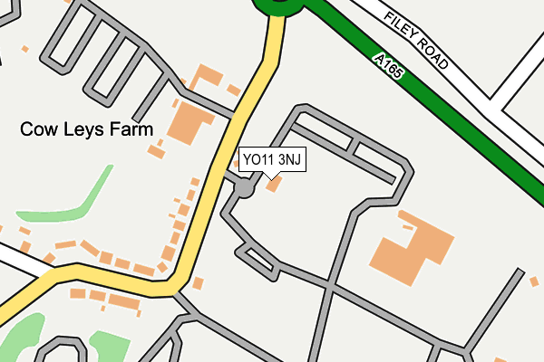
YO11 3NJ is located in the Cayton electoral ward, within the unitary authority of North Yorkshire and the English Parliamentary constituency of Scarborough and Whitby. The Sub Integrated Care Board (ICB) Location is NHS Humber and North Yorkshire ICB - 42D and the police force is North Yorkshire. This postcode has been in use since January 1995.


GetTheData
Source: OS OpenMap – Local (Ordnance Survey)
Source: OS VectorMap District (Ordnance Survey)
Licence: Open Government Licence (requires attribution)
| Easting | 506565 |
| Northing | 483950 |
| Latitude | 54.240164 |
| Longitude | -0.366335 |
GetTheData
Source: Open Postcode Geo
Licence: Open Government Licence
| Country | England |
| Postcode District | YO11 |
| ➜ YO11 open data dashboard ➜ See where YO11 is on a map | |
GetTheData
Source: Land Registry Price Paid Data
Licence: Open Government Licence
Elevation or altitude of YO11 3NJ as distance above sea level:
| Metres | Feet | |
|---|---|---|
| Elevation | 50m | 164ft |
Elevation is measured from the approximate centre of the postcode, to the nearest point on an OS contour line from OS Terrain 50, which has contour spacing of ten vertical metres.
➜ How high above sea level am I? Find the elevation of your current position using your device's GPS.
GetTheData
Source: Open Postcode Elevation
Licence: Open Government Licence
| Ward | Cayton |
| Constituency | Scarborough And Whitby |
GetTheData
Source: ONS Postcode Database
Licence: Open Government Licence
| October 2023 | Violence and sexual offences | On or near Parking Area | 414m |
| October 2023 | Violence and sexual offences | On or near Mill Lane | 484m |
| June 2022 | Criminal damage and arson | On or near Mill Lane | 484m |
| ➜ Get more crime data in our Crime section | |||
GetTheData
Source: data.police.uk
Licence: Open Government Licence
| Haven Holiday Park (Mill Lane) | Cayton Bay | 65m |
| Haven Holiday Park (Mill Lane) | Cayton Bay | 72m |
| Cayton Village Caravan Park (Mill Lane) | Cayton | 824m |
| Cayton Village Caravan Park (Mill Lane) | Cayton | 835m |
| East Lea View (Main Street) | Cayton | 1,045m |
| Seamer Station | 3.3km |
| Scarborough Station | 5.1km |
| Filey Station | 5.8km |
GetTheData
Source: NaPTAN
Licence: Open Government Licence
GetTheData
Source: ONS Postcode Database
Licence: Open Government Licence


➜ Get more ratings from the Food Standards Agency
GetTheData
Source: Food Standards Agency
Licence: FSA terms & conditions
| Last Collection | |||
|---|---|---|---|
| Location | Mon-Fri | Sat | Distance |
| Priory Stores Osgodby Lane | 18:00 | 12:15 | 1,239m |
| Osgodby Post Office | 17:00 | 12:10 | 1,252m |
| Cayton Carr | 16:00 | 11:30 | 1,522m |
GetTheData
Source: Dracos
Licence: Creative Commons Attribution-ShareAlike
| Facility | Distance |
|---|---|
| Cayton School Mill Lane, Cayton Bay, Scarborough Grass Pitches | 974m |
| Mccain Foods Sports Field Osgodby Lane, Osgodby, Scarborough Grass Pitches | 1.2km |
| Cayton Playing Fields Star Carr Road, Cayton, Scarborough Grass Pitches | 1.2km |
GetTheData
Source: Active Places
Licence: Open Government Licence
| School | Phase of Education | Distance |
|---|---|---|
| Cayton Community Primary School Mill Lane, Cayton, Scarborough, YO11 3NN | Primary | 973m |
| St George's Catholic Primary School - a Catholic voluntary academy Overdale, Eastfield, Scarborough, YO11 3RE | Primary | 1.7km |
| George Pindar School Moor Lane, Eastfield, Scarborough, YO11 3LW | Secondary | 1.8km |
GetTheData
Source: Edubase
Licence: Open Government Licence
The below table lists the International Territorial Level (ITL) codes (formerly Nomenclature of Territorial Units for Statistics (NUTS) codes) and Local Administrative Units (LAU) codes for YO11 3NJ:
| ITL 1 Code | Name |
|---|---|
| TLE | Yorkshire and The Humber |
| ITL 2 Code | Name |
| TLE2 | North Yorkshire |
| ITL 3 Code | Name |
| TLE22 | North Yorkshire CC |
| LAU 1 Code | Name |
| E07000168 | Scarborough |
GetTheData
Source: ONS Postcode Directory
Licence: Open Government Licence
The below table lists the Census Output Area (OA), Lower Layer Super Output Area (LSOA), and Middle Layer Super Output Area (MSOA) for YO11 3NJ:
| Code | Name | |
|---|---|---|
| OA | E00141653 | |
| LSOA | E01027807 | Scarborough 011A |
| MSOA | E02005805 | Scarborough 011 |
GetTheData
Source: ONS Postcode Directory
Licence: Open Government Licence
| YO11 3NN | Mill Lane | 253m |
| YO11 3NR | Killerby Cliff | 488m |
| YO11 3NW | Mill Lane | 658m |
| YO11 3PU | Middlefield Close | 965m |
| YO11 3RG | Redcliff Close | 973m |
| YO11 3PT | The Intake | 975m |
| YO11 3PW | Hunters Close | 994m |
| YO11 3SB | Osgodby Lane | 998m |
| YO11 3TN | East Lea View | 1000m |
| YO11 3QR | Knolls Close | 1042m |
GetTheData
Source: Open Postcode Geo; Land Registry Price Paid Data
Licence: Open Government Licence