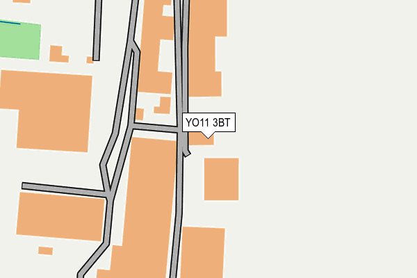
YO11 3BT is located in the Cayton electoral ward, within the unitary authority of North Yorkshire and the English Parliamentary constituency of Scarborough and Whitby. The Sub Integrated Care Board (ICB) Location is NHS Humber and North Yorkshire ICB - 42D and the police force is North Yorkshire. This postcode has been in use since January 1995.


GetTheData
Source: OS OpenMap – Local (Ordnance Survey)
Source: OS VectorMap District (Ordnance Survey)
Licence: Open Government Licence (requires attribution)
| Easting | 504361 |
| Northing | 483324 |
| Latitude | 54.235011 |
| Longitude | -0.400372 |
GetTheData
Source: Open Postcode Geo
Licence: Open Government Licence
| Country | England |
| Postcode District | YO11 |
| ➜ YO11 open data dashboard ➜ See where YO11 is on a map ➜ Where is Scarborough? | |
GetTheData
Source: Land Registry Price Paid Data
Licence: Open Government Licence
Elevation or altitude of YO11 3BT as distance above sea level:
| Metres | Feet | |
|---|---|---|
| Elevation | 40m | 131ft |
Elevation is measured from the approximate centre of the postcode, to the nearest point on an OS contour line from OS Terrain 50, which has contour spacing of ten vertical metres.
➜ How high above sea level am I? Find the elevation of your current position using your device's GPS.
GetTheData
Source: Open Postcode Elevation
Licence: Open Government Licence
| Ward | Cayton |
| Constituency | Scarborough And Whitby |
GetTheData
Source: ONS Postcode Database
Licence: Open Government Licence
| December 2023 | Anti-social behaviour | On or near Sweetbecks Close | 368m |
| October 2023 | Violence and sexual offences | On or near Sweetbecks Close | 368m |
| October 2023 | Violence and sexual offences | On or near Sweetbecks Close | 368m |
| ➜ Get more crime data in our Crime section | |||
GetTheData
Source: data.police.uk
Licence: Open Government Licence
| Pindar School (Moor Lane) | Cayton | 499m |
| Moor Lane | Cayton | 505m |
| Havers Hill (B1261) | Cayton | 531m |
| Havers Hill (B1261) | Cayton | 544m |
| High Street (Westway) | Eastfield | 585m |
| Seamer Station | 1.3km |
| Scarborough Station | 5km |
GetTheData
Source: NaPTAN
Licence: Open Government Licence
| Median download speed | 43.9Mbps |
| Average download speed | 41.3Mbps |
| Maximum download speed | 63.53Mbps |
| Median upload speed | 11.9Mbps |
| Average upload speed | 9.9Mbps |
| Maximum upload speed | 19.74Mbps |
GetTheData
Source: Ofcom
Licence: Ofcom Terms of Use (requires attribution)
GetTheData
Source: ONS Postcode Database
Licence: Open Government Licence


➜ Get more ratings from the Food Standards Agency
GetTheData
Source: Food Standards Agency
Licence: FSA terms & conditions
| Last Collection | |||
|---|---|---|---|
| Location | Mon-Fri | Sat | Distance |
| Cayton Carr | 16:00 | 11:30 | 786m |
| Salter Road Eastfield Ind Est | 18:00 | 13:30 | 792m |
| Salter Road Ind Est | 18:00 | 13:00 | 794m |
GetTheData
Source: Dracos
Licence: Creative Commons Attribution-ShareAlike
| Facility | Distance |
|---|---|
| Braeburn Primary And Nursery Academy Braeburn, Eastfield, Scarborough Swimming Pool, Sports Hall, Grass Pitches | 533m |
| George Pindar School Moor Lane, Eastfield, Scarborough Grass Pitches | 561m |
| Pindar Leisure Centre Moor Lane, Eastfield, Scarborough Sports Hall, Health and Fitness Gym, Artificial Grass Pitch, Indoor Tennis Centre, Outdoor Tennis Courts | 573m |
GetTheData
Source: Active Places
Licence: Open Government Licence
| School | Phase of Education | Distance |
|---|---|---|
| Cambian Scarborough School Unit 11, Plaxton Park, Cayton Low Road, Scarborough, YO11 3BQ | Not applicable | 130m |
| Braeburn Primary and Nursery Academy Braeburn, Eastfield, Scarborough, YO11 3LG | Primary | 585m |
| George Pindar School Moor Lane, Eastfield, Scarborough, YO11 3LW | Secondary | 587m |
GetTheData
Source: Edubase
Licence: Open Government Licence
The below table lists the International Territorial Level (ITL) codes (formerly Nomenclature of Territorial Units for Statistics (NUTS) codes) and Local Administrative Units (LAU) codes for YO11 3BT:
| ITL 1 Code | Name |
|---|---|
| TLE | Yorkshire and The Humber |
| ITL 2 Code | Name |
| TLE2 | North Yorkshire |
| ITL 3 Code | Name |
| TLE22 | North Yorkshire CC |
| LAU 1 Code | Name |
| E07000168 | Scarborough |
GetTheData
Source: ONS Postcode Directory
Licence: Open Government Licence
The below table lists the Census Output Area (OA), Lower Layer Super Output Area (LSOA), and Middle Layer Super Output Area (MSOA) for YO11 3BT:
| Code | Name | |
|---|---|---|
| OA | E00141656 | |
| LSOA | E01027807 | Scarborough 011A |
| MSOA | E02005805 | Scarborough 011 |
GetTheData
Source: ONS Postcode Directory
Licence: Open Government Licence
| YO11 3BY | Cayton Low Road | 401m |
| YO11 3LN | High Street | 417m |
| YO11 3LJ | High Street | 471m |
| YO11 3LP | High Moor Way | 484m |
| YO11 3LW | Moor Lane | 495m |
| YO11 3LH | Burnside | 506m |
| YO11 3LL | High Street | 515m |
| YO11 3LR | Link Walk | 557m |
| YO11 3LF | Holme Hill | 578m |
| YO11 3LG | Braeburn | 606m |
GetTheData
Source: Open Postcode Geo; Land Registry Price Paid Data
Licence: Open Government Licence