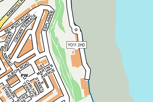
YO11 2HD is located in the Weaponness & Ramshill electoral ward, within the unitary authority of North Yorkshire and the English Parliamentary constituency of Scarborough and Whitby. The Sub Integrated Care Board (ICB) Location is NHS Humber and North Yorkshire ICB - 42D and the police force is North Yorkshire. This postcode has been in use since January 1980.


GetTheData
Source: OS OpenMap – Local (Ordnance Survey)
Source: OS VectorMap District (Ordnance Survey)
Licence: Open Government Licence (requires attribution)
| Easting | 504451 |
| Northing | 487886 |
| Latitude | 54.275959 |
| Longitude | -0.397388 |
GetTheData
Source: Open Postcode Geo
Licence: Open Government Licence
| Country | England |
| Postcode District | YO11 |
| ➜ YO11 open data dashboard ➜ See where YO11 is on a map ➜ Where is Scarborough? | |
GetTheData
Source: Land Registry Price Paid Data
Licence: Open Government Licence
Elevation or altitude of YO11 2HD as distance above sea level:
| Metres | Feet | |
|---|---|---|
| Elevation | 10m | 33ft |
Elevation is measured from the approximate centre of the postcode, to the nearest point on an OS contour line from OS Terrain 50, which has contour spacing of ten vertical metres.
➜ How high above sea level am I? Find the elevation of your current position using your device's GPS.
GetTheData
Source: Open Postcode Elevation
Licence: Open Government Licence
| Ward | Weaponness & Ramshill |
| Constituency | Scarborough And Whitby |
GetTheData
Source: ONS Postcode Database
Licence: Open Government Licence
| January 2024 | Public order | On or near Parking Area | 346m |
| January 2024 | Violence and sexual offences | On or near Park/Open Space | 466m |
| January 2024 | Violence and sexual offences | On or near Park/Open Space | 466m |
| ➜ Get more crime data in our Crime section | |||
GetTheData
Source: data.police.uk
Licence: Open Government Licence
| The Spa (Foreshore Road) | Scarborough | 107m |
| Prince Of Wales Terrace | Weaponness | 288m |
| Aquarium Top Stop Y (Valley Road) | Scarborough | 344m |
| Adelaide House (St Martin's Road) | Weaponness | 355m |
| Adelaide House (West Street) | Weaponness | 356m |
| Scarborough Station | 0.7km |
| Seamer Station | 4.1km |
GetTheData
Source: NaPTAN
Licence: Open Government Licence
GetTheData
Source: ONS Postcode Database
Licence: Open Government Licence


➜ Get more ratings from the Food Standards Agency
GetTheData
Source: Food Standards Agency
Licence: FSA terms & conditions
| Last Collection | |||
|---|---|---|---|
| Location | Mon-Fri | Sat | Distance |
| Outside The Spa Scarborough | 17:30 | 12:45 | 16m |
| South Street Scarborough | 17:30 | 13:00 | 181m |
| Esplanade Corner Belmont Road | 17:30 | 12:45 | 202m |
GetTheData
Source: Dracos
Licence: Creative Commons Attribution-ShareAlike
| Facility | Distance |
|---|---|
| Crown Spa Esplanade, Scarborough Health and Fitness Gym, Swimming Pool, Studio | 173m |
| Ambassador Hotel Esplanade, Scarborough Swimming Pool | 440m |
| Swallow Leisure (St Nicholas Hotel) (Closed) St. Nicholas Cliff, Scarborough Health and Fitness Gym, Swimming Pool | 497m |
GetTheData
Source: Active Places
Licence: Open Government Licence
| School | Phase of Education | Distance |
|---|---|---|
| Scarborough Pupil Referral Unit Valley Bridge Parade, Scarborough, YO11 2PG | Not applicable | 571m |
| Childhaven Community Nursery School 13 Belgrave Crescent, Scarborough, YO11 1UB | Nursery | 840m |
| Friarage Community Primary School Friargate, Scarborough, YO11 1HS | Primary | 1km |
GetTheData
Source: Edubase
Licence: Open Government Licence
The below table lists the International Territorial Level (ITL) codes (formerly Nomenclature of Territorial Units for Statistics (NUTS) codes) and Local Administrative Units (LAU) codes for YO11 2HD:
| ITL 1 Code | Name |
|---|---|
| TLE | Yorkshire and The Humber |
| ITL 2 Code | Name |
| TLE2 | North Yorkshire |
| ITL 3 Code | Name |
| TLE22 | North Yorkshire CC |
| LAU 1 Code | Name |
| E07000168 | Scarborough |
GetTheData
Source: ONS Postcode Directory
Licence: Open Government Licence
The below table lists the Census Output Area (OA), Lower Layer Super Output Area (LSOA), and Middle Layer Super Output Area (MSOA) for YO11 2HD:
| Code | Name | |
|---|---|---|
| OA | E00141893 | |
| LSOA | E01027854 | Scarborough 010D |
| MSOA | E02005804 | Scarborough 010 |
GetTheData
Source: ONS Postcode Directory
Licence: Open Government Licence
| YO11 2AQ | Esplanade | 142m |
| YO11 2DD | St Martins Avenue | 159m |
| YO11 2AF | Esplanade | 161m |
| YO11 2BN | Back South Street | 175m |
| YO11 2BB | Esplanade | 194m |
| YO11 2BP | South Street | 195m |
| YO11 2AH | Prince Of Wales Terrace | 198m |
| YO11 2AE | Wessex Court | 200m |
| YO11 2DA | St Martins Avenue | 219m |
| YO11 2BT | Albion Road | 223m |
GetTheData
Source: Open Postcode Geo; Land Registry Price Paid Data
Licence: Open Government Licence