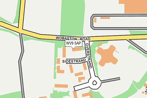
WV9 5AP is located in the Oxley electoral ward, within the metropolitan district of Wolverhampton and the English Parliamentary constituency of Wolverhampton North East. The Sub Integrated Care Board (ICB) Location is NHS Black Country ICB - D2P2L and the police force is West Midlands. This postcode has been in use since November 2008.


GetTheData
Source: OS OpenMap – Local (Ordnance Survey)
Source: OS VectorMap District (Ordnance Survey)
Licence: Open Government Licence (requires attribution)
| Easting | 389814 |
| Northing | 303502 |
| Latitude | 52.629192 |
| Longitude | -2.151919 |
GetTheData
Source: Open Postcode Geo
Licence: Open Government Licence
| Country | England |
| Postcode District | WV9 |
| ➜ WV9 open data dashboard ➜ See where WV9 is on a map ➜ Where is Wolverhampton? | |
GetTheData
Source: Land Registry Price Paid Data
Licence: Open Government Licence
Elevation or altitude of WV9 5AP as distance above sea level:
| Metres | Feet | |
|---|---|---|
| Elevation | 110m | 361ft |
Elevation is measured from the approximate centre of the postcode, to the nearest point on an OS contour line from OS Terrain 50, which has contour spacing of ten vertical metres.
➜ How high above sea level am I? Find the elevation of your current position using your device's GPS.
GetTheData
Source: Open Postcode Elevation
Licence: Open Government Licence
| Ward | Oxley |
| Constituency | Wolverhampton North East |
GetTheData
Source: ONS Postcode Database
Licence: Open Government Licence
| November 2023 | Other crime | On or near Fuchsia Drive | 313m |
| November 2023 | Violence and sexual offences | On or near Fuchsia Drive | 313m |
| November 2023 | Violence and sexual offences | On or near Fuchsia Drive | 313m |
| ➜ Get more crime data in our Crime section | |||
GetTheData
Source: data.police.uk
Licence: Open Government Licence
| Pendeford Trading Estate (Overstrand) | Pendeford | 125m |
| Caravan Park (Pendeford Hall Lane) | Pendleford Hall | 407m |
| Caravan Park (Pendeford Hall Lane) | Pendleford Hall | 419m |
| Armstead Rd (The Droveway) | Pendeford | 521m |
| Armstead Rd (The Droveway) | Pendeford | 527m |
| Bilbrook Station | 2.4km |
| Codsall Station | 3.4km |
| Wolverhampton Station | 5.1km |
GetTheData
Source: NaPTAN
Licence: Open Government Licence
GetTheData
Source: ONS Postcode Database
Licence: Open Government Licence


➜ Get more ratings from the Food Standards Agency
GetTheData
Source: Food Standards Agency
Licence: FSA terms & conditions
| Last Collection | |||
|---|---|---|---|
| Location | Mon-Fri | Sat | Distance |
| Leybourne Crescent | 17:00 | 12:45 | 904m |
| Fordhouses Post Office | 18:00 | 12:15 | 1,676m |
| Hampton Road | 17:15 | 12:15 | 1,725m |
GetTheData
Source: Dracos
Licence: Creative Commons Attribution-ShareAlike
| Facility | Distance |
|---|---|
| Bilbrook Junior Football Club Off Pendeford Lane, Wobaston Road, Wolverhampton Grass Pitches | 444m |
| St Paul's Church Of England Aided Primary School Emsworth Crescent, Wolverhampton Grass Pitches | 895m |
| Jack Threlfall Memorial Ground Wobaston Road, Wolverhampton Grass Pitches | 926m |
GetTheData
Source: Active Places
Licence: Open Government Licence
| School | Phase of Education | Distance |
|---|---|---|
| St Paul's Church of England Aided Primary School Emsworth Crescent, Pendeford, Wolverhampton, WV9 5NR | Primary | 1km |
| Ormiston NEW Academy Marsh Lane, Fordhouses, Wolverhampton, WV10 6SE | Secondary | 1.2km |
| Dovecotes Primary School Ryefield, Dovecotes Estate, Pendeford, Wolverhampton, WV8 1TX | Primary | 1.2km |
GetTheData
Source: Edubase
Licence: Open Government Licence
The below table lists the International Territorial Level (ITL) codes (formerly Nomenclature of Territorial Units for Statistics (NUTS) codes) and Local Administrative Units (LAU) codes for WV9 5AP:
| ITL 1 Code | Name |
|---|---|
| TLG | West Midlands (England) |
| ITL 2 Code | Name |
| TLG3 | West Midlands |
| ITL 3 Code | Name |
| TLG39 | Wolverhampton |
| LAU 1 Code | Name |
| E08000031 | Wolverhampton |
GetTheData
Source: ONS Postcode Directory
Licence: Open Government Licence
The below table lists the Census Output Area (OA), Lower Layer Super Output Area (LSOA), and Middle Layer Super Output Area (MSOA) for WV9 5AP:
| Code | Name | |
|---|---|---|
| OA | E00053030 | |
| LSOA | E01010496 | Wolverhampton 003A |
| MSOA | E02002151 | Wolverhampton 003 |
GetTheData
Source: ONS Postcode Directory
Licence: Open Government Licence
| WV9 5HF | Sidestrand | 41m |
| WV9 5HD | Sidestrand | 99m |
| WV9 5HA | Pendeford Business Park | 118m |
| WV9 5HB | Westrand | 151m |
| WV9 5SH | Camellia Gardens | 274m |
| WV9 5SA | Fuchsia Drive | 298m |
| WV9 5RJ | Jasmine Close | 331m |
| WV9 5RP | Rathlin Close | 369m |
| WV9 5RY | Welney Gardens | 385m |
| WV9 5SE | Ivy Croft | 389m |
GetTheData
Source: Open Postcode Geo; Land Registry Price Paid Data
Licence: Open Government Licence