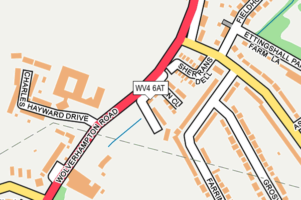
WV4 6AT is located in the Ettingshall South & Spring Vale electoral ward, within the metropolitan district of Wolverhampton and the English Parliamentary constituency of Wolverhampton South East. The Sub Integrated Care Board (ICB) Location is NHS Black Country ICB - D2P2L and the police force is West Midlands. This postcode has been in use since January 1980.


GetTheData
Source: OS OpenMap – Local (Ordnance Survey)
Source: OS VectorMap District (Ordnance Survey)
Licence: Open Government Licence (requires attribution)
| Easting | 391886 |
| Northing | 295435 |
| Latitude | 52.556692 |
| Longitude | -2.121111 |
GetTheData
Source: Open Postcode Geo
Licence: Open Government Licence
| Country | England |
| Postcode District | WV4 |
| ➜ WV4 open data dashboard ➜ See where WV4 is on a map ➜ Where is Wolverhampton? | |
GetTheData
Source: Land Registry Price Paid Data
Licence: Open Government Licence
Elevation or altitude of WV4 6AT as distance above sea level:
| Metres | Feet | |
|---|---|---|
| Elevation | 170m | 558ft |
Elevation is measured from the approximate centre of the postcode, to the nearest point on an OS contour line from OS Terrain 50, which has contour spacing of ten vertical metres.
➜ How high above sea level am I? Find the elevation of your current position using your device's GPS.
GetTheData
Source: Open Postcode Elevation
Licence: Open Government Licence
| Ward | Ettingshall South & Spring Vale |
| Constituency | Wolverhampton South East |
GetTheData
Source: ONS Postcode Database
Licence: Open Government Licence
| June 2022 | Burglary | On or near Tern Close | 39m |
| June 2022 | Burglary | On or near Tern Close | 39m |
| June 2022 | Anti-social behaviour | On or near Sherrans Dell | 95m |
| ➜ Get more crime data in our Crime section | |||
GetTheData
Source: data.police.uk
Licence: Open Government Licence
| Beacon Centre (Wolverhampton Road E) | Northway | 42m |
| Beacon Centre (Wolverhampton Road E) | Northway | 66m |
| Dovedale Rd (Wolverhampton Road E) | Parkfield | 256m |
| Wolverhampton Rd (Northway) | Northway | 311m |
| Dovedale Rd (Wolverhampton Road E) | Parkfield | 334m |
| Coseley Station | 2.7km |
| Wolverhampton Station | 3.5km |
| Tipton Station | 4.8km |
GetTheData
Source: NaPTAN
Licence: Open Government Licence
| Percentage of properties with Next Generation Access | 100.0% |
| Percentage of properties with Superfast Broadband | 100.0% |
| Percentage of properties with Ultrafast Broadband | 100.0% |
| Percentage of properties with Full Fibre Broadband | 0.0% |
Superfast Broadband is between 30Mbps and 300Mbps
Ultrafast Broadband is > 300Mbps
| Percentage of properties unable to receive 2Mbps | 0.0% |
| Percentage of properties unable to receive 5Mbps | 0.0% |
| Percentage of properties unable to receive 10Mbps | 0.0% |
| Percentage of properties unable to receive 30Mbps | 0.0% |
GetTheData
Source: Ofcom
Licence: Ofcom Terms of Use (requires attribution)
GetTheData
Source: ONS Postcode Database
Licence: Open Government Licence


➜ Get more ratings from the Food Standards Agency
GetTheData
Source: Food Standards Agency
Licence: FSA terms & conditions
| Last Collection | |||
|---|---|---|---|
| Location | Mon-Fri | Sat | Distance |
| Birmingham New Road | 16:45 | 12:00 | 800m |
| Wolverhampton Road East | 16:45 | 12:00 | 1,096m |
| Beacon Rise | 17:30 | 11:00 | 1,229m |
GetTheData
Source: Dracos
Licence: Creative Commons Attribution-ShareAlike
| Facility | Distance |
|---|---|
| Springvale Park Kenilworth Crescent, Parkfields, Wolverhampton Grass Pitches | 474m |
| Spring Vale Primary School Kenilworth Crescent, Parkfields, Wolverhampton Grass Pitches | 574m |
| Lawnswood Campus Lawnswood Avenue, Parkfields, Wolverhampton Swimming Pool, Sports Hall, Grass Pitches | 727m |
GetTheData
Source: Active Places
Licence: Open Government Licence
| School | Phase of Education | Distance |
|---|---|---|
| Orchard Centre (The Nightingale Home and Hospital Service) Lawnswood Campus, Lawnswood Avenue, Parkfields, Wolverhampton, WV4 6SR | Not applicable | 227m |
| Midpoint Centre (Key Stage 4 PRU) Lawnswood Avenue, Parkfields, Wolverhampton, WV4 6SR | Not applicable | 275m |
| Spring Vale Primary School Kenilworth Crescent, Parkfield, Wolverhampton, WV4 6SD | Primary | 576m |
GetTheData
Source: Edubase
Licence: Open Government Licence
The below table lists the International Territorial Level (ITL) codes (formerly Nomenclature of Territorial Units for Statistics (NUTS) codes) and Local Administrative Units (LAU) codes for WV4 6AT:
| ITL 1 Code | Name |
|---|---|
| TLG | West Midlands (England) |
| ITL 2 Code | Name |
| TLG3 | West Midlands |
| ITL 3 Code | Name |
| TLG39 | Wolverhampton |
| LAU 1 Code | Name |
| E08000031 | Wolverhampton |
GetTheData
Source: ONS Postcode Directory
Licence: Open Government Licence
The below table lists the Census Output Area (OA), Lower Layer Super Output Area (LSOA), and Middle Layer Super Output Area (MSOA) for WV4 6AT:
| Code | Name | |
|---|---|---|
| OA | E00053174 | |
| LSOA | E01010536 | Wolverhampton 032C |
| MSOA | E02002180 | Wolverhampton 032 |
GetTheData
Source: ONS Postcode Directory
Licence: Open Government Licence
| WV4 6AX | Rodway Close | 52m |
| WV4 6AU | Tern Close | 55m |
| WV4 6RW | Sherrans Dell | 111m |
| WV4 6AY | Wolverhampton Road East | 151m |
| WV4 6GA | Charles Hayward Drive | 166m |
| WV4 6AS | Wolverhampton Road East | 184m |
| WV4 6SN | Fieldhouse Road | 200m |
| WV4 6SW | Fieldhouse Road | 218m |
| WV4 6GB | Charles Hayward Drive | 223m |
| WV4 6QH | Farrington Road | 235m |
GetTheData
Source: Open Postcode Geo; Land Registry Price Paid Data
Licence: Open Government Licence