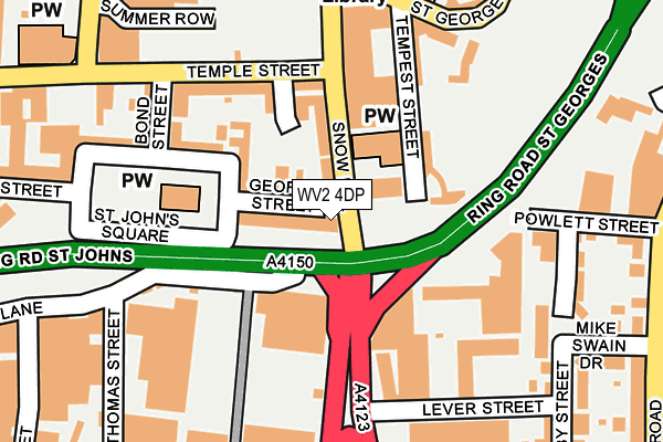
WV2 4DP is located in the St Peters electoral ward, within the metropolitan district of Wolverhampton and the English Parliamentary constituency of Wolverhampton South West. The Sub Integrated Care Board (ICB) Location is NHS Black Country ICB - D2P2L and the police force is West Midlands. This postcode has been in use since April 1986.


GetTheData
Source: OS OpenMap – Local (Ordnance Survey)
Source: OS VectorMap District (Ordnance Survey)
Licence: Open Government Licence (requires attribution)
| Easting | 391565 |
| Northing | 298137 |
| Latitude | 52.580977 |
| Longitude | -2.125915 |
GetTheData
Source: Open Postcode Geo
Licence: Open Government Licence
| Country | England |
| Postcode District | WV2 |
| ➜ WV2 open data dashboard ➜ See where WV2 is on a map ➜ Where is Wolverhampton? | |
GetTheData
Source: Land Registry Price Paid Data
Licence: Open Government Licence
Elevation or altitude of WV2 4DP as distance above sea level:
| Metres | Feet | |
|---|---|---|
| Elevation | 160m | 525ft |
Elevation is measured from the approximate centre of the postcode, to the nearest point on an OS contour line from OS Terrain 50, which has contour spacing of ten vertical metres.
➜ How high above sea level am I? Find the elevation of your current position using your device's GPS.
GetTheData
Source: Open Postcode Elevation
Licence: Open Government Licence
| Ward | St Peters |
| Constituency | Wolverhampton South West |
GetTheData
Source: ONS Postcode Database
Licence: Open Government Licence
| January 2024 | Public order | On or near Parking Area | 302m |
| January 2024 | Public order | On or near Parking Area | 302m |
| January 2024 | Public order | On or near Parking Area | 302m |
| ➜ Get more crime data in our Crime section | |||
GetTheData
Source: data.police.uk
Licence: Open Government Licence
| Temple St (Snow Hill) | Wolverhampton | 97m |
| Temple St (Snow Hill) | Wolverhampton | 169m |
| Wulfrun Centre (Cleveland St) | Wolverhampton | 272m |
| Wulfrun Centre (Cleveland St) | Wolverhampton | 282m |
| Old Hall St (St Georges Parade) | Wolverhampton | 294m |
| Wolverhampton St George's (Midland Metro Stop) (Bilston St) | Wolverhampton | 362m |
| The Royal (Midland Metro Stop) (Bilston St) | Wolverhampton | 562m |
| Wolverhampton Station | 0.9km |
| Coseley Station | 4.8km |
| Bilbrook Station | 6.3km |
GetTheData
Source: NaPTAN
Licence: Open Government Licence
GetTheData
Source: ONS Postcode Database
Licence: Open Government Licence


➜ Get more ratings from the Food Standards Agency
GetTheData
Source: Food Standards Agency
Licence: FSA terms & conditions
| Last Collection | |||
|---|---|---|---|
| Location | Mon-Fri | Sat | Distance |
| Temple Street | 18:30 | 12:45 | 303m |
| Vicarage Road | 17:30 | 12:00 | 336m |
| Cleveland Street | 18:30 | 12:45 | 344m |
GetTheData
Source: Dracos
Licence: Creative Commons Attribution-ShareAlike
| Facility | Distance |
|---|---|
| Complexions Gym Limited Snow Hill, Wolverhampton Health and Fitness Gym, Studio | 175m |
| Trugym Wolverhampton (Closed) Birmingham Road, Wolverhampton Health and Fitness Gym, Studio | 299m |
| The Way Youth Zone School Street, Wolverhampton Sports Hall, Health and Fitness Gym, Artificial Grass Pitch | 408m |
GetTheData
Source: Active Places
Licence: Open Government Licence
| School | Phase of Education | Distance |
|---|---|---|
| Progress Schools - Wolverhampton The Way Youth Zone, School Street, Wolverhampton, WV3 0NR | Not applicable | 408m |
| SS. Mary and John's Catholic Primary Academy Caledonia Road, Wolverhampton, WV2 1HZ | Primary | 649m |
| Graiseley Primary School Pool Street, Graiseley Hill, Wolverhampton, WV2 4NE | Primary | 702m |
GetTheData
Source: Edubase
Licence: Open Government Licence
The below table lists the International Territorial Level (ITL) codes (formerly Nomenclature of Territorial Units for Statistics (NUTS) codes) and Local Administrative Units (LAU) codes for WV2 4DP:
| ITL 1 Code | Name |
|---|---|
| TLG | West Midlands (England) |
| ITL 2 Code | Name |
| TLG3 | West Midlands |
| ITL 3 Code | Name |
| TLG39 | Wolverhampton |
| LAU 1 Code | Name |
| E08000031 | Wolverhampton |
GetTheData
Source: ONS Postcode Directory
Licence: Open Government Licence
The below table lists the Census Output Area (OA), Lower Layer Super Output Area (LSOA), and Middle Layer Super Output Area (MSOA) for WV2 4DP:
| Code | Name | |
|---|---|---|
| OA | E00167325 | |
| LSOA | E01010521 | Wolverhampton 020F |
| MSOA | E02002168 | Wolverhampton 020 |
GetTheData
Source: ONS Postcode Directory
Licence: Open Government Licence
| WV2 4DG | George Street | 52m |
| WV2 4AG | Snow Hill | 71m |
| WV2 1AA | Tempest Street | 117m |
| WV2 4AS | Bond Street | 196m |
| WV2 1AS | Raby Street | 205m |
| WV2 3LQ | Birmingham Road | 219m |
| WV2 1AU | Raby Street | 221m |
| WV2 1AP | Raby Street | 230m |
| WV2 1AQ | Lever Street | 249m |
| WV2 1AF | Powlett Street | 267m |
GetTheData
Source: Open Postcode Geo; Land Registry Price Paid Data
Licence: Open Government Licence