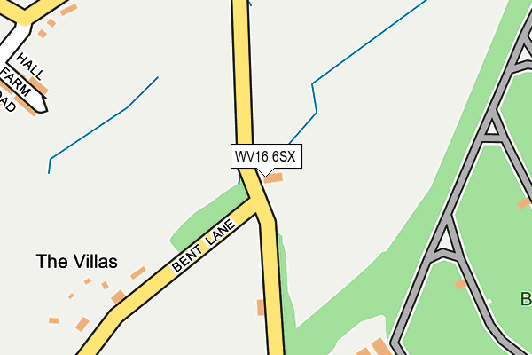
WV16 6SX is located in the Brown Clee electoral ward, within the unitary authority of Shropshire and the English Parliamentary constituency of Ludlow. The Sub Integrated Care Board (ICB) Location is NHS Shropshire, Telford and Wrekin ICB - M2L0M and the police force is West Mercia. This postcode has been in use since December 2000.


GetTheData
Source: OS OpenMap – Local (Ordnance Survey)
Source: OS VectorMap District (Ordnance Survey)
Licence: Open Government Licence (requires attribution)
| Easting | 360792 |
| Northing | 288561 |
| Latitude | 52.493540 |
| Longitude | -2.578911 |
GetTheData
Source: Open Postcode Geo
Licence: Open Government Licence
| Country | England |
| Postcode District | WV16 |
| ➜ WV16 open data dashboard ➜ See where WV16 is on a map | |
GetTheData
Source: Land Registry Price Paid Data
Licence: Open Government Licence
Elevation or altitude of WV16 6SX as distance above sea level:
| Metres | Feet | |
|---|---|---|
| Elevation | 240m | 787ft |
Elevation is measured from the approximate centre of the postcode, to the nearest point on an OS contour line from OS Terrain 50, which has contour spacing of ten vertical metres.
➜ How high above sea level am I? Find the elevation of your current position using your device's GPS.
GetTheData
Source: Open Postcode Elevation
Licence: Open Government Licence
| Ward | Brown Clee |
| Constituency | Ludlow |
GetTheData
Source: ONS Postcode Database
Licence: Open Government Licence
| January 2022 | Violence and sexual offences | On or near Hall Road | 453m |
| ➜ Get more crime data in our Crime section | |||
GetTheData
Source: data.police.uk
Licence: Open Government Licence
| Church (Station Road) | Ditton Priors | 598m |
| Church (Station Road) | Ditton Priors | 599m |
| Industrial Estate (Station Road) | Ditton Priors | 881m |
| Industrial Estate (Station Road) | Ditton Priors | 887m |
| Church (B4364) | Cleobury North | 2,021m |
GetTheData
Source: NaPTAN
Licence: Open Government Licence
| Percentage of properties with Next Generation Access | 100.0% |
| Percentage of properties with Superfast Broadband | 100.0% |
| Percentage of properties with Ultrafast Broadband | 0.0% |
| Percentage of properties with Full Fibre Broadband | 0.0% |
Superfast Broadband is between 30Mbps and 300Mbps
Ultrafast Broadband is > 300Mbps
| Percentage of properties unable to receive 2Mbps | 0.0% |
| Percentage of properties unable to receive 5Mbps | 0.0% |
| Percentage of properties unable to receive 10Mbps | 0.0% |
| Percentage of properties unable to receive 30Mbps | 0.0% |
GetTheData
Source: Ofcom
Licence: Ofcom Terms of Use (requires attribution)
GetTheData
Source: ONS Postcode Database
Licence: Open Government Licence


➜ Get more ratings from the Food Standards Agency
GetTheData
Source: Food Standards Agency
Licence: FSA terms & conditions
| Last Collection | |||
|---|---|---|---|
| Location | Mon-Fri | Sat | Distance |
| Bank Farm | 09:00 | 09:00 | 2,791m |
| Burwarton Lamp Box | 16:00 | 08:00 | 3,583m |
| Abdon | 10:00 | 10:00 | 3,832m |
GetTheData
Source: Dracos
Licence: Creative Commons Attribution-ShareAlike
| School | Phase of Education | Distance |
|---|---|---|
| Brown Clee CofE Primary School Station Road, Ditton Priors, Bridgnorth, WV16 6SS | Primary | 779m |
GetTheData
Source: Edubase
Licence: Open Government Licence
The below table lists the International Territorial Level (ITL) codes (formerly Nomenclature of Territorial Units for Statistics (NUTS) codes) and Local Administrative Units (LAU) codes for WV16 6SX:
| ITL 1 Code | Name |
|---|---|
| TLG | West Midlands (England) |
| ITL 2 Code | Name |
| TLG2 | Shropshire and Staffordshire |
| ITL 3 Code | Name |
| TLG22 | Shropshire |
| LAU 1 Code | Name |
| E06000051 | Shropshire |
GetTheData
Source: ONS Postcode Directory
Licence: Open Government Licence
The below table lists the Census Output Area (OA), Lower Layer Super Output Area (LSOA), and Middle Layer Super Output Area (MSOA) for WV16 6SX:
| Code | Name | |
|---|---|---|
| OA | E00146898 | |
| LSOA | E01028843 | Shropshire 035A |
| MSOA | E02006014 | Shropshire 035 |
GetTheData
Source: ONS Postcode Directory
Licence: Open Government Licence
| WV16 6SL | Chapel Lane | 275m |
| WV16 6SN | Hall Farm Road | 299m |
| WV16 6SJ | South Road | 399m |
| WV16 6SP | Vicarage Road | 536m |
| WV16 6TQ | St Johns Court | 537m |
| WV16 6SY | Bent Lane | 558m |
| WV16 6SS | Station Road | 715m |
| WV16 6SQ | 729m | |
| WV16 6RA | Ruthall Close | 778m |
| WV16 6TH | Church Meadow | 788m |
GetTheData
Source: Open Postcode Geo; Land Registry Price Paid Data
Licence: Open Government Licence