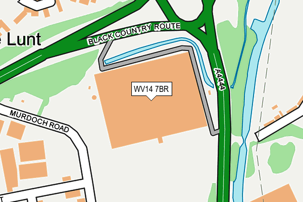
WV14 7BR is located in the Bilston South electoral ward, within the metropolitan district of Wolverhampton and the English Parliamentary constituency of Wolverhampton South East. The Sub Integrated Care Board (ICB) Location is NHS Black Country ICB - D2P2L and the police force is West Midlands. This postcode has been in use since August 2011.


GetTheData
Source: OS OpenMap – Local (Ordnance Survey)
Source: OS VectorMap District (Ordnance Survey)
Licence: Open Government Licence (requires attribution)
| Easting | 396291 |
| Northing | 296646 |
| Latitude | 52.567627 |
| Longitude | -2.056152 |
GetTheData
Source: Open Postcode Geo
Licence: Open Government Licence
| Country | England |
| Postcode District | WV14 |
➜ See where WV14 is on a map ➜ Where is Bilston? | |
GetTheData
Source: Land Registry Price Paid Data
Licence: Open Government Licence
Elevation or altitude of WV14 7BR as distance above sea level:
| Metres | Feet | |
|---|---|---|
| Elevation | 130m | 427ft |
Elevation is measured from the approximate centre of the postcode, to the nearest point on an OS contour line from OS Terrain 50, which has contour spacing of ten vertical metres.
➜ How high above sea level am I? Find the elevation of your current position using your device's GPS.
GetTheData
Source: Open Postcode Elevation
Licence: Open Government Licence
| Ward | Bilston South |
| Constituency | Wolverhampton South East |
GetTheData
Source: ONS Postcode Database
Licence: Open Government Licence
| St Chads Rd (Lunt Rd) | The Lunt | 384m |
| St Chads Rd (Lunt Rd) | The Lunt | 394m |
| Burns Road (Hughes Rd) | Loxdale | 431m |
| Wells Avenue (Stanbury Ave) | Herberts Park | 433m |
| Burns Road (Hughes Rd) | Loxdale | 435m |
| Loxdale (Midland Metro Stop) (Loxdale St) | Bradley | 1,076m |
| Bilston Central (Midland Metro Stop) (Church St) | Bilston | 1,287m |
| Bradley Lane (Midland Metro Stop) (Bradley Lane) | Lower Bradley | 1,333m |
| Coseley Station | 3.2km |
| Tipton Station | 4.2km |
| Bescot Stadium Station | 4.4km |
GetTheData
Source: NaPTAN
Licence: Open Government Licence
GetTheData
Source: ONS Postcode Database
Licence: Open Government Licence

➜ Get more ratings from the Food Standards Agency
GetTheData
Source: Food Standards Agency
Licence: FSA terms & conditions
| Last Collection | |||
|---|---|---|---|
| Location | Mon-Fri | Sat | Distance |
| Mount Pleasant | 18:30 | 11:30 | 1,058m |
| Wednesbury Post Office | 17:30 | 12:00 | 1,533m |
| Wellington Road | 16:45 | 11:15 | 1,569m |
GetTheData
Source: Dracos
Licence: Creative Commons Attribution-ShareAlike
| Risk of WV14 7BR flooding from rivers and sea | Low |
| ➜ WV14 7BR flood map | |
GetTheData
Source: Open Flood Risk by Postcode
Licence: Open Government Licence
The below table lists the International Territorial Level (ITL) codes (formerly Nomenclature of Territorial Units for Statistics (NUTS) codes) and Local Administrative Units (LAU) codes for WV14 7BR:
| ITL 1 Code | Name |
|---|---|
| TLG | West Midlands (England) |
| ITL 2 Code | Name |
| TLG3 | West Midlands |
| ITL 3 Code | Name |
| TLG39 | Wolverhampton |
| LAU 1 Code | Name |
| E08000031 | Wolverhampton |
GetTheData
Source: ONS Postcode Directory
Licence: Open Government Licence
The below table lists the Census Output Area (OA), Lower Layer Super Output Area (LSOA), and Middle Layer Super Output Area (MSOA) for WV14 7BR:
| Code | Name | |
|---|---|---|
| OA | E00167332 | |
| LSOA | E01010414 | Wolverhampton 027A |
| MSOA | E02002175 | Wolverhampton 027 |
GetTheData
Source: ONS Postcode Directory
Licence: Open Government Licence
| WV14 7AU | Marbury Drive | 262m |
| WV14 7AP | Marbury Drive | 329m |
| WS10 8QH | Herberts Park Road | 347m |
| WV14 7AH | Lunt Place | 360m |
| WV14 7BT | Bickley Road | 383m |
| WV14 7BF | Barn Farm Close | 391m |
| WV14 7HF | Lunt Road | 418m |
| WV14 7AJ | Lunt Road | 421m |
| WS10 8QG | Stanbury Avenue | 428m |
| WS10 8SN | Hughes Road | 438m |
GetTheData
Source: Open Postcode Geo; Land Registry Price Paid Data
Licence: Open Government Licence