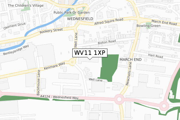
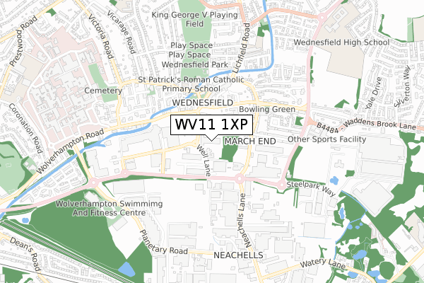
WV11 1XP is located in the Wednesfield South electoral ward, within the metropolitan district of Wolverhampton and the English Parliamentary constituency of Wolverhampton North East. The Sub Integrated Care Board (ICB) Location is NHS Black Country ICB - D2P2L and the police force is West Midlands. This postcode has been in use since January 1980.


GetTheData
Source: OS Open Zoomstack (Ordnance Survey)
Licence: Open Government Licence (requires attribution)
Attribution: Contains OS data © Crown copyright and database right 2024
Source: Open Postcode Geo
Licence: Open Government Licence (requires attribution)
Attribution: Contains OS data © Crown copyright and database right 2024; Contains Royal Mail data © Royal Mail copyright and database right 2024; Source: Office for National Statistics licensed under the Open Government Licence v.3.0
| Easting | 394501 |
| Northing | 299932 |
| Latitude | 52.597152 |
| Longitude | -2.082617 |
GetTheData
Source: Open Postcode Geo
Licence: Open Government Licence
| Country | England |
| Postcode District | WV11 |
| ➜ WV11 open data dashboard ➜ See where WV11 is on a map ➜ Where is Wolverhampton? | |
GetTheData
Source: Land Registry Price Paid Data
Licence: Open Government Licence
Elevation or altitude of WV11 1XP as distance above sea level:
| Metres | Feet | |
|---|---|---|
| Elevation | 140m | 459ft |
Elevation is measured from the approximate centre of the postcode, to the nearest point on an OS contour line from OS Terrain 50, which has contour spacing of ten vertical metres.
➜ How high above sea level am I? Find the elevation of your current position using your device's GPS.
GetTheData
Source: Open Postcode Elevation
Licence: Open Government Licence
| Ward | Wednesfield South |
| Constituency | Wolverhampton North East |
GetTheData
Source: ONS Postcode Database
Licence: Open Government Licence
| January 2024 | Criminal damage and arson | On or near Parking Area | 176m |
| January 2024 | Possession of weapons | On or near Parking Area | 176m |
| January 2024 | Criminal damage and arson | On or near Parking Area | 298m |
| ➜ Get more crime data in our Crime section | |||
GetTheData
Source: data.police.uk
Licence: Open Government Licence
| Gem Centre (Neachells Lane) | Wednesfield | 235m |
| Wednesfield Police Station (Alfred Squire Rd) | Wednesfield | 240m |
| Hall St (Rookery St) | Wednesfield | 243m |
| Gem Centre (Neachells Lane) | Wednesfield | 251m |
| Wednesfield Police Station (Alfred Squire Rd) | Wednesfield | 258m |
| Wolverhampton Station | 2.7km |
| Bloxwich Station | 5.4km |
| Bloxwich North Station | 5.4km |
GetTheData
Source: NaPTAN
Licence: Open Government Licence
GetTheData
Source: ONS Postcode Database
Licence: Open Government Licence


➜ Get more ratings from the Food Standards Agency
GetTheData
Source: Food Standards Agency
Licence: FSA terms & conditions
| Last Collection | |||
|---|---|---|---|
| Location | Mon-Fri | Sat | Distance |
| Wednesfield Post Office | 17:00 | 12:15 | 330m |
| Lichfield Road | 17:15 | 12:00 | 945m |
| New Cross Hospital | 17:15 | 13:00 | 1,239m |
GetTheData
Source: Dracos
Licence: Creative Commons Attribution-ShareAlike
| Facility | Distance |
|---|---|
| Puregym (Wolverhampton Bentley Bridge) Bentley Bridge Park, Bentley Bridge Way, Wednesfield, Wolverhampton Health and Fitness Gym, Studio | 350m |
| Healthland Club (Wednesfield) (Closed) Kenmare Way, Wolverhampton Studio, Swimming Pool, Health and Fitness Gym | 673m |
| King George V Playing Fields (Wolverhampton) Amos Lane, Wolverhampton Grass Pitches | 754m |
GetTheData
Source: Active Places
Licence: Open Government Licence
| School | Phase of Education | Distance |
|---|---|---|
| St Patrick's Catholic Primary Academy Graiseley Lane, Wednesfield, Graiseley Lane, Wednesfield, Wolverhampton, WV11 1PG | Primary | 378m |
| Jennie Lee Centre Litchfield Road, Wednesfield, Wolverhampton, WV11 3HT | Not applicable | 842m |
| Wodensfield Primary School Woden Avenue, Wednesfield, Wolverhampton, WV11 1PW | Primary | 949m |
GetTheData
Source: Edubase
Licence: Open Government Licence
The below table lists the International Territorial Level (ITL) codes (formerly Nomenclature of Territorial Units for Statistics (NUTS) codes) and Local Administrative Units (LAU) codes for WV11 1XP:
| ITL 1 Code | Name |
|---|---|
| TLG | West Midlands (England) |
| ITL 2 Code | Name |
| TLG3 | West Midlands |
| ITL 3 Code | Name |
| TLG39 | Wolverhampton |
| LAU 1 Code | Name |
| E08000031 | Wolverhampton |
GetTheData
Source: ONS Postcode Directory
Licence: Open Government Licence
The below table lists the Census Output Area (OA), Lower Layer Super Output Area (LSOA), and Middle Layer Super Output Area (MSOA) for WV11 1XP:
| Code | Name | |
|---|---|---|
| OA | E00167331 | |
| LSOA | E01010564 | Wolverhampton 012C |
| MSOA | E02002160 | Wolverhampton 012 |
GetTheData
Source: ONS Postcode Directory
Licence: Open Government Licence
| WV11 1XT | Well Lane | 77m |
| WV11 1UA | Bolton Road | 113m |
| WV11 1UB | Bolton Road | 160m |
| WV11 3DR | Sidings Close | 209m |
| WV11 3PS | Neachells Lane | 216m |
| WV11 3QQ | Neachells Lane | 248m |
| WV11 3PR | Neachells Lane | 291m |
| WV11 1SZ | High Street | 305m |
| WV11 1UN | Rookery Street | 306m |
| WV11 3PQ | Satellite Industrial Park | 315m |
GetTheData
Source: Open Postcode Geo; Land Registry Price Paid Data
Licence: Open Government Licence