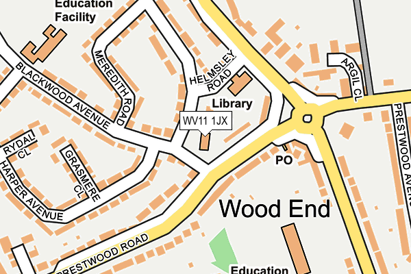
WV11 1JX is located in the Fallings Park electoral ward, within the metropolitan district of Wolverhampton and the English Parliamentary constituency of Wolverhampton North East. The Sub Integrated Care Board (ICB) Location is NHS Black Country ICB - D2P2L and the police force is West Midlands. This postcode has been in use since January 1980.


GetTheData
Source: OS OpenMap – Local (Ordnance Survey)
Source: OS VectorMap District (Ordnance Survey)
Licence: Open Government Licence (requires attribution)
| Easting | 394327 |
| Northing | 301504 |
| Latitude | 52.611282 |
| Longitude | -2.085213 |
GetTheData
Source: Open Postcode Geo
Licence: Open Government Licence
| Country | England |
| Postcode District | WV11 |
| ➜ WV11 open data dashboard ➜ See where WV11 is on a map ➜ Where is Wolverhampton? | |
GetTheData
Source: Land Registry Price Paid Data
Licence: Open Government Licence
Elevation or altitude of WV11 1JX as distance above sea level:
| Metres | Feet | |
|---|---|---|
| Elevation | 150m | 492ft |
Elevation is measured from the approximate centre of the postcode, to the nearest point on an OS contour line from OS Terrain 50, which has contour spacing of ten vertical metres.
➜ How high above sea level am I? Find the elevation of your current position using your device's GPS.
GetTheData
Source: Open Postcode Elevation
Licence: Open Government Licence
| Ward | Fallings Park |
| Constituency | Wolverhampton North East |
GetTheData
Source: ONS Postcode Database
Licence: Open Government Licence
| January 2024 | Violence and sexual offences | On or near Harper Avenue | 183m |
| December 2023 | Violence and sexual offences | On or near Harper Avenue | 183m |
| October 2023 | Violence and sexual offences | On or near Harper Avenue | 183m |
| ➜ Get more crime data in our Crime section | |||
GetTheData
Source: data.police.uk
Licence: Open Government Licence
| Bealeys Avenue (Blackwood Ave) | Long Knowle | 33m |
| Wood End Rd (Lower Prestwood Rd) | Wood End | 58m |
| Bealeys Avenue (Blackwood Ave) | Long Knowle | 61m |
| Wood End Rd (Lower Prestwood Rd) | Wood End | 107m |
| Meredith Rd (Blackwood Ave) | Wood End | 159m |
| Wolverhampton Station | 3.5km |
| Bloxwich North Station | 4.8km |
| Bloxwich Station | 5.1km |
GetTheData
Source: NaPTAN
Licence: Open Government Licence
GetTheData
Source: ONS Postcode Database
Licence: Open Government Licence


➜ Get more ratings from the Food Standards Agency
GetTheData
Source: Food Standards Agency
Licence: FSA terms & conditions
| Last Collection | |||
|---|---|---|---|
| Location | Mon-Fri | Sat | Distance |
| Blackhalve Lane | 16:00 | 12:30 | 989m |
| Lichfield Road | 17:15 | 12:00 | 1,067m |
| Wednesfield Post Office | 17:00 | 12:15 | 1,262m |
GetTheData
Source: Dracos
Licence: Creative Commons Attribution-ShareAlike
| Facility | Distance |
|---|---|
| Wood End Primary School Wood End Road, Wolverhampton Grass Pitches | 225m |
| Bellamy Lane Playing Fields Bellamy Lane, Wednesfield, Wolverhampton Grass Pitches | 495m |
| Cottage Ground Amos Lane, Wolverhampton Grass Pitches | 575m |
GetTheData
Source: Active Places
Licence: Open Government Licence
| School | Phase of Education | Distance |
|---|---|---|
| Wood End Primary School Wood End Road, Wednesfield, Wolverhampton, WV11 1YQ | Primary | 248m |
| Long Knowle Primary School Blackwood Avenue, Wednesfield, Wolverhampton, WV11 1EB | Primary | 268m |
| St Thomas' Church of England Primary Academy Mattox Road, Wednesfield, Wolverhampton, WV11 3TG | Primary | 652m |
GetTheData
Source: Edubase
Licence: Open Government Licence
The below table lists the International Territorial Level (ITL) codes (formerly Nomenclature of Territorial Units for Statistics (NUTS) codes) and Local Administrative Units (LAU) codes for WV11 1JX:
| ITL 1 Code | Name |
|---|---|
| TLG | West Midlands (England) |
| ITL 2 Code | Name |
| TLG3 | West Midlands |
| ITL 3 Code | Name |
| TLG39 | Wolverhampton |
| LAU 1 Code | Name |
| E08000031 | Wolverhampton |
GetTheData
Source: ONS Postcode Directory
Licence: Open Government Licence
The below table lists the Census Output Area (OA), Lower Layer Super Output Area (LSOA), and Middle Layer Super Output Area (MSOA) for WV11 1JX:
| Code | Name | |
|---|---|---|
| OA | E00052811 | |
| LSOA | E01010458 | Wolverhampton 008A |
| MSOA | E02002156 | Wolverhampton 008 |
GetTheData
Source: ONS Postcode Directory
Licence: Open Government Licence
| WV11 1EA | Bealeys Avenue | 28m |
| WV11 1EE | Bealeys Avenue | 61m |
| WV11 1YG | Wood End Road | 102m |
| WV11 1JP | Lower Prestwood Road | 111m |
| WV11 1JY | Lower Prestwood Road | 116m |
| WV11 1EF | Helmsley Road | 120m |
| WV11 1HF | Harper Avenue | 135m |
| WV11 1EG | Bealeys Avenue | 154m |
| WV11 1EQ | Meredith Road | 176m |
| WV11 1ED | Blackwood Avenue | 177m |
GetTheData
Source: Open Postcode Geo; Land Registry Price Paid Data
Licence: Open Government Licence