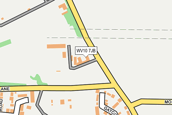
WV10 7JB is located in the Bushbury North electoral ward, within the metropolitan district of Wolverhampton and the English Parliamentary constituency of Wolverhampton North East. The Sub Integrated Care Board (ICB) Location is NHS Black Country ICB - D2P2L and the police force is West Midlands. This postcode has been in use since January 1995.


GetTheData
Source: OS OpenMap – Local (Ordnance Survey)
Source: OS VectorMap District (Ordnance Survey)
Licence: Open Government Licence (requires attribution)
| Easting | 392509 |
| Northing | 304168 |
| Latitude | 52.635208 |
| Longitude | -2.112123 |
GetTheData
Source: Open Postcode Geo
Licence: Open Government Licence
| Country | England |
| Postcode District | WV10 |
| ➜ WV10 open data dashboard ➜ See where WV10 is on a map ➜ Where is Wolverhampton? | |
GetTheData
Source: Land Registry Price Paid Data
Licence: Open Government Licence
Elevation or altitude of WV10 7JB as distance above sea level:
| Metres | Feet | |
|---|---|---|
| Elevation | 120m | 394ft |
Elevation is measured from the approximate centre of the postcode, to the nearest point on an OS contour line from OS Terrain 50, which has contour spacing of ten vertical metres.
➜ How high above sea level am I? Find the elevation of your current position using your device's GPS.
GetTheData
Source: Open Postcode Elevation
Licence: Open Government Licence
| Ward | Bushbury North |
| Constituency | Wolverhampton North East |
GetTheData
Source: ONS Postcode Database
Licence: Open Government Licence
| January 2024 | Violence and sexual offences | On or near Gatcombe Close | 249m |
| January 2024 | Other theft | On or near Gatcombe Close | 249m |
| January 2024 | Other theft | On or near Gatcombe Close | 249m |
| ➜ Get more crime data in our Crime section | |||
GetTheData
Source: data.police.uk
Licence: Open Government Licence
| Cat And Kittens Lane (Greenfield Lane) | Northwood Park | 102m |
| Cat And Kittens Lane (Greenfield Lane) | Northwood Park | 126m |
| Ainsworth Rd (Greenfield Lane) | Northwood Park | 319m |
| Ainsworth Rd (Greenfield Lane) | Northwood Park | 321m |
| Abbeyfield Rd (Northycote Lane) | Northwood Park | 365m |
GetTheData
Source: NaPTAN
Licence: Open Government Licence
GetTheData
Source: ONS Postcode Database
Licence: Open Government Licence


➜ Get more ratings from the Food Standards Agency
GetTheData
Source: Food Standards Agency
Licence: FSA terms & conditions
| Last Collection | |||
|---|---|---|---|
| Location | Mon-Fri | Sat | Distance |
| Abbeyfield Road | 17:00 | 12:30 | 362m |
| Cavalier Circus | 17:00 | 12:00 | 620m |
| St Annes Road | 17:00 | 13:00 | 777m |
GetTheData
Source: Dracos
Licence: Creative Commons Attribution-ShareAlike
| Facility | Distance |
|---|---|
| Greenfield Golf Club Greenfield Lane, Greenfield Lane, Wolverhampton Golf | 78m |
| Nuffield Health (Wolverhampton) Broadlands, Wolverhampton Swimming Pool, Health and Fitness Gym, Studio | 822m |
| Northicote Recreation Centre (Closed) Northwood Park Road, Wolverhampton Sports Hall, Grass Pitches | 968m |
GetTheData
Source: Active Places
Licence: Open Government Licence
| School | Phase of Education | Distance |
|---|---|---|
| St Anthony's Catholic Primary Academy Stafford Road, Fordhouses, Wolverhampton, WV10 6NW | Primary | 1.4km |
| Woodbury School Hellier Road, Wolverhampton, WV10 8ED | Not applicable | 1.4km |
| Featherstone Academy The Avenue, Featherstone, Wolverhampton, WV10 7AS | Primary | 1.6km |
GetTheData
Source: Edubase
Licence: Open Government Licence
The below table lists the International Territorial Level (ITL) codes (formerly Nomenclature of Territorial Units for Statistics (NUTS) codes) and Local Administrative Units (LAU) codes for WV10 7JB:
| ITL 1 Code | Name |
|---|---|
| TLG | West Midlands (England) |
| ITL 2 Code | Name |
| TLG3 | West Midlands |
| ITL 3 Code | Name |
| TLG39 | Wolverhampton |
| LAU 1 Code | Name |
| E08000031 | Wolverhampton |
GetTheData
Source: ONS Postcode Directory
Licence: Open Government Licence
The below table lists the Census Output Area (OA), Lower Layer Super Output Area (LSOA), and Middle Layer Super Output Area (MSOA) for WV10 7JB:
| Code | Name | |
|---|---|---|
| OA | E00052711 | |
| LSOA | E01010436 | Wolverhampton 001B |
| MSOA | E02002149 | Wolverhampton 001 |
GetTheData
Source: ONS Postcode Directory
Licence: Open Government Licence
| WV10 8TW | Gatcombe Close | 218m |
| WV10 8TN | Brightstone Close | 262m |
| WV10 8UL | Bridgemary Close | 280m |
| WV10 7JE | Northycote Lane | 298m |
| WV10 8TP | Downend Close | 316m |
| WV10 8TH | Abbeyfield Road | 321m |
| WV10 8UN | Titchfield Close | 337m |
| WV10 8TB | Blackbrook Way | 341m |
| WV10 8TL | Medina Close | 367m |
| WV10 8TJ | Stenbury Close | 367m |
GetTheData
Source: Open Postcode Geo; Land Registry Price Paid Data
Licence: Open Government Licence