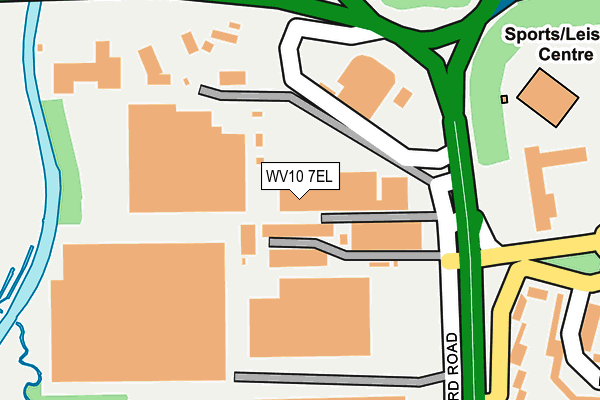
WV10 7EL is located in the Bushbury North electoral ward, within the metropolitan district of Wolverhampton and the English Parliamentary constituency of Wolverhampton North East. The Sub Integrated Care Board (ICB) Location is NHS Black Country ICB - D2P2L and the police force is West Midlands. This postcode has been in use since January 1980.


GetTheData
Source: OS OpenMap – Local (Ordnance Survey)
Source: OS VectorMap District (Ordnance Survey)
Licence: Open Government Licence (requires attribution)
| Easting | 391462 |
| Northing | 304245 |
| Latitude | 52.635885 |
| Longitude | -2.127595 |
GetTheData
Source: Open Postcode Geo
Licence: Open Government Licence
| Country | England |
| Postcode District | WV10 |
| ➜ WV10 open data dashboard ➜ See where WV10 is on a map ➜ Where is Wolverhampton? | |
GetTheData
Source: Land Registry Price Paid Data
Licence: Open Government Licence
Elevation or altitude of WV10 7EL as distance above sea level:
| Metres | Feet | |
|---|---|---|
| Elevation | 110m | 361ft |
Elevation is measured from the approximate centre of the postcode, to the nearest point on an OS contour line from OS Terrain 50, which has contour spacing of ten vertical metres.
➜ How high above sea level am I? Find the elevation of your current position using your device's GPS.
GetTheData
Source: Open Postcode Elevation
Licence: Open Government Licence
| Ward | Bushbury North |
| Constituency | Wolverhampton North East |
GetTheData
Source: ONS Postcode Database
Licence: Open Government Licence
| June 2022 | Other theft | On or near Broadlands | 169m |
| June 2022 | Other theft | On or near Broadlands | 169m |
| June 2022 | Other theft | On or near Broadlands | 169m |
| ➜ Get more crime data in our Crime section | |||
GetTheData
Source: data.police.uk
Licence: Open Government Licence
| Greenfield Lane (Stafford Rd) | Fordhouses | 215m |
| Stafford Rd (Broadlands) | Fordhouses | 262m |
| Greenfield Lane (Stafford Rd) | Fordhouses | 265m |
| Springfield Lane (Stafford Rd) | Fordhouses | 432m |
| Fontwell Rd (Springfield Lane) | Northwood Park | 467m |
| Bilbrook Station | 4.2km |
GetTheData
Source: NaPTAN
Licence: Open Government Licence
| Median download speed | 21.8Mbps |
| Average download speed | 26.0Mbps |
| Maximum download speed | 52.45Mbps |
| Median upload speed | 3.4Mbps |
| Average upload speed | 6.9Mbps |
| Maximum upload speed | 17.67Mbps |
GetTheData
Source: Ofcom
Licence: Ofcom Terms of Use (requires attribution)
GetTheData
Source: ONS Postcode Database
Licence: Open Government Licence


➜ Get more ratings from the Food Standards Agency
GetTheData
Source: Food Standards Agency
Licence: FSA terms & conditions
| Last Collection | |||
|---|---|---|---|
| Location | Mon-Fri | Sat | Distance |
| Scotlands Post Office | 17:30 | 12:00 | 413m |
| Farmbrook Avenue | 16:45 | 12:00 | 719m |
| Fordhouses Post Office | 18:00 | 12:15 | 915m |
GetTheData
Source: Dracos
Licence: Creative Commons Attribution-ShareAlike
| Facility | Distance |
|---|---|
| Nuffield Health (Wolverhampton) Broadlands, Wolverhampton Swimming Pool, Health and Fitness Gym, Studio | 266m |
| Utc Collins Sports Ground Stratford Road, Fordhouses, Wolverhampton Grass Pitches | 433m |
| Greenfield Golf Club Greenfield Lane, Greenfield Lane, Wolverhampton Golf | 972m |
GetTheData
Source: Active Places
Licence: Open Government Licence
| School | Phase of Education | Distance |
|---|---|---|
| St Anthony's Catholic Primary Academy Stafford Road, Fordhouses, Wolverhampton, WV10 6NW | Primary | 1.1km |
| Elston Hall Primary School Stafford Road, Fordhouses, Wolverhampton, WV10 6NN | Primary | 1.4km |
| Ormiston NEW Academy Marsh Lane, Fordhouses, Wolverhampton, WV10 6SE | Secondary | 1.6km |
GetTheData
Source: Edubase
Licence: Open Government Licence
The below table lists the International Territorial Level (ITL) codes (formerly Nomenclature of Territorial Units for Statistics (NUTS) codes) and Local Administrative Units (LAU) codes for WV10 7EL:
| ITL 1 Code | Name |
|---|---|
| TLG | West Midlands (England) |
| ITL 2 Code | Name |
| TLG3 | West Midlands |
| ITL 3 Code | Name |
| TLG39 | Wolverhampton |
| LAU 1 Code | Name |
| E08000031 | Wolverhampton |
GetTheData
Source: ONS Postcode Directory
Licence: Open Government Licence
The below table lists the Census Output Area (OA), Lower Layer Super Output Area (LSOA), and Middle Layer Super Output Area (MSOA) for WV10 7EL:
| Code | Name | |
|---|---|---|
| OA | E00053026 | |
| LSOA | E01010495 | Wolverhampton 002A |
| MSOA | E02002150 | Wolverhampton 002 |
GetTheData
Source: ONS Postcode Directory
Licence: Open Government Licence
| WV10 6NX | Greenfield Lane | 255m |
| WV10 6NU | Stafford Road | 308m |
| WV10 6NZ | Lingfield Avenue | 336m |
| WV10 6NY | Greenfield Lane | 389m |
| WV10 6TB | Venture Court | 392m |
| WV10 7EW | Club Lane | 410m |
| WV10 7EY | Ball Lane | 428m |
| WV10 6PA | Wetherby Close | 429m |
| WV10 6AU | Brabourne Avenue | 446m |
| WV10 6PD | Lingfield Avenue | 449m |
GetTheData
Source: Open Postcode Geo; Land Registry Price Paid Data
Licence: Open Government Licence