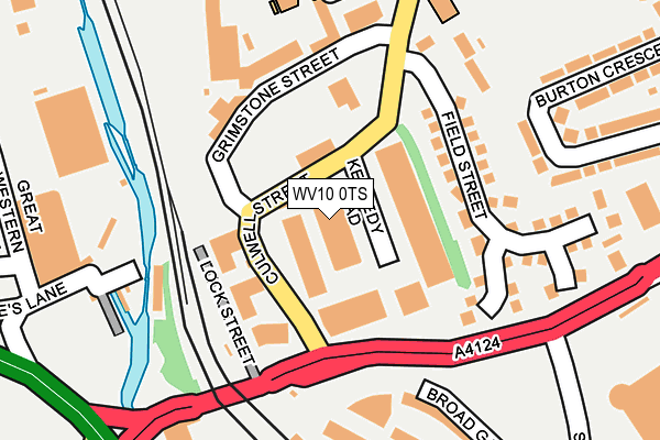
WV10 0TS is located in the Heath Town electoral ward, within the metropolitan district of Wolverhampton and the English Parliamentary constituency of Wolverhampton North East. The Sub Integrated Care Board (ICB) Location is NHS Black Country ICB - D2P2L and the police force is West Midlands. This postcode has been in use since October 2002.


GetTheData
Source: OS OpenMap – Local (Ordnance Survey)
Source: OS VectorMap District (Ordnance Survey)
Licence: Open Government Licence (requires attribution)
| Easting | 391968 |
| Northing | 299153 |
| Latitude | 52.590117 |
| Longitude | -2.119993 |
GetTheData
Source: Open Postcode Geo
Licence: Open Government Licence
| Country | England |
| Postcode District | WV10 |
| ➜ WV10 open data dashboard ➜ See where WV10 is on a map ➜ Where is Wolverhampton? | |
GetTheData
Source: Land Registry Price Paid Data
Licence: Open Government Licence
Elevation or altitude of WV10 0TS as distance above sea level:
| Metres | Feet | |
|---|---|---|
| Elevation | 140m | 459ft |
Elevation is measured from the approximate centre of the postcode, to the nearest point on an OS contour line from OS Terrain 50, which has contour spacing of ten vertical metres.
➜ How high above sea level am I? Find the elevation of your current position using your device's GPS.
GetTheData
Source: Open Postcode Elevation
Licence: Open Government Licence
| Ward | Heath Town |
| Constituency | Wolverhampton North East |
GetTheData
Source: ONS Postcode Database
Licence: Open Government Licence
| January 2024 | Anti-social behaviour | On or near Park/Open Space | 252m |
| December 2023 | Violence and sexual offences | On or near Field Street | 134m |
| November 2023 | Criminal damage and arson | On or near Field Street | 134m |
| ➜ Get more crime data in our Crime section | |||
GetTheData
Source: data.police.uk
Licence: Open Government Licence
| Wednesfield Rd (Culwell St) | Wolverhampton | 101m |
| Wednesfield Rd (Culwell St) | Wolverhampton | 110m |
| Culwell St (Wednesfield Rd) | Wolverhampton | 122m |
| Culwell St (Wednesfield Rd) | Wolverhampton | 140m |
| Coach Park (Faulkland St) | Wolverhampton | 291m |
| Wolverhampton St George's (Midland Metro Stop) (Bilston St) | Wolverhampton | 732m |
| The Royal (Midland Metro Stop) (Bilston St) | Wolverhampton | 986m |
| Wolverhampton Station | 0.3km |
| Bilbrook Station | 5.8km |
GetTheData
Source: NaPTAN
Licence: Open Government Licence
GetTheData
Source: ONS Postcode Database
Licence: Open Government Licence


➜ Get more ratings from the Food Standards Agency
GetTheData
Source: Food Standards Agency
Licence: FSA terms & conditions
| Last Collection | |||
|---|---|---|---|
| Location | Mon-Fri | Sat | Distance |
| High Level Station | 18:30 | 12:15 | 299m |
| University Of Wolverhampton | 16:15 | 327m | |
| Royal Mail Sun Street | 19:30 | 14:00 | 490m |
GetTheData
Source: Dracos
Licence: Creative Commons Attribution-ShareAlike
| Facility | Distance |
|---|---|
| Thomas Telford University Technical College Cambridge Street, Wolverhampton Sports Hall, Artificial Grass Pitch | 197m |
| Woden Primary School Springfield Road, Wolverhampton Grass Pitches | 470m |
| Jd Gyms (Wolverhampton) Stafford Street, Stafford Street, Whitmore Reans, Wolverhampton Health and Fitness Gym | 561m |
GetTheData
Source: Active Places
Licence: Open Government Licence
| School | Phase of Education | Distance |
|---|---|---|
| Thomas Telford University Technical College Springfield Campus, Cambridge Street, Wolverhampton, WV10 0JR | Secondary | 197m |
| Woden Primary School Springfield Road, Wolverhampton, WV10 0LH | Primary | 470m |
| University of Wolverhampton Wulfruna Street, Wolverhampton, WV1 1LY | Not applicable | 590m |
GetTheData
Source: Edubase
Licence: Open Government Licence
The below table lists the International Territorial Level (ITL) codes (formerly Nomenclature of Territorial Units for Statistics (NUTS) codes) and Local Administrative Units (LAU) codes for WV10 0TS:
| ITL 1 Code | Name |
|---|---|
| TLG | West Midlands (England) |
| ITL 2 Code | Name |
| TLG3 | West Midlands |
| ITL 3 Code | Name |
| TLG39 | Wolverhampton |
| LAU 1 Code | Name |
| E08000031 | Wolverhampton |
GetTheData
Source: ONS Postcode Directory
Licence: Open Government Licence
The below table lists the Census Output Area (OA), Lower Layer Super Output Area (LSOA), and Middle Layer Super Output Area (MSOA) for WV10 0TS:
| Code | Name | |
|---|---|---|
| OA | E00167323 | |
| LSOA | E01010521 | Wolverhampton 020F |
| MSOA | E02002168 | Wolverhampton 020 |
GetTheData
Source: ONS Postcode Directory
Licence: Open Government Licence
| WV10 0BA | Broad Gauge Way | 227m |
| WV1 1LJ | Wednesfield Road | 235m |
| WV10 0EE | Burton Crescent | 274m |
| WV10 0AZ | Broad Gauge Way | 285m |
| WV10 0EF | Burton Crescent | 295m |
| WV10 0LE | Hilton Street | 333m |
| WV10 0JG | Yarwell Close | 334m |
| WV10 0AX | Broad Gauge Way | 337m |
| WV10 0DW | Wednesfield Road | 353m |
| WV10 0EG | Burton Road | 390m |
GetTheData
Source: Open Postcode Geo; Land Registry Price Paid Data
Licence: Open Government Licence