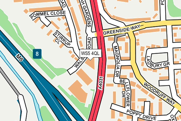
WS5 4QL is located in the Palfrey electoral ward, within the metropolitan district of Walsall and the English Parliamentary constituency of Walsall South. The Sub Integrated Care Board (ICB) Location is NHS Black Country ICB - D2P2L and the police force is West Midlands. This postcode has been in use since December 2012.


GetTheData
Source: OS OpenMap – Local (Ordnance Survey)
Source: OS VectorMap District (Ordnance Survey)
Licence: Open Government Licence (requires attribution)
| Easting | 401771 |
| Northing | 295493 |
| Latitude | 52.557288 |
| Longitude | -1.975304 |
GetTheData
Source: Open Postcode Geo
Licence: Open Government Licence
| Country | England |
| Postcode District | WS5 |
| ➜ WS5 open data dashboard ➜ See where WS5 is on a map ➜ Where is Walsall? | |
GetTheData
Source: Land Registry Price Paid Data
Licence: Open Government Licence
Elevation or altitude of WS5 4QL as distance above sea level:
| Metres | Feet | |
|---|---|---|
| Elevation | 120m | 394ft |
Elevation is measured from the approximate centre of the postcode, to the nearest point on an OS contour line from OS Terrain 50, which has contour spacing of ten vertical metres.
➜ How high above sea level am I? Find the elevation of your current position using your device's GPS.
GetTheData
Source: Open Postcode Elevation
Licence: Open Government Licence
| Ward | Palfrey |
| Constituency | Walsall South |
GetTheData
Source: ONS Postcode Database
Licence: Open Government Licence
| November 2023 | Possession of weapons | On or near Honeysuckle Drive | 488m |
| May 2023 | Burglary | On or near Snapdragon Drive | 325m |
| May 2023 | Vehicle crime | On or near Snapdragon Drive | 325m |
| ➜ Get more crime data in our Crime section | |||
GetTheData
Source: data.police.uk
Licence: Open Government Licence
| Tame Bridge (Walsall Rd) | Friar Park | 65m |
| Tame Bridge (Walsall Rd) | Friar Park | 103m |
| West Bromwich Rd (Greenside Way) | Friar Park | 244m |
| West Bromwich Rd (Greenside Way) | Friar Park | 244m |
| Poplar Ave (Greenside Way) | Friar Park | 401m |
| Tame Bridge Parkway Station | 0.5km |
| Bescot Stadium Station | 1.3km |
| Walsall Station | 3.1km |
GetTheData
Source: NaPTAN
Licence: Open Government Licence
GetTheData
Source: ONS Postcode Database
Licence: Open Government Licence


➜ Get more ratings from the Food Standards Agency
GetTheData
Source: Food Standards Agency
Licence: FSA terms & conditions
| Last Collection | |||
|---|---|---|---|
| Location | Mon-Fri | Sat | Distance |
| Ladbury Road | 16:30 | 11:45 | 323m |
| Woodruff Way | 17:30 | 11:45 | 394m |
| Wolseley Road / St Vincents Cres | 17:30 | 12:00 | 601m |
GetTheData
Source: Dracos
Licence: Creative Commons Attribution-ShareAlike
| Facility | Distance |
|---|---|
| Friar Park Playing Fields Friar Park Road, Wednesbury Grass Pitches | 870m |
| Joseph Leckie Academy Walstead Road West, Walsall Sports Hall, Swimming Pool | 941m |
| Leisure United Friar Park Friar Park Road, Wednesbury Health and Fitness Gym, Artificial Grass Pitch, Grass Pitches, Studio | 954m |
GetTheData
Source: Active Places
Licence: Open Government Licence
| School | Phase of Education | Distance |
|---|---|---|
| Delves Infant School Botany Road, Delves, Walsall, WS5 4PU | Primary | 735m |
| Delves Junior School Bell Lane, Delves, Walsall, WS5 4PU | Primary | 735m |
| Joseph Leckie Academy Walstead Road West, Walsall, WS5 4PG | Secondary | 940m |
GetTheData
Source: Edubase
Licence: Open Government Licence
The below table lists the International Territorial Level (ITL) codes (formerly Nomenclature of Territorial Units for Statistics (NUTS) codes) and Local Administrative Units (LAU) codes for WS5 4QL:
| ITL 1 Code | Name |
|---|---|
| TLG | West Midlands (England) |
| ITL 2 Code | Name |
| TLG3 | West Midlands |
| ITL 3 Code | Name |
| TLG38 | Walsall |
| LAU 1 Code | Name |
| E08000030 | Walsall |
GetTheData
Source: ONS Postcode Directory
Licence: Open Government Licence
The below table lists the Census Output Area (OA), Lower Layer Super Output Area (LSOA), and Middle Layer Super Output Area (MSOA) for WS5 4QL:
| Code | Name | |
|---|---|---|
| OA | E00052247 | |
| LSOA | E01010337 | Walsall 037B |
| MSOA | E02002146 | Walsall 037 |
GetTheData
Source: ONS Postcode Directory
Licence: Open Government Licence
| WS5 4SP | Magnolia Drive | 159m |
| WS5 4QF | Stirrup Close | 167m |
| WS5 4SS | Bellflower Drive | 176m |
| WS5 4SR | Woodruff Way | 184m |
| WS5 4SF | Wisteria Drive | 189m |
| WS5 4SX | Elderberry Close | 199m |
| WS5 4RB | Poppy Drive | 211m |
| WS5 4ST | Lavender Close | 213m |
| WS5 4QD | Segundo Road | 214m |
| WS5 4EZ | Ladbury Grove | 242m |
GetTheData
Source: Open Postcode Geo; Land Registry Price Paid Data
Licence: Open Government Licence