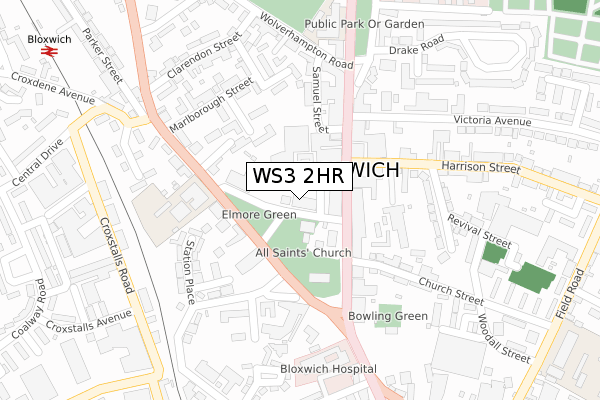
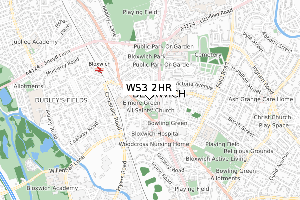
WS3 2HR is located in the Bloxwich West electoral ward, within the metropolitan district of Walsall and the English Parliamentary constituency of Walsall North. The Sub Integrated Care Board (ICB) Location is NHS Black Country ICB - D2P2L and the police force is West Midlands. This postcode has been in use since January 1980.


GetTheData
Source: OS Open Zoomstack (Ordnance Survey)
Licence: Open Government Licence (requires attribution)
Attribution: Contains OS data © Crown copyright and database right 2024
Source: Open Postcode Geo
Licence: Open Government Licence (requires attribution)
Attribution: Contains OS data © Crown copyright and database right 2024; Contains Royal Mail data © Royal Mail copyright and database right 2024; Source: Office for National Statistics licensed under the Open Government Licence v.3.0
| Easting | 399723 |
| Northing | 302040 |
| Latitude | 52.616131 |
| Longitude | -2.005525 |
GetTheData
Source: Open Postcode Geo
Licence: Open Government Licence
| Country | England |
| Postcode District | WS3 |
| ➜ WS3 open data dashboard ➜ See where WS3 is on a map ➜ Where is Bloxwich? | |
GetTheData
Source: Land Registry Price Paid Data
Licence: Open Government Licence
Elevation or altitude of WS3 2HR as distance above sea level:
| Metres | Feet | |
|---|---|---|
| Elevation | 160m | 525ft |
Elevation is measured from the approximate centre of the postcode, to the nearest point on an OS contour line from OS Terrain 50, which has contour spacing of ten vertical metres.
➜ How high above sea level am I? Find the elevation of your current position using your device's GPS.
GetTheData
Source: Open Postcode Elevation
Licence: Open Government Licence
| Ward | Bloxwich West |
| Constituency | Walsall North |
GetTheData
Source: ONS Postcode Database
Licence: Open Government Licence
| January 2024 | Bicycle theft | On or near Parking Area | 145m |
| January 2024 | Robbery | On or near Croxstalls Road | 319m |
| January 2024 | Theft from the person | On or near Croxstalls Road | 319m |
| ➜ Get more crime data in our Crime section | |||
GetTheData
Source: data.police.uk
Licence: Open Government Licence
| Elmore Row (Market Pl) | Bloxwich | 34m |
| High St | Bloxwich | 83m |
| High St | Bloxwich | 120m |
| Bulls Head (High St) | Bloxwich | 215m |
| High St (Wolverhampton Road) | Bloxwich | 232m |
| Bloxwich Station | 0.5km |
| Bloxwich North Station | 1.3km |
| Walsall Station | 3.8km |
GetTheData
Source: NaPTAN
Licence: Open Government Licence
| Percentage of properties with Next Generation Access | 50.0% |
| Percentage of properties with Superfast Broadband | 50.0% |
| Percentage of properties with Ultrafast Broadband | 33.3% |
| Percentage of properties with Full Fibre Broadband | 33.3% |
Superfast Broadband is between 30Mbps and 300Mbps
Ultrafast Broadband is > 300Mbps
| Percentage of properties unable to receive 2Mbps | 0.0% |
| Percentage of properties unable to receive 5Mbps | 0.0% |
| Percentage of properties unable to receive 10Mbps | 0.0% |
| Percentage of properties unable to receive 30Mbps | 50.0% |
GetTheData
Source: Ofcom
Licence: Ofcom Terms of Use (requires attribution)
Estimated total energy consumption in WS3 2HR by fuel type, 2015.
| Consumption (kWh) | 136,581 |
|---|---|
| Meter count | 10 |
| Mean (kWh/meter) | 13,658 |
| Median (kWh/meter) | 10,693 |
| Consumption (kWh) | 14,243 |
|---|---|
| Meter count | 6 |
| Mean (kWh/meter) | 2,374 |
| Median (kWh/meter) | 1,869 |
GetTheData
Source: Postcode level gas estimates: 2015 (experimental)
Source: Postcode level electricity estimates: 2015 (experimental)
Licence: Open Government Licence
GetTheData
Source: ONS Postcode Database
Licence: Open Government Licence


➜ Get more ratings from the Food Standards Agency
GetTheData
Source: Food Standards Agency
Licence: FSA terms & conditions
| Last Collection | |||
|---|---|---|---|
| Location | Mon-Fri | Sat | Distance |
| Bloxwich Post Office | 17:30 | 12:15 | 50m |
| High Street | 17:30 | 12:00 | 105m |
| Sandbank | 16:30 | 11:30 | 383m |
GetTheData
Source: Dracos
Licence: Creative Commons Attribution-ShareAlike
| Facility | Distance |
|---|---|
| Bloxwich Leisure Centre (Closed) High Street, Bloxwich, Walsall Sports Hall, Swimming Pool, Health and Fitness Gym, Studio | 593m |
| Bloxwich Stafford Road Sports Club Stafford Road, Stafford Road, Walsall Grass Pitches | 676m |
| Bloxwich Active Living Centre High Street, Bloxwich, Walsall Swimming Pool, Sports Hall, Health and Fitness Gym, Studio | 700m |
GetTheData
Source: Active Places
Licence: Open Government Licence
| School | Phase of Education | Distance |
|---|---|---|
| Sandbank Nursery School Elmore Row, Bloxwich, Walsall, WS3 2HR | Nursery | 110m |
| Elmore Green Primary School Elmore Green Road, Bloxwich, Walsall, WS3 2HW | Primary | 178m |
| All Saints National Academy High Street, Bloxwich, Walsall, WS3 3LP | Primary | 297m |
GetTheData
Source: Edubase
Licence: Open Government Licence
The below table lists the International Territorial Level (ITL) codes (formerly Nomenclature of Territorial Units for Statistics (NUTS) codes) and Local Administrative Units (LAU) codes for WS3 2HR:
| ITL 1 Code | Name |
|---|---|
| TLG | West Midlands (England) |
| ITL 2 Code | Name |
| TLG3 | West Midlands |
| ITL 3 Code | Name |
| TLG38 | Walsall |
| LAU 1 Code | Name |
| E08000030 | Walsall |
GetTheData
Source: ONS Postcode Directory
Licence: Open Government Licence
The below table lists the Census Output Area (OA), Lower Layer Super Output Area (LSOA), and Middle Layer Super Output Area (MSOA) for WS3 2HR:
| Code | Name | |
|---|---|---|
| OA | E00052046 | |
| LSOA | E01010292 | Walsall 008A |
| MSOA | E02002117 | Walsall 008 |
GetTheData
Source: ONS Postcode Directory
Licence: Open Government Licence
| WS3 3LE | High Street | 63m |
| WS3 3LA | High Street | 98m |
| WS3 3LG | High Street | 105m |
| WS3 2HX | New Street | 120m |
| WS3 3JZ | High Street | 134m |
| WS3 3LQ | High Street | 144m |
| WS3 2EU | Samuel Street | 151m |
| WS3 3LH | High Street | 162m |
| WS3 2HW | Elmore Green Road | 171m |
| WS3 3HP | Harrison Street | 173m |
GetTheData
Source: Open Postcode Geo; Land Registry Price Paid Data
Licence: Open Government Licence