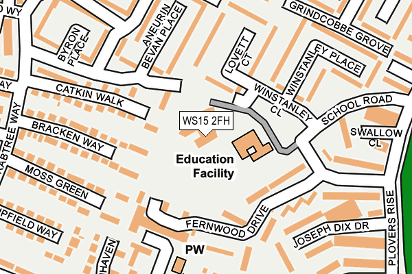
WS15 2FH is located in the Western Springs electoral ward, within the local authority district of Cannock Chase and the English Parliamentary constituency of Cannock Chase. The Sub Integrated Care Board (ICB) Location is NHS Staffordshire and Stoke-on-Trent ICB - 04Y and the police force is Staffordshire. This postcode has been in use since November 2008.


GetTheData
Source: OS OpenMap – Local (Ordnance Survey)
Source: OS VectorMap District (Ordnance Survey)
Licence: Open Government Licence (requires attribution)
| Easting | 403636 |
| Northing | 318829 |
| Latitude | 52.767064 |
| Longitude | -1.947546 |
GetTheData
Source: Open Postcode Geo
Licence: Open Government Licence
| Country | England |
| Postcode District | WS15 |
| ➜ WS15 open data dashboard ➜ See where WS15 is on a map ➜ Where is Rugeley? | |
GetTheData
Source: Land Registry Price Paid Data
Licence: Open Government Licence
Elevation or altitude of WS15 2FH as distance above sea level:
| Metres | Feet | |
|---|---|---|
| Elevation | 80m | 262ft |
Elevation is measured from the approximate centre of the postcode, to the nearest point on an OS contour line from OS Terrain 50, which has contour spacing of ten vertical metres.
➜ How high above sea level am I? Find the elevation of your current position using your device's GPS.
GetTheData
Source: Open Postcode Elevation
Licence: Open Government Licence
| Ward | Western Springs |
| Constituency | Cannock Chase |
GetTheData
Source: ONS Postcode Database
Licence: Open Government Licence
| January 2024 | Violence and sexual offences | On or near Bonney Drive | 413m |
| January 2024 | Violence and sexual offences | On or near Green Lane | 415m |
| January 2024 | Vehicle crime | On or near Jeffery Close | 428m |
| ➜ Get more crime data in our Crime section | |||
GetTheData
Source: data.police.uk
Licence: Open Government Licence
| Fernwood Drive (Plovers Rise) | Springfields | 268m |
| Highland Way (Crabtree Way) | Springfields | 276m |
| Morrisons Local (Green Lane) | Springfields | 281m |
| Morrisons Local (Green Lane) | Springfields | 287m |
| Moss Green (Crabtree Way) | Springfields | 307m |
| Rugeley Trent Valley Station | 1.2km |
| Rugeley Town Station | 1.6km |
GetTheData
Source: NaPTAN
Licence: Open Government Licence
GetTheData
Source: ONS Postcode Database
Licence: Open Government Licence


➜ Get more ratings from the Food Standards Agency
GetTheData
Source: Food Standards Agency
Licence: FSA terms & conditions
| Last Collection | |||
|---|---|---|---|
| Location | Mon-Fri | Sat | Distance |
| Armitage Road | 17:30 | 07:30 | 1,039m |
| Rugeley Post Office | 18:00 | 11:00 | 1,225m |
| Wolseley Bridge Post Office | 16:45 | 11:30 | 2,689m |
GetTheData
Source: Dracos
Licence: Creative Commons Attribution-ShareAlike
| Facility | Distance |
|---|---|
| Forest Hills Primary School Springfields Estate, Rugeley Grass Pitches | 61m |
| Green Lane Playing Field Green Lane, Rugeley Grass Pitches | 322m |
| Etching Hill Primary Academy Penk Drive North, Rugeley Grass Pitches | 529m |
GetTheData
Source: Active Places
Licence: Open Government Licence
| School | Phase of Education | Distance |
|---|---|---|
| Forest Hills Primary School School Road, Rugeley, WS15 2PD | Primary | 61m |
| Etching Hill CofE Primary Academy Penk Drive, Etching Hill, Rugeley, WS15 2XY | Primary | 529m |
| The John Bamford Primary School Crabtree Way, Etching Hill, Rugeley, WS15 2PA | Primary | 626m |
GetTheData
Source: Edubase
Licence: Open Government Licence
The below table lists the International Territorial Level (ITL) codes (formerly Nomenclature of Territorial Units for Statistics (NUTS) codes) and Local Administrative Units (LAU) codes for WS15 2FH:
| ITL 1 Code | Name |
|---|---|
| TLG | West Midlands (England) |
| ITL 2 Code | Name |
| TLG2 | Shropshire and Staffordshire |
| ITL 3 Code | Name |
| TLG24 | Staffordshire CC |
| LAU 1 Code | Name |
| E07000192 | Cannock Chase |
GetTheData
Source: ONS Postcode Directory
Licence: Open Government Licence
The below table lists the Census Output Area (OA), Lower Layer Super Output Area (LSOA), and Middle Layer Super Output Area (MSOA) for WS15 2FH:
| Code | Name | |
|---|---|---|
| OA | E00149824 | |
| LSOA | E01029401 | Cannock Chase 002C |
| MSOA | E02006119 | Cannock Chase 002 |
GetTheData
Source: ONS Postcode Directory
Licence: Open Government Licence
| WS15 2PZ | Fernwood Drive | 134m |
| WS15 2QD | Lovett Court | 139m |
| WS15 2PY | Fernwood Drive | 149m |
| WS15 2NS | Catkin Walk | 158m |
| WS15 2PX | Fernwood Drive | 158m |
| WS15 2WF | Chapelside | 168m |
| WS15 2NT | Bracken Way | 177m |
| WS15 2QE | Aneurin Bevan Place | 192m |
| WS15 2QB | Winstanley Place | 196m |
| WS15 2NU | Moss Green | 227m |
GetTheData
Source: Open Postcode Geo; Land Registry Price Paid Data
Licence: Open Government Licence