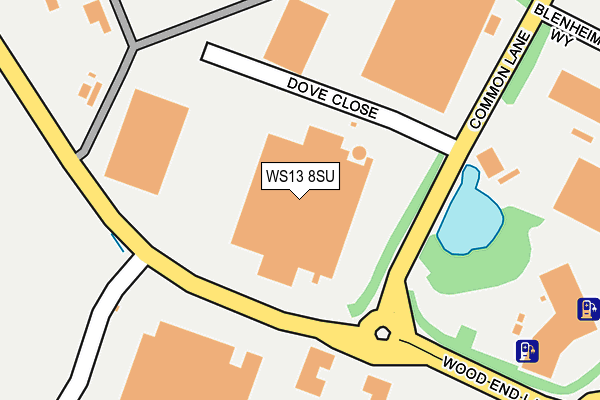
WS13 8SU is located in the Alrewas & Fradley electoral ward, within the local authority district of Lichfield and the English Parliamentary constituency of Lichfield. The Sub Integrated Care Board (ICB) Location is NHS Staffordshire and Stoke-on-Trent ICB - 05D and the police force is Staffordshire. This postcode has been in use since April 2012.


GetTheData
Source: OS OpenMap – Local (Ordnance Survey)
Source: OS VectorMap District (Ordnance Survey)
Licence: Open Government Licence (requires attribution)
| Easting | 414696 |
| Northing | 312167 |
| Latitude | 52.706991 |
| Longitude | -1.783924 |
GetTheData
Source: Open Postcode Geo
Licence: Open Government Licence
| Country | England |
| Postcode District | WS13 |
| ➜ WS13 open data dashboard ➜ See where WS13 is on a map ➜ Where is Fradley South? | |
GetTheData
Source: Land Registry Price Paid Data
Licence: Open Government Licence
Elevation or altitude of WS13 8SU as distance above sea level:
| Metres | Feet | |
|---|---|---|
| Elevation | 70m | 230ft |
Elevation is measured from the approximate centre of the postcode, to the nearest point on an OS contour line from OS Terrain 50, which has contour spacing of ten vertical metres.
➜ How high above sea level am I? Find the elevation of your current position using your device's GPS.
GetTheData
Source: Open Postcode Elevation
Licence: Open Government Licence
| Ward | Alrewas & Fradley |
| Constituency | Lichfield |
GetTheData
Source: ONS Postcode Database
Licence: Open Government Licence
| June 2022 | Vehicle crime | On or near Wellington Crescent | 424m |
| June 2022 | Vehicle crime | On or near Wood End Lane | 427m |
| June 2022 | Vehicle crime | On or near Wood End Lane | 427m |
| ➜ Get more crime data in our Crime section | |||
GetTheData
Source: data.police.uk
Licence: Open Government Licence
| Dove Close (Common Lane) | Fradley Park | 109m |
| Dove Close (Common Lane) | Fradley Park | 136m |
| Wellington Crescent (Wood End Ln) | Fradley Park | 277m |
| Wellington Crescent (Wood End Ln) | Fradley Park | 283m |
| Blenheim Way (Common Lane) | Fradley Park | 340m |
| Lichfield Trent Valley Station | 2.5km |
| Lichfield Trent Valley High Level Station | 2.5km |
| Lichfield City Station | 4.1km |
GetTheData
Source: NaPTAN
Licence: Open Government Licence
GetTheData
Source: ONS Postcode Database
Licence: Open Government Licence


➜ Get more ratings from the Food Standards Agency
GetTheData
Source: Food Standards Agency
Licence: FSA terms & conditions
| Last Collection | |||
|---|---|---|---|
| Location | Mon-Fri | Sat | Distance |
| Wellington Crescent | 17:00 | 10:30 | 426m |
| Harvey Road | 16:15 | 10:15 | 1,069m |
| Ash Tree Lane | 16:30 | 08:30 | 1,799m |
GetTheData
Source: Dracos
Licence: Creative Commons Attribution-ShareAlike
| Facility | Distance |
|---|---|
| Fradley Park Primary School Murphy Street, Fradley, Lichfield Grass Pitches | 799m |
| Orchard Farm (Closed) Rykneld Street, Streethay, Lichfield Grass Pitches | 901m |
| Afc Fradley Oakden Crescent, Fradley, Lichfield Grass Pitches | 1.5km |
GetTheData
Source: Active Places
Licence: Open Government Licence
| School | Phase of Education | Distance |
|---|---|---|
| Fradley Park Primary and Nursery School Murphy Street, Fradley, Lichfield, WS13 8TW | Primary | 799m |
| St Stephen's Primary School Church Lane, Fradley, Lichfield, WS13 8NL | Primary | 1.6km |
| Streethay Primary School Yoxall Way, Lichfield, WS13 8FT | Primary | 1.9km |
GetTheData
Source: Edubase
Licence: Open Government Licence
The below table lists the International Territorial Level (ITL) codes (formerly Nomenclature of Territorial Units for Statistics (NUTS) codes) and Local Administrative Units (LAU) codes for WS13 8SU:
| ITL 1 Code | Name |
|---|---|
| TLG | West Midlands (England) |
| ITL 2 Code | Name |
| TLG2 | Shropshire and Staffordshire |
| ITL 3 Code | Name |
| TLG24 | Staffordshire CC |
| LAU 1 Code | Name |
| E07000194 | Lichfield |
GetTheData
Source: ONS Postcode Directory
Licence: Open Government Licence
The below table lists the Census Output Area (OA), Lower Layer Super Output Area (LSOA), and Middle Layer Super Output Area (MSOA) for WS13 8SU:
| Code | Name | |
|---|---|---|
| OA | E00168371 | |
| LSOA | E01029479 | Lichfield 002C |
| MSOA | E02006147 | Lichfield 002 |
GetTheData
Source: ONS Postcode Directory
Licence: Open Government Licence
| WS13 8TP | Shaw Drive | 804m |
| WS13 8TJ | Godfrey Drive | 846m |
| WS13 8TG | Common Lane | 859m |
| WS13 8TR | Horner Avenue | 874m |
| WS13 8RG | Brookhay Lane | 919m |
| WS13 8TF | Webb Close | 923m |
| WS13 8TS | Ward Close | 951m |
| WS13 8TH | Fletcher Drive | 956m |
| WS13 8SL | Mitchell Close | 987m |
| WS13 8TB | Turnbull Road | 995m |
GetTheData
Source: Open Postcode Geo; Land Registry Price Paid Data
Licence: Open Government Licence