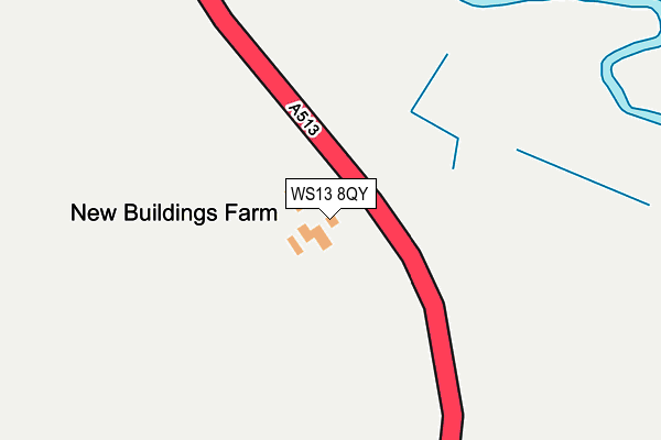
WS13 8QY is located in the Mease Valley electoral ward, within the local authority district of Lichfield and the English Parliamentary constituency of Tamworth. The Sub Integrated Care Board (ICB) Location is NHS Staffordshire and Stoke-on-Trent ICB - 05Q and the police force is Staffordshire. This postcode has been in use since January 1980.


GetTheData
Source: OS OpenMap – Local (Ordnance Survey)
Source: OS VectorMap District (Ordnance Survey)
Licence: Open Government Licence (requires attribution)
| Easting | 419981 |
| Northing | 312823 |
| Latitude | 52.712720 |
| Longitude | -1.705665 |
GetTheData
Source: Open Postcode Geo
Licence: Open Government Licence
| Country | England |
| Postcode District | WS13 |
| ➜ WS13 open data dashboard ➜ See where WS13 is on a map ➜ Where is Croxall? | |
GetTheData
Source: Land Registry Price Paid Data
Licence: Open Government Licence
Elevation or altitude of WS13 8QY as distance above sea level:
| Metres | Feet | |
|---|---|---|
| Elevation | 60m | 197ft |
Elevation is measured from the approximate centre of the postcode, to the nearest point on an OS contour line from OS Terrain 50, which has contour spacing of ten vertical metres.
➜ How high above sea level am I? Find the elevation of your current position using your device's GPS.
GetTheData
Source: Open Postcode Elevation
Licence: Open Government Licence
| Ward | Mease Valley |
| Constituency | Tamworth |
GetTheData
Source: ONS Postcode Database
Licence: Open Government Licence
| Mary Howard School (School Lane) | Edingale | 1,291m |
| Woodyard Drive (Croxall Road) | Edingale | 1,409m |
| Woodyard Drive (Croxall Road) | Edingale | 1,426m |
GetTheData
Source: NaPTAN
Licence: Open Government Licence
| Percentage of properties with Next Generation Access | 100.0% |
| Percentage of properties with Superfast Broadband | 0.0% |
| Percentage of properties with Ultrafast Broadband | 0.0% |
| Percentage of properties with Full Fibre Broadband | 0.0% |
Superfast Broadband is between 30Mbps and 300Mbps
Ultrafast Broadband is > 300Mbps
| Percentage of properties unable to receive 2Mbps | 50.0% |
| Percentage of properties unable to receive 5Mbps | 100.0% |
| Percentage of properties unable to receive 10Mbps | 100.0% |
| Percentage of properties unable to receive 30Mbps | 100.0% |
GetTheData
Source: Ofcom
Licence: Ofcom Terms of Use (requires attribution)
GetTheData
Source: ONS Postcode Database
Licence: Open Government Licence

➜ Get more ratings from the Food Standards Agency
GetTheData
Source: Food Standards Agency
Licence: FSA terms & conditions
| Last Collection | |||
|---|---|---|---|
| Location | Mon-Fri | Sat | Distance |
| Edingale | 16:30 | 07:45 | 1,426m |
| National Arboretum | 17:00 | 2,444m | |
| Catton Hall | 16:00 | 12:00 | 2,525m |
GetTheData
Source: Dracos
Licence: Creative Commons Attribution-ShareAlike
| Facility | Distance |
|---|---|
| Elford Playing Field Brickhouse Lane, Elford, Tamworth Grass Pitches | 2.4km |
| Harlaston Bridge Manor Lane, Harlaston, Tamworth Grass Pitches | 2.5km |
| All Saints C Of E (C) Primary School Furlong Close, Alrewas, Burton-on-trent Grass Pitches | 3.5km |
GetTheData
Source: Active Places
Licence: Open Government Licence
| School | Phase of Education | Distance |
|---|---|---|
| Mary Howard CofE (VC) Primary School School Lane, Edingale, Tamworth, B79 9JJ | Primary | 1.3km |
| The Howard Primary School The Square, Elford, Tamworth, B79 9DB | Primary | 2.5km |
| All Saints Church of England Primary and Nursery School Furlong Close, Alrewas, Burton-on-Trent, DE13 7EF | Primary | 3.5km |
GetTheData
Source: Edubase
Licence: Open Government Licence
The below table lists the International Territorial Level (ITL) codes (formerly Nomenclature of Territorial Units for Statistics (NUTS) codes) and Local Administrative Units (LAU) codes for WS13 8QY:
| ITL 1 Code | Name |
|---|---|
| TLG | West Midlands (England) |
| ITL 2 Code | Name |
| TLG2 | Shropshire and Staffordshire |
| ITL 3 Code | Name |
| TLG24 | Staffordshire CC |
| LAU 1 Code | Name |
| E07000194 | Lichfield |
GetTheData
Source: ONS Postcode Directory
Licence: Open Government Licence
The below table lists the Census Output Area (OA), Lower Layer Super Output Area (LSOA), and Middle Layer Super Output Area (MSOA) for WS13 8QY:
| Code | Name | |
|---|---|---|
| OA | E00150396 | |
| LSOA | E01029516 | Lichfield 008A |
| MSOA | E02006153 | Lichfield 008 |
GetTheData
Source: ONS Postcode Directory
Licence: Open Government Licence
| WS13 8RB | 742m | |
| WS13 8QZ | 840m | |
| B79 9DF | 1187m | |
| B79 9JN | Pessall Lane | 1282m |
| B79 9JJ | School Lane | 1318m |
| B79 9LL | Blakeways Close | 1349m |
| WS13 8QU | 1371m | |
| B79 9LN | Rowley Close | 1382m |
| B79 9JF | Croxall Road | 1394m |
| B79 9LJ | Moores Croft | 1403m |
GetTheData
Source: Open Postcode Geo; Land Registry Price Paid Data
Licence: Open Government Licence