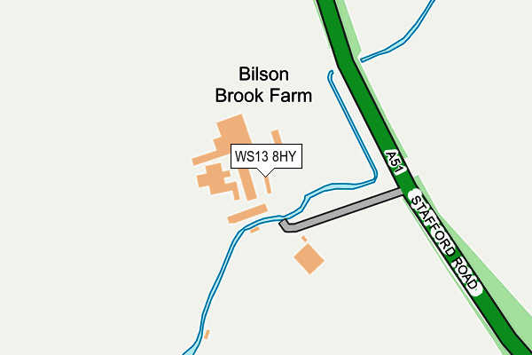
WS13 8HY is located in the Longdon electoral ward, within the local authority district of Lichfield and the English Parliamentary constituency of Lichfield. The Sub Integrated Care Board (ICB) Location is NHS Staffordshire and Stoke-on-Trent ICB - 05Q and the police force is Staffordshire. This postcode has been in use since January 1980.


GetTheData
Source: OS OpenMap – Local (Ordnance Survey)
Source: OS VectorMap District (Ordnance Survey)
Licence: Open Government Licence (requires attribution)
| Easting | 409068 |
| Northing | 312118 |
| Latitude | 52.706656 |
| Longitude | -1.867228 |
GetTheData
Source: Open Postcode Geo
Licence: Open Government Licence
| Country | England |
| Postcode District | WS13 |
➜ See where WS13 is on a map | |
GetTheData
Source: Land Registry Price Paid Data
Licence: Open Government Licence
Elevation or altitude of WS13 8HY as distance above sea level:
| Metres | Feet | |
|---|---|---|
| Elevation | 100m | 328ft |
Elevation is measured from the approximate centre of the postcode, to the nearest point on an OS contour line from OS Terrain 50, which has contour spacing of ten vertical metres.
➜ How high above sea level am I? Find the elevation of your current position using your device's GPS.
GetTheData
Source: Open Postcode Elevation
Licence: Open Government Licence
| Ward | Longdon |
| Constituency | Lichfield |
GetTheData
Source: ONS Postcode Database
Licence: Open Government Licence
| Sunnyside Farm (Tewnalls Lane) | Elmhurst | 1,296m |
| Sunnyside Farm (Tewnalls Lane) | Elmhurst | 1,296m |
| Grange Lane (Featherbed Lane) | Christ Church | 1,337m |
| Grange Lane (Featherbed Lane) | Christ Church | 1,349m |
| Lysways Lane (The Green) | Longdon Green | 1,506m |
| Lichfield City Station | 4.1km |
| Lichfield Trent Valley High Level Station | 5km |
| Lichfield Trent Valley Station | 5km |
GetTheData
Source: NaPTAN
Licence: Open Government Licence
| Percentage of properties with Next Generation Access | 100.0% |
| Percentage of properties with Superfast Broadband | 0.0% |
| Percentage of properties with Ultrafast Broadband | 0.0% |
| Percentage of properties with Full Fibre Broadband | 0.0% |
Superfast Broadband is between 30Mbps and 300Mbps
Ultrafast Broadband is > 300Mbps
| Percentage of properties unable to receive 2Mbps | 0.0% |
| Percentage of properties unable to receive 5Mbps | 100.0% |
| Percentage of properties unable to receive 10Mbps | 100.0% |
| Percentage of properties unable to receive 30Mbps | 100.0% |
GetTheData
Source: Ofcom
Licence: Ofcom Terms of Use (requires attribution)
GetTheData
Source: ONS Postcode Database
Licence: Open Government Licence


➜ Get more ratings from the Food Standards Agency
GetTheData
Source: Food Standards Agency
Licence: FSA terms & conditions
| Last Collection | |||
|---|---|---|---|
| Location | Mon-Fri | Sat | Distance |
| Stafford Road | 17:30 | 11:00 | 2,248m |
| Marks Walk | 17:30 | 11:00 | 2,361m |
| Nursery Croft | 17:30 | 11:00 | 2,441m |
GetTheData
Source: Dracos
Licence: Creative Commons Attribution-ShareAlike
| Risk of WS13 8HY flooding from rivers and sea | Medium |
| ➜ WS13 8HY flood map | |
GetTheData
Source: Open Flood Risk by Postcode
Licence: Open Government Licence
The below table lists the International Territorial Level (ITL) codes (formerly Nomenclature of Territorial Units for Statistics (NUTS) codes) and Local Administrative Units (LAU) codes for WS13 8HY:
| ITL 1 Code | Name |
|---|---|
| TLG | West Midlands (England) |
| ITL 2 Code | Name |
| TLG2 | Shropshire and Staffordshire |
| ITL 3 Code | Name |
| TLG24 | Staffordshire CC |
| LAU 1 Code | Name |
| E07000194 | Lichfield |
GetTheData
Source: ONS Postcode Directory
Licence: Open Government Licence
The below table lists the Census Output Area (OA), Lower Layer Super Output Area (LSOA), and Middle Layer Super Output Area (MSOA) for WS13 8HY:
| Code | Name | |
|---|---|---|
| OA | E00150387 | |
| LSOA | E01029515 | Lichfield 003D |
| MSOA | E02006148 | Lichfield 003 |
GetTheData
Source: ONS Postcode Directory
Licence: Open Government Licence
| WS15 4QD | 885m | |
| WS13 8DT | 1029m | |
| WS13 8DY | Cross In Hand Lane | 1142m |
| WS13 8HZ | Stafford Road | 1279m |
| WS13 8HD | Tewnals Lane | 1312m |
| WS15 4QF | Rookery Cottages | 1364m |
| WS15 4PZ | Lysways Lane | 1514m |
| WS15 4QQ | Hay Lane | 1525m |
| WS15 4QB | Lysways Lane | 1540m |
| WS13 8JA | Stafford Road | 1546m |
GetTheData
Source: Open Postcode Geo; Land Registry Price Paid Data
Licence: Open Government Licence