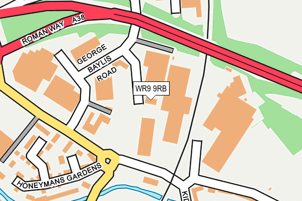
WR9 9RB lies on George Baylis Road in Berry Hill Industrial Estate, Droitwich. WR9 9RB is located in the Droitwich West electoral ward, within the local authority district of Wychavon and the English Parliamentary constituency of Mid Worcestershire. The Sub Integrated Care Board (ICB) Location is NHS Herefordshire and Worcestershire ICB - 18C and the police force is West Mercia. This postcode has been in use since January 1993.


GetTheData
Source: OS OpenMap – Local (Ordnance Survey)
Source: OS VectorMap District (Ordnance Survey)
Licence: Open Government Licence (requires attribution)
| Easting | 389530 |
| Northing | 263936 |
| Latitude | 52.273489 |
| Longitude | -2.154858 |
GetTheData
Source: Open Postcode Geo
Licence: Open Government Licence
| Street | George Baylis Road |
| Locality | Berry Hill Industrial Estate |
| Town/City | Droitwich |
| Country | England |
| Postcode District | WR9 |
| ➜ WR9 open data dashboard ➜ See where WR9 is on a map ➜ Where is Droitwich Spa? | |
GetTheData
Source: Land Registry Price Paid Data
Licence: Open Government Licence
Elevation or altitude of WR9 9RB as distance above sea level:
| Metres | Feet | |
|---|---|---|
| Elevation | 40m | 131ft |
Elevation is measured from the approximate centre of the postcode, to the nearest point on an OS contour line from OS Terrain 50, which has contour spacing of ten vertical metres.
➜ How high above sea level am I? Find the elevation of your current position using your device's GPS.
GetTheData
Source: Open Postcode Elevation
Licence: Open Government Licence
| Ward | Droitwich West |
| Constituency | Mid Worcestershire |
GetTheData
Source: ONS Postcode Database
Licence: Open Government Licence
| June 2022 | Shoplifting | On or near George Baylis Road | 129m |
| June 2022 | Shoplifting | On or near George Baylis Road | 129m |
| June 2022 | Burglary | On or near Kidderminster Road | 162m |
| ➜ George Baylis Road crime map and outcomes | |||
GetTheData
Source: data.police.uk
Licence: Open Government Licence
| Dfs (Kidderminster Road) | Berry Hill | 217m |
| Union Lane Railway Bridge (Union Lane) | Droitwich Spa | 298m |
| Meadow Road (Westwood Road) | Westlands | 474m |
| Union Lane | Droitwich Spa | 480m |
| Droitwich Spa Railway Station (Union Lane) | Droitwich Spa | 596m |
| Droitwich Spa Station | 0.6km |
GetTheData
Source: NaPTAN
Licence: Open Government Licence
| Median download speed | 80.0Mbps |
| Average download speed | 80.0Mbps |
| Maximum download speed | 80.00Mbps |
| Median upload speed | 20.0Mbps |
| Average upload speed | 20.0Mbps |
| Maximum upload speed | 20.00Mbps |
GetTheData
Source: Ofcom
Licence: Ofcom Terms of Use (requires attribution)
Estimated total energy consumption in WR9 9RB by fuel type, 2015.
| Consumption (kWh) | 233,589 |
|---|---|
| Meter count | 8 |
| Mean (kWh/meter) | 29,199 |
| Median (kWh/meter) | 25,819 |
GetTheData
Source: Postcode level gas estimates: 2015 (experimental)
Source: Postcode level electricity estimates: 2015 (experimental)
Licence: Open Government Licence
GetTheData
Source: ONS Postcode Database
Licence: Open Government Licence


➜ Get more ratings from the Food Standards Agency
GetTheData
Source: Food Standards Agency
Licence: FSA terms & conditions
| Last Collection | |||
|---|---|---|---|
| Location | Mon-Fri | Sat | Distance |
| George Baylis Road | 17:30 | 10:30 | 155m |
| Droitwich Pdo | 17:00 | 10:30 | 190m |
| Hampton Road | 16:45 | 10:30 | 416m |
GetTheData
Source: Dracos
Licence: Creative Commons Attribution-ShareAlike
| Facility | Distance |
|---|---|
| Physique Fitness (Closed) George Baylis Road, Berry Hill Industrial Estate, Droitwich Health and Fitness Gym, Studio | 110m |
| Physique Fitness West Bank, Berry Hill Industrial Estate, Droitwich Health and Fitness Gym, Studio | 578m |
| Droitwich Working Mens Club Friar Street, Droitwich Sports Hall | 644m |
GetTheData
Source: Active Places
Licence: Open Government Licence
| School | Phase of Education | Distance |
|---|---|---|
| RGS Dodderhill Dodderhill Road, Droitwich Spa, Worcestershire, WR9 0BE | Not applicable | 684m |
| Westlands First School Farmers Way, Westlands, Droitwich, WR9 9EQ | Primary | 803m |
| Westacre Middle School Ombersley Way, Droitwich, WR9 0AA | Middle deemed primary | 1km |
GetTheData
Source: Edubase
Licence: Open Government Licence
The below table lists the International Territorial Level (ITL) codes (formerly Nomenclature of Territorial Units for Statistics (NUTS) codes) and Local Administrative Units (LAU) codes for WR9 9RB:
| ITL 1 Code | Name |
|---|---|
| TLG | West Midlands (England) |
| ITL 2 Code | Name |
| TLG1 | Herefordshire, Worcestershire and Warwickshire |
| ITL 3 Code | Name |
| TLG12 | Worcestershire CC |
| LAU 1 Code | Name |
| E07000238 | Wychavon |
GetTheData
Source: ONS Postcode Directory
Licence: Open Government Licence
The below table lists the Census Output Area (OA), Lower Layer Super Output Area (LSOA), and Middle Layer Super Output Area (MSOA) for WR9 9RB:
| Code | Name | |
|---|---|---|
| OA | E00165102 | |
| LSOA | E01032369 | Wychavon 002B |
| MSOA | E02006749 | Wychavon 002 |
GetTheData
Source: ONS Postcode Directory
Licence: Open Government Licence
| WR9 9AY | Kidderminster Road | 160m |
| WR9 9AF | Netherwich Gardens | 177m |
| WR9 9AL | Honeymans Gardens | 212m |
| WR9 8LE | Vines Mews | 215m |
| WR9 9AT | Hipkiss Gardens | 237m |
| WR9 8LS | Vines Lane | 262m |
| WR9 9AD | Honeymans Gardens | 277m |
| WR9 9AR | Honeymans Gardens | 333m |
| WR9 9AJ | Roman Way Business Centre | 366m |
| WR9 9AZ | Union Lane | 399m |
GetTheData
Source: Open Postcode Geo; Land Registry Price Paid Data
Licence: Open Government Licence