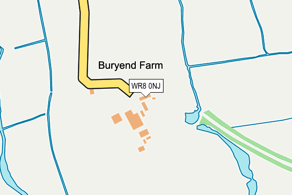
WR8 0NJ lies on Bury End Lane in Upton Upon Severn, Worcester. WR8 0NJ is located in the Upton & Ripple electoral ward, within the local authority district of Malvern Hills and the English Parliamentary constituency of West Worcestershire. The Sub Integrated Care Board (ICB) Location is NHS Herefordshire and Worcestershire ICB - 18C and the police force is West Mercia. This postcode has been in use since October 1985.


GetTheData
Source: OS OpenMap – Local (Ordnance Survey)
Source: OS VectorMap District (Ordnance Survey)
Licence: Open Government Licence (requires attribution)
| Easting | 385680 |
| Northing | 239273 |
| Latitude | 52.051667 |
| Longitude | -2.210233 |
GetTheData
Source: Open Postcode Geo
Licence: Open Government Licence
| Street | Bury End Lane |
| Locality | Upton Upon Severn |
| Town/City | Worcester |
| Country | England |
| Postcode District | WR8 |
➜ See where WR8 is on a map | |
GetTheData
Source: Land Registry Price Paid Data
Licence: Open Government Licence
Elevation or altitude of WR8 0NJ as distance above sea level:
| Metres | Feet | |
|---|---|---|
| Elevation | 20m | 66ft |
Elevation is measured from the approximate centre of the postcode, to the nearest point on an OS contour line from OS Terrain 50, which has contour spacing of ten vertical metres.
➜ How high above sea level am I? Find the elevation of your current position using your device's GPS.
GetTheData
Source: Open Postcode Elevation
Licence: Open Government Licence
| Ward | Upton & Ripple |
| Constituency | West Worcestershire |
GetTheData
Source: ONS Postcode Database
Licence: Open Government Licence
| The Graftons | Upper Ham | 482m |
| Thomas Morris House (Queensmead) | Upton Upon Severn | 800m |
| Fire Station (Old Road) | Upton Upon Severn | 1,085m |
| Church (Old Street) | Upton Upon Severn | 1,099m |
| Church (Old Street) | Upton Upon Severn | 1,179m |
GetTheData
Source: NaPTAN
Licence: Open Government Licence
| Percentage of properties with Next Generation Access | 100.0% |
| Percentage of properties with Superfast Broadband | 100.0% |
| Percentage of properties with Ultrafast Broadband | 0.0% |
| Percentage of properties with Full Fibre Broadband | 0.0% |
Superfast Broadband is between 30Mbps and 300Mbps
Ultrafast Broadband is > 300Mbps
| Percentage of properties unable to receive 2Mbps | 0.0% |
| Percentage of properties unable to receive 5Mbps | 0.0% |
| Percentage of properties unable to receive 10Mbps | 0.0% |
| Percentage of properties unable to receive 30Mbps | 0.0% |
GetTheData
Source: Ofcom
Licence: Ofcom Terms of Use (requires attribution)
GetTheData
Source: ONS Postcode Database
Licence: Open Government Licence


➜ Get more ratings from the Food Standards Agency
GetTheData
Source: Food Standards Agency
Licence: FSA terms & conditions
| Last Collection | |||
|---|---|---|---|
| Location | Mon-Fri | Sat | Distance |
| The Graftons | 16:45 | 10:45 | 508m |
| William Tennant Way | 16:30 | 09:00 | 811m |
| Rectory Road | 16:45 | 10:30 | 977m |
GetTheData
Source: Dracos
Licence: Creative Commons Attribution-ShareAlike
| Risk of WR8 0NJ flooding from rivers and sea | Low |
| ➜ WR8 0NJ flood map | |
GetTheData
Source: Open Flood Risk by Postcode
Licence: Open Government Licence
The below table lists the International Territorial Level (ITL) codes (formerly Nomenclature of Territorial Units for Statistics (NUTS) codes) and Local Administrative Units (LAU) codes for WR8 0NJ:
| ITL 1 Code | Name |
|---|---|
| TLG | West Midlands (England) |
| ITL 2 Code | Name |
| TLG1 | Herefordshire, Worcestershire and Warwickshire |
| ITL 3 Code | Name |
| TLG12 | Worcestershire CC |
| LAU 1 Code | Name |
| E07000235 | Malvern Hills |
GetTheData
Source: ONS Postcode Directory
Licence: Open Government Licence
The below table lists the Census Output Area (OA), Lower Layer Super Output Area (LSOA), and Middle Layer Super Output Area (MSOA) for WR8 0NJ:
| Code | Name | |
|---|---|---|
| OA | E00164344 | |
| LSOA | E01032216 | Malvern Hills 011D |
| MSOA | E02006720 | Malvern Hills 011 |
GetTheData
Source: ONS Postcode Directory
Licence: Open Government Licence
| WR8 0QG | Rectory Road | 293m |
| WR8 0NP | Rectory Road | 349m |
| WR8 0NT | Rectory Road | 355m |
| WR8 0NQ | Hall Green | 420m |
| WR8 0NG | Rectory Road | 457m |
| WR8 0NH | Charles Orchard | 525m |
| WR8 0NE | Rectory Road | 559m |
| WR8 0NU | Upton Gardens | 613m |
| WR8 0LX | Rectory Road | 633m |
| WR8 0ND | Queens Mead | 651m |
GetTheData
Source: Open Postcode Geo; Land Registry Price Paid Data
Licence: Open Government Licence