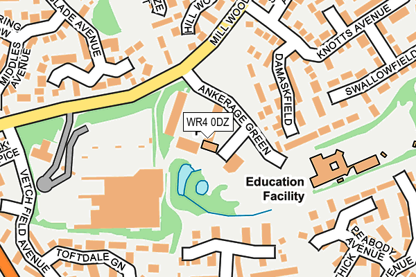
WR4 0DZ lies on Ankerage Green in Worcester. WR4 0DZ is located in the Warndon Parish South electoral ward, within the local authority district of Worcester and the English Parliamentary constituency of Worcester. The Sub Integrated Care Board (ICB) Location is NHS Herefordshire and Worcestershire ICB - 18C and the police force is West Mercia. This postcode has been in use since May 1994.


GetTheData
Source: OS OpenMap – Local (Ordnance Survey)
Source: OS VectorMap District (Ordnance Survey)
Licence: Open Government Licence (requires attribution)
| Easting | 387937 |
| Northing | 255768 |
| Latitude | 52.200009 |
| Longitude | -2.177917 |
GetTheData
Source: Open Postcode Geo
Licence: Open Government Licence
| Street | Ankerage Green |
| Town/City | Worcester |
| Country | England |
| Postcode District | WR4 |
| ➜ WR4 open data dashboard ➜ See where WR4 is on a map ➜ Where is Worcester? | |
GetTheData
Source: Land Registry Price Paid Data
Licence: Open Government Licence
Elevation or altitude of WR4 0DZ as distance above sea level:
| Metres | Feet | |
|---|---|---|
| Elevation | 60m | 197ft |
Elevation is measured from the approximate centre of the postcode, to the nearest point on an OS contour line from OS Terrain 50, which has contour spacing of ten vertical metres.
➜ How high above sea level am I? Find the elevation of your current position using your device's GPS.
GetTheData
Source: Open Postcode Elevation
Licence: Open Government Licence
| Ward | Warndon Parish South |
| Constituency | Worcester |
GetTheData
Source: ONS Postcode Database
Licence: Open Government Licence
| January 2024 | Anti-social behaviour | On or near Worthington Gardens | 174m |
| November 2023 | Burglary | On or near Pitt Avenue | 379m |
| November 2023 | Criminal damage and arson | On or near Farundles Avenue | 462m |
| ➜ Get more crime data in our Crime section | |||
GetTheData
Source: data.police.uk
Licence: Open Government Licence
| Lyppard Centre (Mill Wood Drive) | Lyppard Grange | 123m |
| Lyppard Centre (Mill Wood Drive) | Lyppard Grange | 141m |
| Knotts Avenue (Mill Wood Drive) | Lyppard Grange | 203m |
| Lyppard Tesco (Tesco) | Lyppard Grange | 214m |
| Knotts Avenue (Mill Wood Drive) | Lyppard Grange | 225m |
| Worcester Shrub Hill Station | 2.2km |
| Worcester Foregate Street Station | 3km |
GetTheData
Source: NaPTAN
Licence: Open Government Licence
GetTheData
Source: ONS Postcode Database
Licence: Open Government Licence


➜ Get more ratings from the Food Standards Agency
GetTheData
Source: Food Standards Agency
Licence: FSA terms & conditions
| Last Collection | |||
|---|---|---|---|
| Location | Mon-Fri | Sat | Distance |
| Ankeridge Green | 17:30 | 11:30 | 16m |
| Millwood Drive | 17:15 | 11:30 | 409m |
| Dugdale Drive | 17:00 | 11:30 | 455m |
GetTheData
Source: Dracos
Licence: Creative Commons Attribution-ShareAlike
| Facility | Distance |
|---|---|
| Tolladine Golf Club (Closed) The Fairways, Tolladine Road, Worcester Golf | 738m |
| Warndon Park Shap Drive, Warndon, Worcester Grass Pitches | 1.1km |
| Oasis Academy Warndon Edgeworth Close, Worcester Grass Pitches | 1.2km |
GetTheData
Source: Active Places
Licence: Open Government Licence
| School | Phase of Education | Distance |
|---|---|---|
| The Lyppard Grange Primary School Ankerage Green, Worcester, WR4 0DZ | Primary | 35m |
| Oasis Academy Warndon Edgeworth Close, Warndon, Worcester, WR4 9PE | Primary | 1.2km |
| Perry Wood Primary and Nursery School St Albans Close, Worcester, WR5 1PP | Primary | 1.2km |
GetTheData
Source: Edubase
Licence: Open Government Licence
The below table lists the International Territorial Level (ITL) codes (formerly Nomenclature of Territorial Units for Statistics (NUTS) codes) and Local Administrative Units (LAU) codes for WR4 0DZ:
| ITL 1 Code | Name |
|---|---|
| TLG | West Midlands (England) |
| ITL 2 Code | Name |
| TLG1 | Herefordshire, Worcestershire and Warwickshire |
| ITL 3 Code | Name |
| TLG12 | Worcestershire CC |
| LAU 1 Code | Name |
| E07000237 | Worcester |
GetTheData
Source: ONS Postcode Directory
Licence: Open Government Licence
The below table lists the Census Output Area (OA), Lower Layer Super Output Area (LSOA), and Middle Layer Super Output Area (MSOA) for WR4 0DZ:
| Code | Name | |
|---|---|---|
| OA | E00164939 | |
| LSOA | E01032338 | Worcester 008B |
| MSOA | E02006741 | Worcester 008 |
GetTheData
Source: ONS Postcode Directory
Licence: Open Government Licence
| WR4 0JL | Mapit Place | 113m |
| WR4 0HY | Damaskfield | 134m |
| WR4 0LQ | Six Acres Croft | 147m |
| WR4 0NX | Huxtable Rise | 152m |
| WR4 0PF | Wiselack Place | 175m |
| WR4 0LR | Worthington Gardens | 179m |
| WR4 0EZ | Hill Wood Close | 180m |
| WR4 0PX | Neason Close | 206m |
| WR4 0EY | Haze Croft | 212m |
| WR4 0PW | Bomford Hill | 218m |
GetTheData
Source: Open Postcode Geo; Land Registry Price Paid Data
Licence: Open Government Licence