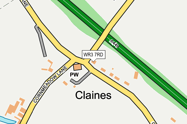
WR3 7RD is located in the Claines electoral ward, within the local authority district of Worcester and the English Parliamentary constituency of Worcester. The Sub Integrated Care Board (ICB) Location is NHS Herefordshire and Worcestershire ICB - 18C and the police force is West Mercia. This postcode has been in use since June 2009.


GetTheData
Source: OS OpenMap – Local (Ordnance Survey)
Source: OS VectorMap District (Ordnance Survey)
Licence: Open Government Licence (requires attribution)
| Easting | 385196 |
| Northing | 258886 |
| Latitude | 52.227986 |
| Longitude | -2.218154 |
GetTheData
Source: Open Postcode Geo
Licence: Open Government Licence
| Country | England |
| Postcode District | WR3 |
| ➜ WR3 open data dashboard ➜ See where WR3 is on a map ➜ Where is Claines? | |
GetTheData
Source: Land Registry Price Paid Data
Licence: Open Government Licence
Elevation or altitude of WR3 7RD as distance above sea level:
| Metres | Feet | |
|---|---|---|
| Elevation | 40m | 131ft |
Elevation is measured from the approximate centre of the postcode, to the nearest point on an OS contour line from OS Terrain 50, which has contour spacing of ten vertical metres.
➜ How high above sea level am I? Find the elevation of your current position using your device's GPS.
GetTheData
Source: Open Postcode Elevation
Licence: Open Government Licence
| Ward | Claines |
| Constituency | Worcester |
GetTheData
Source: ONS Postcode Database
Licence: Open Government Licence
| April 2022 | Vehicle crime | On or near Claines Lane | 142m |
| March 2022 | Violence and sexual offences | On or near Claines Lane | 142m |
| January 2022 | Other crime | On or near Claines Lane | 142m |
| ➜ Get more crime data in our Crime section | |||
GetTheData
Source: data.police.uk
Licence: Open Government Licence
| Claines Crossroads (Cornmeadow Lane) | Claines | 67m |
| Claines Crossroads (Cornmeadow Lane) | Claines | 78m |
| Bevere Lane (A449) | Bevere | 464m |
| Bevere Lane (A449) | Bevere | 478m |
| Meadow Road (Cornmeadow Lane) | Cornmeadows | 584m |
| Worcester Foregate Street Station | 3.7km |
| Worcester Shrub Hill Station | 3.7km |
| Droitwich Spa Station | 6.1km |
GetTheData
Source: NaPTAN
Licence: Open Government Licence
| Percentage of properties with Next Generation Access | 100.0% |
| Percentage of properties with Superfast Broadband | 100.0% |
| Percentage of properties with Ultrafast Broadband | 0.0% |
| Percentage of properties with Full Fibre Broadband | 0.0% |
Superfast Broadband is between 30Mbps and 300Mbps
Ultrafast Broadband is > 300Mbps
| Percentage of properties unable to receive 2Mbps | 0.0% |
| Percentage of properties unable to receive 5Mbps | 0.0% |
| Percentage of properties unable to receive 10Mbps | 0.0% |
| Percentage of properties unable to receive 30Mbps | 0.0% |
GetTheData
Source: Ofcom
Licence: Ofcom Terms of Use (requires attribution)
GetTheData
Source: ONS Postcode Database
Licence: Open Government Licence


➜ Get more ratings from the Food Standards Agency
GetTheData
Source: Food Standards Agency
Licence: FSA terms & conditions
| Last Collection | |||
|---|---|---|---|
| Location | Mon-Fri | Sat | Distance |
| Claines Church | 17:30 | 09:15 | 21m |
| Bevere Green | 17:30 | 07:15 | 733m |
| The Raven | 17:15 | 07:15 | 819m |
GetTheData
Source: Dracos
Licence: Creative Commons Attribution-ShareAlike
| Facility | Distance |
|---|---|
| County Sports Ground Claines Lane, Claines, Worcester Grass Pitches, Artificial Grass Pitch | 593m |
| Rgs The Grange Grange Lane, Claines, Worcester Artificial Grass Pitch | 600m |
| The River School Rose Bank, Claines, Worcester Sports Hall, Grass Pitches | 625m |
GetTheData
Source: Active Places
Licence: Open Government Licence
| School | Phase of Education | Distance |
|---|---|---|
| Claines CofE Primary School School Bank, Claines, Worcester, WR3 7RW | Primary | 244m |
| The River School Oakfield House, Droitwich Road, Worcester, WR3 7ST | Not applicable | 628m |
| North Worcester Primary School John Comyn Drive, Worcester, WR3 7NS | Primary | 1.3km |
GetTheData
Source: Edubase
Licence: Open Government Licence
The below table lists the International Territorial Level (ITL) codes (formerly Nomenclature of Territorial Units for Statistics (NUTS) codes) and Local Administrative Units (LAU) codes for WR3 7RD:
| ITL 1 Code | Name |
|---|---|
| TLG | West Midlands (England) |
| ITL 2 Code | Name |
| TLG1 | Herefordshire, Worcestershire and Warwickshire |
| ITL 3 Code | Name |
| TLG12 | Worcestershire CC |
| LAU 1 Code | Name |
| E07000237 | Worcester |
GetTheData
Source: ONS Postcode Directory
Licence: Open Government Licence
The below table lists the Census Output Area (OA), Lower Layer Super Output Area (LSOA), and Middle Layer Super Output Area (MSOA) for WR3 7RD:
| Code | Name | |
|---|---|---|
| OA | E00164746 | |
| LSOA | E01032297 | Worcester 001B |
| MSOA | E02006734 | Worcester 001 |
GetTheData
Source: ONS Postcode Directory
Licence: Open Government Licence
| WR3 7RN | Claines Lane | 127m |
| WR3 7RH | Ombersley Road | 493m |
| WR3 7PW | Cornmeadow Lane | 536m |
| WR3 7RP | Vicarage Lane | 561m |
| WR3 7SS | Claines Lane | 635m |
| WR3 7PP | Meadow Road | 661m |
| WR3 7RS | Danes Green | 681m |
| WR3 7SR | Droitwich Road | 703m |
| WR3 7ST | Rose Bank | 703m |
| WR3 7PN | Cornmeadow Green | 716m |
GetTheData
Source: Open Postcode Geo; Land Registry Price Paid Data
Licence: Open Government Licence