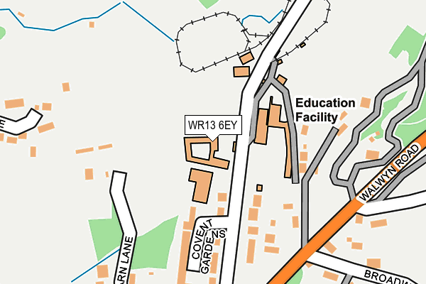
WR13 6EY is located in the Hope End electoral ward, within the unitary authority of Herefordshire, County of and the English Parliamentary constituency of North Herefordshire. The Sub Integrated Care Board (ICB) Location is NHS Herefordshire and Worcestershire ICB - 18C and the police force is West Mercia. This postcode has been in use since January 1980.


GetTheData
Source: OS OpenMap – Local (Ordnance Survey)
Source: OS VectorMap District (Ordnance Survey)
Licence: Open Government Licence (requires attribution)
| Easting | 375810 |
| Northing | 243153 |
| Latitude | 52.086205 |
| Longitude | -2.354443 |
GetTheData
Source: Open Postcode Geo
Licence: Open Government Licence
| Country | England |
| Postcode District | WR13 |
➜ See where WR13 is on a map ➜ Where is Colwall Stone? | |
GetTheData
Source: Land Registry Price Paid Data
Licence: Open Government Licence
Elevation or altitude of WR13 6EY as distance above sea level:
| Metres | Feet | |
|---|---|---|
| Elevation | 140m | 459ft |
Elevation is measured from the approximate centre of the postcode, to the nearest point on an OS contour line from OS Terrain 50, which has contour spacing of ten vertical metres.
➜ How high above sea level am I? Find the elevation of your current position using your device's GPS.
GetTheData
Source: Open Postcode Elevation
Licence: Open Government Licence
| Ward | Hope End |
| Constituency | North Herefordshire |
GetTheData
Source: ONS Postcode Database
Licence: Open Government Licence
| The Winnings (Walwyn Road) | Colwall Stone | 193m |
| The Winnings (Walwyn Road) | Colwall Stone | 208m |
| Old Church Road (Walwyn Road) | Colwall Stone | 282m |
| Old Church Road (Walwyn Road) | Colwall Stone | 311m |
| Oak Drive (Walwyn Road) | Colwall Stone | 465m |
| Colwall Station | 0.7km |
| Great Malvern Station | 3.6km |
| Malvern Link Station | 5km |
GetTheData
Source: NaPTAN
Licence: Open Government Licence
GetTheData
Source: ONS Postcode Database
Licence: Open Government Licence


➜ Get more ratings from the Food Standards Agency
GetTheData
Source: Food Standards Agency
Licence: FSA terms & conditions
| Last Collection | |||
|---|---|---|---|
| Location | Mon-Fri | Sat | Distance |
| New Court | 17:00 | 10:00 | 235m |
| Hoe Court | 16:00 | 07:00 | 665m |
| Colwall P.o. | 16:45 | 11:00 | 680m |
GetTheData
Source: Dracos
Licence: Creative Commons Attribution-ShareAlike
The below table lists the International Territorial Level (ITL) codes (formerly Nomenclature of Territorial Units for Statistics (NUTS) codes) and Local Administrative Units (LAU) codes for WR13 6EY:
| ITL 1 Code | Name |
|---|---|
| TLG | West Midlands (England) |
| ITL 2 Code | Name |
| TLG1 | Herefordshire, Worcestershire and Warwickshire |
| ITL 3 Code | Name |
| TLG11 | Herefordshire, County of |
| LAU 1 Code | Name |
| E06000019 | Herefordshire, County of |
GetTheData
Source: ONS Postcode Directory
Licence: Open Government Licence
The below table lists the Census Output Area (OA), Lower Layer Super Output Area (LSOA), and Middle Layer Super Output Area (MSOA) for WR13 6EY:
| Code | Name | |
|---|---|---|
| OA | E00070829 | |
| LSOA | E01014028 | Herefordshire 009B |
| MSOA | E02002913 | Herefordshire 009 |
GetTheData
Source: ONS Postcode Directory
Licence: Open Government Licence
| WR13 6EX | Brockhill Road | 135m |
| WR13 6FA | Covent Gardens | 139m |
| WR13 6EU | Cowl Barn Lane | 239m |
| WR13 6QY | Ballards Drive | 262m |
| WR13 6QE | Walwyn Road | 284m |
| WR13 6ET | Old Church Road | 296m |
| WR13 6ES | Redland Drive | 306m |
| WR13 6QD | Broadwood Drive | 318m |
| WR13 6QF | Harbour Drive | 362m |
| WR13 6QA | Walwyn Road | 410m |
GetTheData
Source: Open Postcode Geo; Land Registry Price Paid Data
Licence: Open Government Licence