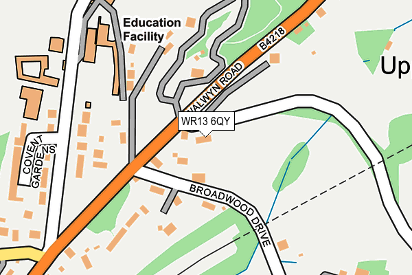
WR13 6QY lies on Ballards Drive in Colwall, Malvern. WR13 6QY is located in the Hope End electoral ward, within the unitary authority of Herefordshire, County of and the English Parliamentary constituency of North Herefordshire. The Sub Integrated Care Board (ICB) Location is NHS Herefordshire and Worcestershire ICB - 18C and the police force is West Mercia. This postcode has been in use since January 1980.


GetTheData
Source: OS OpenMap – Local (Ordnance Survey)
Source: OS VectorMap District (Ordnance Survey)
Licence: Open Government Licence (requires attribution)
| Easting | 376047 |
| Northing | 243042 |
| Latitude | 52.085207 |
| Longitude | -2.350980 |
GetTheData
Source: Open Postcode Geo
Licence: Open Government Licence
| Street | Ballards Drive |
| Locality | Colwall |
| Town/City | Malvern |
| Country | England |
| Postcode District | WR13 |
➜ See where WR13 is on a map ➜ Where is Colwall Stone? | |
GetTheData
Source: Land Registry Price Paid Data
Licence: Open Government Licence
Elevation or altitude of WR13 6QY as distance above sea level:
| Metres | Feet | |
|---|---|---|
| Elevation | 150m | 492ft |
Elevation is measured from the approximate centre of the postcode, to the nearest point on an OS contour line from OS Terrain 50, which has contour spacing of ten vertical metres.
➜ How high above sea level am I? Find the elevation of your current position using your device's GPS.
GetTheData
Source: Open Postcode Elevation
Licence: Open Government Licence
| Ward | Hope End |
| Constituency | North Herefordshire |
GetTheData
Source: ONS Postcode Database
Licence: Open Government Licence
2018 10 JUL £725,000 |
2014 29 JAN £268,000 |
GetTheData
Source: HM Land Registry Price Paid Data
Licence: Contains HM Land Registry data © Crown copyright and database right 2025. This data is licensed under the Open Government Licence v3.0.
| The Winnings (Walwyn Road) | Colwall Stone | 93m |
| The Winnings (Walwyn Road) | Colwall Stone | 116m |
| Old Church Road (Walwyn Road) | Colwall Stone | 297m |
| Old Church Road (Walwyn Road) | Colwall Stone | 313m |
| Shelsley Drive (Walwyn Road) | Upper Colwall | 453m |
| Colwall Station | 0.7km |
| Great Malvern Station | 3.5km |
| Malvern Link Station | 5km |
GetTheData
Source: NaPTAN
Licence: Open Government Licence
| Percentage of properties with Next Generation Access | 100.0% |
| Percentage of properties with Superfast Broadband | 100.0% |
| Percentage of properties with Ultrafast Broadband | 0.0% |
| Percentage of properties with Full Fibre Broadband | 0.0% |
Superfast Broadband is between 30Mbps and 300Mbps
Ultrafast Broadband is > 300Mbps
| Percentage of properties unable to receive 2Mbps | 0.0% |
| Percentage of properties unable to receive 5Mbps | 0.0% |
| Percentage of properties unable to receive 10Mbps | 0.0% |
| Percentage of properties unable to receive 30Mbps | 0.0% |
GetTheData
Source: Ofcom
Licence: Ofcom Terms of Use (requires attribution)
GetTheData
Source: ONS Postcode Database
Licence: Open Government Licence


➜ Get more ratings from the Food Standards Agency
GetTheData
Source: Food Standards Agency
Licence: FSA terms & conditions
| Last Collection | |||
|---|---|---|---|
| Location | Mon-Fri | Sat | Distance |
| New Court | 17:00 | 10:00 | 235m |
| Chase Road | 17:00 | 10:00 | 641m |
| Colwall P.o. | 16:45 | 11:00 | 721m |
GetTheData
Source: Dracos
Licence: Creative Commons Attribution-ShareAlike
The below table lists the International Territorial Level (ITL) codes (formerly Nomenclature of Territorial Units for Statistics (NUTS) codes) and Local Administrative Units (LAU) codes for WR13 6QY:
| ITL 1 Code | Name |
|---|---|
| TLG | West Midlands (England) |
| ITL 2 Code | Name |
| TLG1 | Herefordshire, Worcestershire and Warwickshire |
| ITL 3 Code | Name |
| TLG11 | Herefordshire, County of |
| LAU 1 Code | Name |
| E06000019 | Herefordshire, County of |
GetTheData
Source: ONS Postcode Directory
Licence: Open Government Licence
The below table lists the Census Output Area (OA), Lower Layer Super Output Area (LSOA), and Middle Layer Super Output Area (MSOA) for WR13 6QY:
| Code | Name | |
|---|---|---|
| OA | E00070828 | |
| LSOA | E01014028 | Herefordshire 009B |
| MSOA | E02002913 | Herefordshire 009 |
GetTheData
Source: ONS Postcode Directory
Licence: Open Government Licence
| WR13 6QD | Broadwood Drive | 100m |
| WR13 6EX | Brockhill Road | 180m |
| WR13 6QE | Walwyn Road | 212m |
| WR13 6QA | Walwyn Road | 248m |
| WR13 6FA | Covent Gardens | 275m |
| WR13 6QQ | Broadwood Park | 317m |
| WR13 6QF | Harbour Drive | 334m |
| WR13 6PZ | Walwyn Road | 361m |
| WR13 6ET | Old Church Road | 388m |
| WR13 6EU | Cowl Barn Lane | 400m |
GetTheData
Source: Open Postcode Geo; Land Registry Price Paid Data
Licence: Open Government Licence