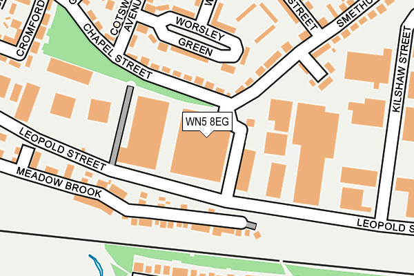
WN5 8EG is located in the Pemberton electoral ward, within the metropolitan district of Wigan and the English Parliamentary constituency of Wigan. The Sub Integrated Care Board (ICB) Location is NHS Greater Manchester ICB - 02H and the police force is Greater Manchester. This postcode has been in use since January 1980.


GetTheData
Source: OS OpenMap – Local (Ordnance Survey)
Source: OS VectorMap District (Ordnance Survey)
Licence: Open Government Licence (requires attribution)
| Easting | 354941 |
| Northing | 404112 |
| Latitude | 53.531735 |
| Longitude | -2.681252 |
GetTheData
Source: Open Postcode Geo
Licence: Open Government Licence
| Country | England |
| Postcode District | WN5 |
| ➜ WN5 open data dashboard ➜ See where WN5 is on a map ➜ Where is Wigan? | |
GetTheData
Source: Land Registry Price Paid Data
Licence: Open Government Licence
Elevation or altitude of WN5 8EG as distance above sea level:
| Metres | Feet | |
|---|---|---|
| Elevation | 70m | 230ft |
Elevation is measured from the approximate centre of the postcode, to the nearest point on an OS contour line from OS Terrain 50, which has contour spacing of ten vertical metres.
➜ How high above sea level am I? Find the elevation of your current position using your device's GPS.
GetTheData
Source: Open Postcode Elevation
Licence: Open Government Licence
| Ward | Pemberton |
| Constituency | Wigan |
GetTheData
Source: ONS Postcode Database
Licence: Open Government Licence
| Leopold St/Factory (Leopold St) | Pemberton | 82m |
| Leopold St/Kilshaw St (Leopold St) | Pemberton | 241m |
| Kilshaw St/Remploy (Kilshaw St) | Pemberton | 347m |
| Ormskirk Rd/Major St (Ormskirk Rd) | Pemberton | 463m |
| Ormskirk Rd/Major St (Ormskirk Rd) | Pemberton | 471m |
| Pemberton Station | 0.7km |
| Orrell Station | 1.8km |
| Gathurst Station | 3.2km |
GetTheData
Source: NaPTAN
Licence: Open Government Licence
GetTheData
Source: ONS Postcode Database
Licence: Open Government Licence


➜ Get more ratings from the Food Standards Agency
GetTheData
Source: Food Standards Agency
Licence: FSA terms & conditions
| Last Collection | |||
|---|---|---|---|
| Location | Mon-Fri | Sat | Distance |
| Lamberhead Green P O | 18:55 | 12:25 | 569m |
| Pemberton Road | 17:55 | 11:15 | 1,284m |
| Tanhouse Drive | 18:00 | 12:20 | 1,431m |
GetTheData
Source: Dracos
Licence: Creative Commons Attribution-ShareAlike
| Facility | Distance |
|---|---|
| Highfield St. Matthews Primary School Billinge Road, Wigan Grass Pitches | 528m |
| Highfield Cricket Club Billinge Road, Wigan Grass Pitches | 554m |
| Bankes Avenue Playing Fields Bankes Avenue, Orrell, Wigan Grass Pitches | 747m |
GetTheData
Source: Active Places
Licence: Open Government Licence
| School | Phase of Education | Distance |
|---|---|---|
| TMP College 830 Ormskirk Road, Pemberton, Wigan, WN5 8EX | Not applicable | 590m |
| Highfield St Matthew's Church of England Primary School Billinge Road, Pemberton, Wigan, WN3 6BL | Primary | 660m |
| St John's CofE Primary School Church Street, Pemberton, Wigan, WN5 0DT | Primary | 694m |
GetTheData
Source: Edubase
Licence: Open Government Licence
The below table lists the International Territorial Level (ITL) codes (formerly Nomenclature of Territorial Units for Statistics (NUTS) codes) and Local Administrative Units (LAU) codes for WN5 8EG:
| ITL 1 Code | Name |
|---|---|
| TLD | North West (England) |
| ITL 2 Code | Name |
| TLD3 | Greater Manchester |
| ITL 3 Code | Name |
| TLD36 | Greater Manchester North West |
| LAU 1 Code | Name |
| E08000010 | Wigan |
GetTheData
Source: ONS Postcode Directory
Licence: Open Government Licence
The below table lists the Census Output Area (OA), Lower Layer Super Output Area (LSOA), and Middle Layer Super Output Area (MSOA) for WN5 8EG:
| Code | Name | |
|---|---|---|
| OA | E00032233 | |
| LSOA | E01006358 | Wigan 014D |
| MSOA | E02001300 | Wigan 014 |
GetTheData
Source: ONS Postcode Directory
Licence: Open Government Licence
| WN5 8JY | Chapel Street | 142m |
| WN3 6AT | Merton Road | 158m |
| WN5 8BN | Worsley Green | 168m |
| WN5 8BL | Smethurst Lane | 194m |
| WN5 8DT | Smethurst Farm Mews | 214m |
| WN5 8ED | Meadow Brook | 217m |
| WN3 6AU | Abberley Way | 227m |
| WN3 6AY | Grebe Close | 229m |
| WN5 8JZ | Cotswold Avenue | 258m |
| WN5 8BJ | Lambton Street | 271m |
GetTheData
Source: Open Postcode Geo; Land Registry Price Paid Data
Licence: Open Government Licence